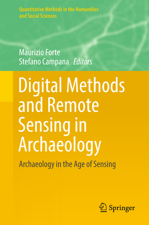
Digital Methods and Remote Sensing in Archaeology: Archaeology in the Age of Sensing: Quantitative Methods in the Humanities and Social Sciences
Editat de Maurizio Forte, Stefano Campanaen Limba Engleză Hardback – 20 feb 2017
| Toate formatele și edițiile | Preț | Express |
|---|---|---|
| Paperback (1) | 737.12 lei 6-8 săpt. | |
| Springer International Publishing – 13 iul 2018 | 737.12 lei 6-8 săpt. | |
| Hardback (1) | 1015.70 lei 6-8 săpt. | |
| Springer International Publishing – 20 feb 2017 | 1015.70 lei 6-8 săpt. |
Din seria Quantitative Methods in the Humanities and Social Sciences
- 17%
 Preț: 525.40 lei
 - 17%
 Preț: 393.97 lei
 - 18%
 Preț: 904.74 lei
 - 18%
 Preț: 1077.71 lei
 -
 Preț: 388.52 lei
 -
 Preț: 416.40 lei
 - 18%
 Preț: 787.47 lei
 - 18%
 Preț: 780.52 lei
 -
 Preț: 483.92 lei
 - 18%
 Preț: 1117.50 lei
 - 18%
 Preț: 943.57 lei
 - 15%
 Preț: 643.48 lei
 - 18%
 Preț: 729.68 lei
 - 18%
 Preț: 734.09 lei
 - 18%
 Preț: 905.23 lei
 -
 Preț: 454.92 lei
 - 18%
 Preț: 894.34 lei
 -
 Preț: 353.99 lei
 - 18%
 Preț: 727.31 lei
Preț: 1015.70 lei
Preț vechi: 1238.65 lei
-18% Nou
Puncte Express: 1524
Preț estimativ în valută:
194.35€ • 203.46$ • 160.81£
194.35€ • 203.46$ • 160.81£
Carte tipărită la comandă
Livrare economică 07-21 aprilie
Preluare comenzi: 021 569.72.76
Specificații
ISBN-13: 9783319406565
ISBN-10: 3319406566
Pagini: 355
Ilustrații: XIX, 496 p. 223 illus., 175 illus. in color.
Dimensiuni: 155 x 235 x 29 mm
Greutate: 0.9 kg
Ediția:1st ed. 2016
Editura: Springer International Publishing
Colecția Springer
Seria Quantitative Methods in the Humanities and Social Sciences
Locul publicării:Cham, Switzerland
Cuprins
Preface.- Acknowledgements.- Introduction.- Chapter 1 Data Collection and Technology.- Chapter 2 Image and Digital Processing.- Chapter 3 Landscape Representation and Scales.- Chapter 4 Simulation, Visualization and Computing.- Chapter 5 Interpretation and Discussion.- Chapter 6 Cultural Resource Management: Communication and Society.
Recenzii
“The book is sequentially organized and well structured, and many chapters are self-contained. … This volume is a rich source of information and an excellent reference book. … The book is useful as reference book for researchers and practitioners, providing real and interesting colored figures, data, and applications. In summary, this is an important contribution, providing up-to-date coverage on remote sensing in a systematic fashion.” (S. Ejaz Ahmed, Technometrics, Vol. 59 (3), July, 2017)
Notă biografică
Maurizio Forte is William and Sue Gross Professor of Classical Studies Art, Art History, and Visual Studies at Duke University. He is also the founder of the DIG@Lab (for a digital knowledge of the past) at Duke. His main research topics are: digital archaeology, classical archaeology, and neuro-archaeology. He was professor of World Heritage at the University of California, Merced, (School of Social Sciences, Humanities and Arts) and Director of the Virtual Heritage Lab. He was Chief of Research at Italian National Research Council (CNR) of “Virtual Heritage: Integrated digital technologies for knowledge and communication of cultural heritage through virtual reality systems”, Senior Scientist at CNR’s Institute for Technologies Applied to the Cultural Heritage (ITABC), and Professor of "Virtual Environments for Cultural Heritage" in the Master of Science in Technology-Enhanced Communication for Cultural Heritage at the University of Lugano. He has coordinated archaeological fieldwork and research projects in Italy as well as Ethiopia, Egypt, Syria, Kazakhstan, Peru, China, Oman, India, Honduras, Turkey, USA, and Mexico. Since 2010 he has been director of the 3D-Digging project at Çatalhöyük.
Stefano Campana is currently MC advanced Research Fellow at the University of Cambridge UK. He is specializing in landscape archaeology, remote sensing, GIS, and archaeological methodology for purposes of research, recording, and conservation. His work is focused on the understanding of past landscapes from prehistory to the present day. The principal context for his work has been Tuscany but he has also participated in and led research work in the UK, Spain, Turkey, Palestine, and Asia. Since 2006 he has been a faculty member of the University of Siena (Italy), in the Department of History and Cultural Heritage, where he has engaged in teaching and research as Senior Lecturer in Ancient Topography. He has been very active in the international sphere and has established a sound reputation for innovative research. In 2011 he was proposed and admitted as a Fellow of the Society of Antiquaries of London (FSA) and in 2012 he was invited to be a member of the General Management Board of HIST, the Governing Board of the International Centre on Space Technologies for Natural and Cultural Heritage, under the auspices of UNESCO and the Chinese Academy of Sciences.
Caracteristici
Shares current research from an innovative field with immediate implications for scholars working in history, archaeology & geoarchaeology, geography, cultural heritage methodology, and the earth sciences more broadly Represents cross-disciplinary topics at the intersection of the humanities and hard sciences Includes topics for collecting, interpreting, and sharing data from remote and close range sensing, 3D modeling, spatial technologies, and virtual landscapes ? Includes supplementary material: sn.pub/extras
