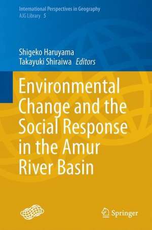
Environmental Change and the Social Response in the Amur River Basin: International Perspectives in Geography, cartea 5
Editat de Shigeko Haruyama, Takayuki Shiraiwaen Limba Engleză Hardback – 15 dec 2014
| Toate formatele și edițiile | Preț | Express |
|---|---|---|
| Paperback (1) | 558.71 lei 38-44 zile | |
| Springer – 10 sep 2016 | 558.71 lei 38-44 zile | |
| Hardback (1) | 649.06 lei 6-8 săpt. | |
| Springer – 15 dec 2014 | 649.06 lei 6-8 săpt. |
Din seria International Perspectives in Geography
- 20%
 Preț: 551.82 lei
 - 24%
 Preț: 729.72 lei
 - 18%
 Preț: 719.28 lei
 - 20%
 Preț: 555.18 lei
 - 24%
 Preț: 738.56 lei
 - 18%
 Preț: 784.79 lei
 - 18%
 Preț: 727.18 lei
 - 18%
 Preț: 1010.03 lei
 - 18%
 Preț: 727.97 lei
 - 18%
 Preț: 892.59 lei
 - 24%
 Preț: 774.88 lei
 - 24%
 Preț: 724.66 lei
 - 15%
 Preț: 701.59 lei
 - 18%
 Preț: 938.83 lei
 - 18%
 Preț: 885.47 lei
 - 18%
 Preț: 943.73 lei
 - 15%
 Preț: 644.95 lei
 - 15%
 Preț: 644.95 lei
 - 15%
 Preț: 640.24 lei
 - 15%
 Preț: 642.51 lei
Preț: 649.06 lei
Preț vechi: 763.60 lei
-15% Nou
Puncte Express: 974
Preț estimativ în valută:
124.21€ • 129.20$ • 102.55£
124.21€ • 129.20$ • 102.55£
Carte tipărită la comandă
Livrare economică 14-28 aprilie
Preluare comenzi: 021 569.72.76
Specificații
ISBN-13: 9784431552444
ISBN-10: 4431552448
Pagini: 262
Ilustrații: VIII, 262 p. 121 illus., 76 illus. in color.
Dimensiuni: 155 x 235 x 17 mm
Greutate: 0.66 kg
Ediția:2015
Editura: Springer
Colecția Springer
Seria International Perspectives in Geography
Locul publicării:Tokyo, Japan
ISBN-10: 4431552448
Pagini: 262
Ilustrații: VIII, 262 p. 121 illus., 76 illus. in color.
Dimensiuni: 155 x 235 x 17 mm
Greutate: 0.66 kg
Ediția:2015
Editura: Springer
Colecția Springer
Seria International Perspectives in Geography
Locul publicării:Tokyo, Japan
Public țintă
ResearchCuprins
Amur Region of Russia - Natural Resources, Population and Economy.- Land-cover Change and Climate Change Analysis of the Amur River Basin Using Remote Sensing Data.- Wetland and Flooding in the Amur River Basin.- Changes in Wetland and Floodplain Sedimentation Processes in the Middle Reach of the Amur River Basin.- Water Chemistry of the Middle Amur River.- Droughts in North Eurasia and Climate Warming: Regional Changes and Consequences.- Geographical Information System for the Amur River Basin.- Characteristics of Irrigation and Drainage Development on the Sanjiang Plain: A Case Study of State Farms.- Developments of Sino-Russo Timber Trade in the Amur River Basin, with Special Reference to the Transition Period during 1995–2005.- Development Process of Timber Harvesting in the Khabarovsk Region, Russian Federation.- Land-Use Dynamics in the Amur River Basin in the 20th Century: Main Tendencies, Driving Forces and Environmental Consequences.
Textul de pe ultima copertă
This book features research on historical land use and land cover in the Amur River Basin, which are important not only for residents there but also for those affected by its material and water cycles. Land use and land cover are affected by natural and human interactions over long and short timescales. The authors address historical changes in the land cover analysis of the Amur. The Amur region of Russia, land cover change analysis of the Amur, wetland, and flooding of the Amur provide evidence of land cover change. Changes of wetland and floodplain sedimentation processes demonstrate the influences of land cover change on fluvial environment, which are discussed with geomorphology. Water chemistry is showing the physical dimension of the geography of the Amur. The development process of timber harvesting in the Khabarovsk area and land use dynamics in the twentieth century are important evidence of development. The Amur poses an essential question: how can we manage a transboundary watershed without disturbing terrestrial and marine ecosystems for future generations? This book provides essential information for geographers about this relatively unknown region.
Caracteristici
Reveals land use and land cover change processes in the Amur River Basin Leads readers to understand the linkages in land-river-sea Explains the use remote sensing and GIS for thorough investigation Includes supplementary material: sn.pub/extras
