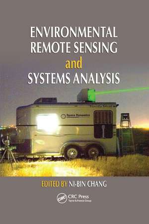
Environmental Remote Sensing and Systems Analysis
Editat de Ni-Bin Changen Limba Engleză Paperback – 23 oct 2019
Organized into three parts, this full-color book provides systematic coverage of water quality monitoring, air quality monitoring, and monitoring of land use patterns and degradation. Chapters elaborate on the interactions between human and natural systems, addressing questions such as "what are the regional impacts of an oil spill in coastal environments?" and "how does urbanization affect the rate of infiltration of water at urban–rural interfaces?" Throughout, contributors discuss new techniques and methods for measurements, mathematical modeling, and image processing.
Key features:
- Compares data mining, machine learning, and image processing methods to help you select the best one for your needs
- Incorporates ground-based monitoring networks as part of air and water quality management
- Emphasizes environmental information management, with proper integration of GPS, GIS, and existing environmental databases
- Shows how modeling can be used for decision making
- Examines how remote sensing can be used to understand environmental health implications and to shape environmental management policies
- Demonstrates how systems analysis can be used to aid in environmental policy analysis
- Discusses opportunities for integrated field and laboratory studies in remote sensing education
A useful reference for students, professionals, scientists, and policy makers in environmental management and informatics as well as environmental, agricultural, forest, and sustainability sciences, this book shows readers how to m
| Toate formatele și edițiile | Preț | Express |
|---|---|---|
| Paperback (1) | 380.64 lei 43-57 zile | |
| CRC Press – 23 oct 2019 | 380.64 lei 43-57 zile | |
| Hardback (1) | 857.50 lei 43-57 zile | |
| CRC Press – 23 mar 2012 | 857.50 lei 43-57 zile |
Preț: 380.64 lei
Preț vechi: 483.11 lei
-21% Nou
Puncte Express: 571
Preț estimativ în valută:
72.84€ • 76.24$ • 60.62£
72.84€ • 76.24$ • 60.62£
Carte tipărită la comandă
Livrare economică 31 martie-14 aprilie
Preluare comenzi: 021 569.72.76
Specificații
ISBN-13: 9780367381554
ISBN-10: 0367381559
Pagini: 520
Dimensiuni: 156 x 234 mm
Greutate: 1.01 kg
Ediția:1
Editura: CRC Press
Colecția CRC Press
ISBN-10: 0367381559
Pagini: 520
Dimensiuni: 156 x 234 mm
Greutate: 1.01 kg
Ediția:1
Editura: CRC Press
Colecția CRC Press
Public țintă
Academic and Professional Practice & DevelopmentCuprins
Linkages between Environmental Remote Sensing and Systems Analysis. Water Quality Monitoring, Watershed Development, and Coastal Management: Using Remote Sensing–Based Carlson Index Mapping to Assess Hurricane and Drought Effects on Lake Trophic State. Mapping Potential Annual Pollutant Loads in River Basins Using Remotely Sensed Imagery. Identifying the Impact of Oil Spills with the Remote Sensing– Based Oil Spread Index Method. Remote Sensing to Predict Estuarine Water Salinity. Multitemporal Remote Sensing of Coastal Sediment Dynamics. Estimating Total Phosphorus Impacts in a Coastal Bay with Remote Sensing Images and In Situ Measurements. Monitoring and Mapping of Flood Plumes in the Great Barrier Reef Based on In Situ and Remote Sensing Observations. Sensing and Monitoring for Land Use Patterns, Reclamation, and Degradation: Satellite Remote Sensing for Landslide Prediction. Analysis of Impervious Surface and Suburban Form Using High Spatial Resolution Satellite Imagery. Use of InSAR for Monitoring Land Subsidence in Mashhad Subbasin, Iran. Remote Sensing Assessment of Coastal Land Reclamation Impact in Dalian, China, Using High-Resolution SPOT Images and Support Vector Machine. Mapping Impervious Surface Distribution with the Integration of Landsat TM and QuickBird Images in a Complex Urban– Rural Frontier in Brazil. Air Quality Monitoring, Land Use/Land Cover Changes, and Environmental Health Concern: Using Lidar to Characterize Particles from Point and Diffuse Sources in an Agricultural Field. Measurement of Aerosol Properties over Urban Environments from Satellite Remote Sensing. DOAS Technique: Emission Measurements in Urban and Industrial Regions. Interactions between Ultraviolet-B and Total Ozone Concentrations in the Continental United States. Remote Sensing of Asian Dust Storms. Forest Fire and Air Quality Monitoring from Space. Satellite Remote Sensing of Global Air Quality.
Notă biografică
Dr. Ni-Bin Chang is currently a professor with the Department of Civil, Environmental, and Construction Engineering at the University of Central Florida. He is also a senior member of the Institute of Electronics and Electrical Engineers (IEEE) and is affiliated with the IEEE Geoscience and Remote Sensing Society and the IEEE Computational Intelligence Society. He has earned the selectively awarded titles of Certificate of Leadership in Energy and Environment Design (LEED) in 2004, Board Certified Environmental Engineer (BCEE) in 2006, Diplomat of Water Resources Engineer (DWRE) in 2007, elected Member of the European Academy of Sciences (EAS) in 2008, elected Fellow of the American Society of Civil Engineers (ASCE) in 2009, and elected Fellow of the American Association for the Advancement of Science (AAAS) in 2011. He was one of the founders of International Society of Environmental Information Management and the former editor-in-chief of the Journal of Environmental Informatics. He is currently an editor, associate editor, or editorial board member of more than 30 international journals.
Descriere
Reflecting the dramatic changes in the field due to global climate change, economic development, and population growth, this book presents an integrated, quantitative, systems-level method of remote sensing that is essential for tracking down the dynamics of coupled natural and human systems. It provides systematic coverage of water quality monitoring, air quality monitoring, and land-use patterns and degradation, from the urban to the global scale. Focusing on applications to enhance field-oriented problem solving, it explores new methods and techniques to demonstrate state-of-the-art accomplishments and future trends in remote sensing.
