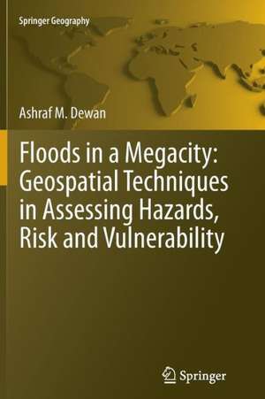
Floods in a Megacity: Geospatial Techniques in Assessing Hazards, Risk and Vulnerability: Springer Geography
Autor Ashraf Dewanen Limba Engleză Paperback – 8 feb 2015
This book uses geospatial techniques to evaluate hazards, risk and vulnerability at a metropolitan scale in a data-scarce country. An empirical study was performed using remote sensing, GIS and census data. This research offers a new approach to mapping population, infrastructures and communities at risk which can greatly contribute to the deeper understanding of flood disasters in a rapidly expanding megacity. Examples shown in this book are from Dhaka Megacity, however, the techniques and methods can easily be implemented in medium to large cities of similar characteristics.
The book is essential reading for hazard researchers, geospatial scientists, disaster management professionals, geographers, urban planners, and social scientists.
Ashraf M. Dewan is currently a Lecturer in the Department of Spatial Sciences at Curtin University, Western Australia (on leave from his substantive position as Associate Professor in the Geography & Environment Department at the University of Dhaka, Bangladesh).
| Toate formatele și edițiile | Preț | Express |
|---|---|---|
| Paperback (1) | 637.13 lei 43-57 zile | |
| SPRINGER NETHERLANDS – 8 feb 2015 | 637.13 lei 43-57 zile | |
| Hardback (1) | 645.79 lei 43-57 zile | |
| SPRINGER NETHERLANDS – 15 mar 2013 | 645.79 lei 43-57 zile |
Din seria Springer Geography
- 18%
 Preț: 961.55 lei
 - 15%
 Preț: 665.01 lei
 - 18%
 Preț: 792.72 lei
 - 20%
 Preț: 564.76 lei
 - 15%
 Preț: 533.88 lei
 - 18%
 Preț: 1224.36 lei
 - 18%
 Preț: 949.73 lei
 - 18%
 Preț: 1115.46 lei
 - 18%
 Preț: 1115.46 lei
 - 18%
 Preț: 730.35 lei
 -
 Preț: 441.36 lei
 - 18%
 Preț: 1004.19 lei
 - 18%
 Preț: 949.55 lei
 - 15%
 Preț: 644.30 lei
 -
 Preț: 398.74 lei
 - 18%
 Preț: 955.25 lei
 - 18%
 Preț: 787.15 lei
 - 18%
 Preț: 1003.38 lei
 - 18%
 Preț: 897.14 lei
 - 18%
 Preț: 1117.03 lei
 - 18%
 Preț: 1120.18 lei
 - 18%
 Preț: 1128.08 lei
 - 18%
 Preț: 726.37 lei
 - 18%
 Preț: 964.54 lei
 - 15%
 Preț: 647.40 lei
 - 15%
 Preț: 646.62 lei
 - 15%
 Preț: 640.71 lei
 - 18%
 Preț: 2154.04 lei
 - 15%
 Preț: 648.05 lei
 - 24%
 Preț: 1118.07 lei
 -
 Preț: 391.61 lei
 - 18%
 Preț: 961.55 lei
 - 18%
 Preț: 948.16 lei
 - 18%
 Preț: 1563.24 lei
 - 15%
 Preț: 647.27 lei
 - 24%
 Preț: 857.90 lei
 - 24%
 Preț: 1139.69 lei
 - 5%
 Preț: 1116.73 lei
 - 20%
 Preț: 551.31 lei
 - 15%
 Preț: 642.03 lei
 - 18%
 Preț: 940.39 lei
 -
 Preț: 395.09 lei
 -
 Preț: 365.45 lei
 - 18%
 Preț: 960.13 lei
 - 24%
 Preț: 642.99 lei
Preț: 637.13 lei
Preț vechi: 749.56 lei
-15% Nou
Puncte Express: 956
Preț estimativ în valută:
121.92€ • 127.61$ • 101.47£
121.92€ • 127.61$ • 101.47£
Carte tipărită la comandă
Livrare economică 31 martie-14 aprilie
Preluare comenzi: 021 569.72.76
Specificații
ISBN-13: 9789400794573
ISBN-10: 9400794576
Pagini: 228
Ilustrații: XXV, 199 p. 47 illus., 27 illus. in color.
Dimensiuni: 155 x 235 x 12 mm
Greutate: 0.33 kg
Ediția:2013
Editura: SPRINGER NETHERLANDS
Colecția Springer
Seria Springer Geography
Locul publicării:Dordrecht, Netherlands
ISBN-10: 9400794576
Pagini: 228
Ilustrații: XXV, 199 p. 47 illus., 27 illus. in color.
Dimensiuni: 155 x 235 x 12 mm
Greutate: 0.33 kg
Ediția:2013
Editura: SPRINGER NETHERLANDS
Colecția Springer
Seria Springer Geography
Locul publicării:Dordrecht, Netherlands
Public țintă
ResearchCuprins
Hazards, Risk and Vulnerability.- Floods in megacity: a case of Dhaka.- Spatial and temporal distribution of floods.- Modelling flood hazards.- Vulnerability and risk assessment.
Textul de pe ultima copertă
Flooding is one of the most devastating natural hazards in the world. Available records suggest that both flood frequency and severity are on the rise and this is likely to worsen in the context of climate change. As population, infrastructure and poverty grow rapidly in developing countries, particularly in urban agglomerations of 10 million people or more, floods could cause widespread devastation, economic damage and loss of life. Assessment of vulnerability and risk from naturally occurring phenomena is therefore imperative in order to achieve urban sustainability.
This book uses geospatial techniques to evaluate hazards, risk and vulnerability at a metropolitan scale in a data-scarce country. An empirical study was performed using remote sensing, GIS and census data. This research offers a new approach to mapping population, infrastructures and communities at risk which can greatly contribute to the deeper understanding of flood disasters in a rapidly expanding megacity. Examples shown in this book are from Dhaka Megacity, however, the techniques and methods can easily be implemented in medium to large cities of similar characteristics.
The book is essential reading for hazard researchers, geospatial scientists, disaster management professionals, geographers, urban planners, and social scientists.
Ashraf M. Dewan is currently a Lecturerin the Department of Spatial Sciences at Curtin University, Western Australia (on leave from his substantive position as Associate Professor in the Geography & Environment Department at the University of Dhaka, Bangladesh).
Caracteristici
Substantially contributes to the deeper understanding of global change and flood vulnerability in megacities of developing countries Discusses existing urban vulnerability models and proposes a new model First comprehensive work on flood vulnerability and risk of natural hazards at community scale of a megacity An aid for informed decision making, especially for rapidly urbanizing countries


