
Geodetic and Geophysical Observations in Antarctica: An Overview in the IPY Perspective
Editat de Alessandro Capra, Reinhard Dietrichen Limba Engleză Hardback – 11 sep 2008
| Toate formatele și edițiile | Preț | Express |
|---|---|---|
| Paperback (1) | 1215.19 lei 6-8 săpt. | |
| Springer Berlin, Heidelberg – 19 oct 2010 | 1215.19 lei 6-8 săpt. | |
| Hardback (1) | 1225.16 lei 6-8 săpt. | |
| Springer Berlin, Heidelberg – 11 sep 2008 | 1225.16 lei 6-8 săpt. |
Preț: 1225.16 lei
Preț vechi: 1494.10 lei
-18% Nou
Puncte Express: 1838
Preț estimativ în valută:
234.44€ • 245.39$ • 195.12£
234.44€ • 245.39$ • 195.12£
Carte tipărită la comandă
Livrare economică 31 martie-14 aprilie
Preluare comenzi: 021 569.72.76
Specificații
ISBN-13: 9783540748816
ISBN-10: 3540748814
Pagini: 380
Ilustrații: XX, 356 p. 292 illus.
Dimensiuni: 155 x 235 x 26 mm
Greutate: 0.66 kg
Ediția:2008
Editura: Springer Berlin, Heidelberg
Colecția Springer
Locul publicării:Berlin, Heidelberg, Germany
ISBN-10: 3540748814
Pagini: 380
Ilustrații: XX, 356 p. 292 illus.
Dimensiuni: 155 x 235 x 26 mm
Greutate: 0.66 kg
Ediția:2008
Editura: Springer Berlin, Heidelberg
Colecția Springer
Locul publicării:Berlin, Heidelberg, Germany
V-ar putea interesa
-
 The Physics of GlaciersKurt M. Cuffey-8%Preț: 491.85 lei534.62 lei
 -
 -18%Preț: 1550.35 lei1890.67 lei
 -
 Field Geophysics 4eJ MilsomPreț: 234.83 lei
 -
 Seismic InterferometryGerard Thomas SchusterPreț: 425.26 lei
 -
 Introduction to SeismologyPeter M. Shearer-11%Preț: 535.25 lei601.40 lei
 -
 3-D Seismic InterpretationM. Bacon-11%Preț: 469.16 lei527.14 lei
 -
 An Introduction to Our Dynamic PlanetNick RogersPreț: 498.11 lei
 -
 The Lithosphere: An Interdisciplinary ApproachIrina Artemieva-14%Preț: 1302.65 lei1514.71 lei
 -
 -19%Preț: 513.63 lei634.11 lei
 -
 Earthquake and Volcano DeformationPaul Segall-19%Preț: 696.18 lei859.49 lei
 -
 The Global Carbon CycleDavid ArcherPreț: 264.22 lei
 -
 Solved Problems in GeophysicsElisa BufornPreț: 470.66 lei
 -
 X-Ray Fluorescence Spectrometry (XRF) in GeoarchaeologyM. Steven ShackleyPreț: 385.84 lei
 -
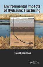 Environmental Impacts of Hydraulic FracturingFrank R. Spellman-25%Preț: 882.08 lei1181.96 lei
 -
 Analytic Methods in GeomechanicsKam-tim Chau-15%Preț: 591.84 lei696.29 lei
 -
 Geoid Determination: Theory and MethodsFernando Sansò-18%Preț: 1854.94 lei2262.12 lei
Public țintă
Professional/practitionerCuprins
A Precise Reference Frame for Antarctica from SCAR GPS Campaign Data and Some Geophysical Implications.- Technologies to Operate Year-Round Remote Global Navigation Satellite System (GNSS) Stations in Extreme Environments.- VLNDEF Project for Geodetic Infrastructure Definition of Northern Victoria Land, Antarctica.- Communications Systems for Remote Polar GNSS Station Operation.- Current Status and Future Prospects for the Australian Antarctic Geodetic Network.- Geodetic Research on Deception Island and its Environment (South Shetland Islands, Bransfield Sea and Antarctic Peninsula) During Spanish Antarctic Campaigns (1987–2007).- Validation of the Atmospheric Water Vapour Content from NCEP Using GPS Observations Over Antarctica.- Geodynamics of the Tectonic Detachment in the Penola Strait (Antarctic Peninsula, Archipelago of Argentina Islands).- GPS and Radiosonde Derived Precipitable Water Vapour Content and its Relationship with 5 Years of Long-Wave Radiation Measurements at “Mario Zucchelli” Station, Terra Nova Bay, Antarctica.- Results of the Investigations of the GNSS Antennae in the Framework of SCAR GIANT Project “In Situ GNSS Antenna Tests and Validation of Phase Centre Calibration Data”.- Atmospheric Impact on GNSS Observations, Sea Level Change Investigations and GPS-Photogrammetry Ice Cap Survey at Vernadsky Station in Antarctic Peninsula.- A Validation of Ocean Tide Models Around Antarctica Using GPS Measurements.- Continuous Gravity Observation with the Superconducting Gravimeter CT #043 at Syowa Station, Antarctica.- Tide Gauges in the Antarctic and sub-Antarctic: Instrumentation and Calibration Issues from an Australian Perspective.- Tidal Gravimetry in Polar Regions: An Observation Tool Complementary to Continuous GPS for the Validation ofOcean Tide Models.- Joint Geophysical Observations of Ice Stream Dynamics.- Geomagnetic Observatories in Antarctica; State of the Art and a Perspective View in the Global and Regional Frameworks.- Structure of the Wilkes Basin Lithosphere along the ITASE01 Geotraverse.- Report on Photogrammetric Research Conducted at the Antarctic Station “Academician Vernadskyy”.- The Contribution of Russian Geodesists and Topographers to Antarctic Mapping.
Recenzii
From the reviews:
“This book is a set of 20 research articles written by 80 authors from 12 countries. … They successfully guided and edited this book, which may be considered an important step in discovery and better recognition of the continent. … Subsequent articles, in a concise but sufficiently informative style, deal with issues of different scale and importance. … interesting to all geoscientists active in polar regions as well as to graduate students in geophysics and geodesy for the many methodological aspects touched upon by the authors.” (Marek Lewandowski, Pure and Applied Geophysics, Vol. 168, 2011)
“This book is a set of 20 research articles written by 80 authors from 12 countries. … They successfully guided and edited this book, which may be considered an important step in discovery and better recognition of the continent. … Subsequent articles, in a concise but sufficiently informative style, deal with issues of different scale and importance. … interesting to all geoscientists active in polar regions as well as to graduate students in geophysics and geodesy for the many methodological aspects touched upon by the authors.” (Marek Lewandowski, Pure and Applied Geophysics, Vol. 168, 2011)
Notă biografică
Professor Alessandro Capra is a faculty member in the University of Modena's Civil and Mechanical Engineering Department.
Dr-Ing Reinhard Dietrich is a professor at the Institute of Planetary Geodesy at the Technical Universtiy of Dresden.
Dr-Ing Reinhard Dietrich is a professor at the Institute of Planetary Geodesy at the Technical Universtiy of Dresden.
Caracteristici
Integrates data acquired in the field with observations in order to provide an understanding of the polar region environment Provides a great overview on the advantages of the scientific utilization of polar observatories