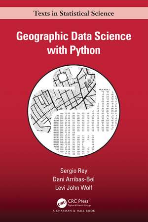
Geographic Data Science with Python: Chapman & Hall/CRC Texts in Statistical Science
Autor Sergio Rey, Dani Arribas-Bel, Levi John Wolfen Limba Engleză Paperback – 14 iun 2023
Key Features:
● Showcases the excellent data science environment in Python.
● Provides examples for readers to replicate, adapt, extend, and improve.
● Covers the crucial knowledge needed by geographic data scientists.
It presents concepts in a far more geographic way than competing textbooks, covering spatial data, mapping, and spatial statistics whilst covering concepts, such as clusters and outliers, as geographic concepts.
Intended for data scientists, GIScientists, and geographers, the material provided in this book is of interest due to the manner in which it presents geospatial data, methods, tools, and practices in this new field.
| Toate formatele și edițiile | Preț | Express |
|---|---|---|
| Paperback (1) | 388.07 lei 3-5 săpt. | +27.38 lei 4-10 zile |
| CRC Press – 14 iun 2023 | 388.07 lei 3-5 săpt. | +27.38 lei 4-10 zile |
| Hardback (1) | 1013.08 lei 6-8 săpt. | |
| CRC Press – 14 iun 2023 | 1013.08 lei 6-8 săpt. |
Din seria Chapman & Hall/CRC Texts in Statistical Science
- 5%
 Preț: 635.71 lei
 - 8%
 Preț: 572.20 lei
 - 8%
 Preț: 547.79 lei
 - 5%
 Preț: 838.31 lei
 - 9%
 Preț: 595.17 lei
 - 9%
 Preț: 772.11 lei
 - 8%
 Preț: 544.47 lei
 - 9%
 Preț: 641.60 lei
 - 8%
 Preț: 487.35 lei
 - 8%
 Preț: 551.97 lei
 - 9%
 Preț: 1080.81 lei
 - 9%
 Preț: 613.84 lei
 -
 Preț: 357.59 lei
 - 9%
 Preț: 609.24 lei
 - 9%
 Preț: 581.19 lei
 - 9%
 Preț: 578.21 lei
 -
 Preț: 371.71 lei
 - 8%
 Preț: 548.14 lei
 - 9%
 Preț: 602.45 lei
 - 9%
 Preț: 593.60 lei
 - 9%
 Preț: 608.07 lei
 - 8%
 Preț: 496.94 lei
 - 9%
 Preț: 610.93 lei
 - 20%
 Preț: 515.53 lei
 -
 Preț: 341.42 lei
 - 8%
 Preț: 495.89 lei
 -
 Preț: 355.65 lei
 - 8%
 Preț: 547.09 lei
 -
 Preț: 349.09 lei
 - 8%
 Preț: 536.31 lei
 - 8%
 Preț: 465.05 lei
 - 9%
 Preț: 617.40 lei
 - 9%
 Preț: 681.69 lei
 -
 Preț: 356.63 lei
 - 8%
 Preț: 547.27 lei
 - 9%
 Preț: 599.18 lei
 -
 Preț: 316.73 lei
 -
 Preț: 341.85 lei
 - 9%
 Preț: 595.90 lei
 -
 Preț: 356.63 lei
 - 8%
 Preț: 418.95 lei
 - 11%
 Preț: 686.52 lei
 - 8%
 Preț: 510.12 lei
 - 8%
 Preț: 511.06 lei
 - 8%
 Preț: 563.39 lei
 - 18%
 Preț: 713.39 lei
 - 15%
 Preț: 684.84 lei
Preț: 388.07 lei
Nou
Puncte Express: 582
Preț estimativ în valută:
74.26€ • 77.09$ • 61.93£
74.26€ • 77.09$ • 61.93£
Carte disponibilă
Livrare economică 04-18 martie
Livrare express 15-21 februarie pentru 37.37 lei
Preluare comenzi: 021 569.72.76
Specificații
ISBN-13: 9781032445953
ISBN-10: 1032445955
Pagini: 410
Ilustrații: 69 Line drawings, color; 4 Line drawings, black and white; 50 Halftones, color; 119 Illustrations, color; 4 Illustrations, black and white
Dimensiuni: 156 x 234 x 21 mm
Greutate: 0.58 kg
Ediția:1
Editura: CRC Press
Colecția Chapman and Hall/CRC
Seria Chapman & Hall/CRC Texts in Statistical Science
Public țintă
Postgraduate and Professional ReferenceNotă biografică
Sergio Rey is Professor of Geography and Founding Director of the Center for Open Geographical Science at San Diego State University. Rey is the creator and lead developer of the open source package STARS: Space-Time Analysis of Regional Systems as well as co-founder and lead developer of PySAL: A Python Library for Spatial Analysis. He is an elected fellow of the Regional Science Association International, a fellow of the Spatial Econometrics Association, and has served as the Editor of the International Regional Science Review from 1999-2014, editor of Geographical Analysis 2014-2017, and the president of the Western Regional Science Association.
Dani Arribas-Bel is a Professor in Geographic Data Science at the Department of Geography and Planning of the University of Liverpool (UK), and Deputy Programme Director for Urban Analytics at the Alan Turing Institute, where he is also ESRC Fellow. At Liverpool, he is a member of the Geographic Data Science Lab, and directs the MSc in Geographic Data Science.
Levi John Wolf is a Senior Lecturer/Assistant Professor in Quantitative Human Geography at the University of Bristol’s Quantitative Spatial Science Lab, Fellow at the University of Chicago Center for Spatial Data Science, an Affiliate Faculty at the University of California, Riverside’s Center for Geospatial Sciences, and Fellow at the Alan Turing Institute. He works in spatial data science, building new methods and software to learn new things about social and natural processes.
Cuprins
Part 1. Building Blocks 1. Geographic thinking for data scientists 2. Computational Tools for Geographic Data Science 3. Spatial Data 4. Spatial Weights Part 2. Spatial Data Analysis 5. Choropleth Mapping 6. Global Spatial Autocorrelation 7. Local Spatial Autocorrelation 8. Point Pattern Analysis Part 3. Advanced Topics 9. Spatial Inequality Dynamics 10. Clustering & Regionalization 11. Spatial Regression 12. Spatial Feature Engineering
Recenzii
"The geospatial Python ecosystem is evolving rapidly, and until now there has been no one-stop reference for the geospatial programmer on data I/O, spatial analysis, and geovisualization. I will use this book in my teaching and will also recommend it to students as a book to keep on the shelf and use as a supplement to other courses, for independent projects, and for their future careers. I don't think there is anything quite like it in the market."
-Professor Lee Hachadoorian, Temple University
"Geographic Data Science with Python is an essential resource for data scientists looking to extend their skills into the geographic domain and for geographers looking to add data science skills. The book's approach achieves a highly effective balance between introducing theoretical concepts and applying them to practical examples. The book also serves as a guide to the modern open source spatial Python stack. The accompanying interactive Jupyter notebooks are great resources for running what-if scenarios to extend the concepts introduced in the book and for getting started with new projects. If you want to understand the unique properties of spatial data and how to apply them in creative ways using Python, this book is a must have."
- David C. Folch, Associate Professor, Northern Arizona University
"Three things will stand out after taking a close look at this book. First, the authors present a timely book that is like an encyclopedia of the emerging field of geographic data science. This book will aspire geographers with what data science can do in helping them answer questions with spatial data, and data scientists in providing critical spatial and methodological contexts of the data. For this reason, this book provides what the seemingly countless tutorials out there in the digital cloud cannot do: a wholistic view of the landscape that may often be daunting to grasp by both communities. Second, the core of this book comes from years of intensive software development of the authors. Their experience (and hard work) has made reading this book a treasure hunt -- not necessarily the challenging sort because you can find good stuff everywhere you turn. Lastly, this is an "open" book because of the Jupyter notebooks associated with this book that are ready to use and, more importantly, to extend to new problems and applications. Because of these features, this book transcends a traditional GIS textbook or how-to tech book and is highly recommended for anyone wishing to understand geographic data."
- Ningchuan Xiao, Professor, The Ohio State University
Descriere
This book serves as an introduction to a whole new way of thinking systematically about geographic data, using geographical analysis and computation to unlock new insights hidden within data. The book is structured around the excellent data science environment in Python.
