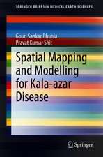
Geospatial Analysis of Public Health
Autor Gouri Sankar Bhunia, Pravat Kumar Shiten Limba Engleză Hardback – 14 ian 2019
Preț: 948.61 lei
Preț vechi: 1156.84 lei
-18% Nou
Puncte Express: 1423
Preț estimativ în valută:
181.51€ • 190.03$ • 150.19£
181.51€ • 190.03$ • 150.19£
Carte tipărită la comandă
Livrare economică 05-19 aprilie
Preluare comenzi: 021 569.72.76
Specificații
ISBN-13: 9783030016791
ISBN-10: 303001679X
Pagini: 110
Ilustrații: XXVI, 228 p. 71 illus., 32 illus. in color.
Dimensiuni: 155 x 235 mm
Greutate: 0.54 kg
Ediția:1st ed. 2019
Editura: Springer International Publishing
Colecția Springer
Locul publicării:Cham, Switzerland
ISBN-10: 303001679X
Pagini: 110
Ilustrații: XXVI, 228 p. 71 illus., 32 illus. in color.
Dimensiuni: 155 x 235 mm
Greutate: 0.54 kg
Ediția:1st ed. 2019
Editura: Springer International Publishing
Colecția Springer
Locul publicării:Cham, Switzerland
Cuprins
Introduction.- Spatial database for public health.- Spatio-temporal assessment of health events.- Analyzing spatial clustering of health events.- Exploring ecology and associated disease pattern.- Spatial technology in health-care planning and policy.
Notă biografică
Gouri Sankar Bhunia has received his Ph.D. degree from the University of Calcutta, India in 2015. His Ph.D. dissertation focused on environmental control measures of infectious disease (Visceral leishmaniasis or kala-azar) using Geospatial technology. His research interests include Kala-azar disease transmission modeling, data mining, and information retrieval using Geospatial technology. Dr. Bhunia is an associate editor and on the editorial boards of three international journal in Health GIS and Geosciences. He works as a ‘Resource Scientist’ in Bihar Remote Sensing Application Centre, Patna (Bihar, India). He is recipient of the Senior Research Fellow (SRF) from Rajendra Memorial Research Institute of Medical Sciences (ICMR, India) and contributed to multiple entomological studies and research programs on Kala-azar disease transmission modelling and development of Customized GIS software for Kala-azar “risk” and “non-risk” area. Dr. Bhunia has published 40 articles in total including 20 articles in journals indexed in Scopus (h-index: 7).
Pravat Kumar Shit has received his Ph.D. degree in 2013 at Vidyasagar University in India. He is an Assistant Professor in the Department of Geography, Raja N. L. Khan Women’s College, Gope Palace, Midnapore, West Bengal, India. He worked on applied geomorphology, environmental modeling, and published more than 35 international and national research articles in various journals. Dr. Shit research focuses on soil erosion spatial modeling, badland geomorphology, gully morphology and natural resources mapping and modeling. His research work has been funded by the University Grants Commission (UGC), India. Dr. Shit is an associate editor and on the editorial boards of three international journals of geography and environment earth science.
Textul de pe ultima copertă
This book is specifically designed to serve the community of postgraduates and researchers in the fields of epidemiology, health GIS, medical geography, and health management. It starts with the basic concepts and role of remote sensing, GIS in Kala-azar diseases. The book gives an exhaustive coverage of Satellite data, GPS, GIS, spatial and attribute data modeling, and geospatial analysis of Kala-azar diseases. It also presents the modern trends of remote sensing and GIS in health risk assessment with an illustrated discussion on its numerous applications.
Caracteristici
Includes research based on geospatial database on vector borne diseases in India Discusses the application of GIS in studies of vector borne / communicable diseases in hot humid environment Gathers creative research on geomedical application using remote sensing and GIS technology Includes materials of immense significance for professionals, epidemiologist as well as to the amateur environmental scientist
