Gully Erosion Studies from India and Surrounding Regions: Advances in Science, Technology & Innovation
Editat de Pravat Kumar Shit, Hamid Reza Pourghasemi, Gouri Sankar Bhuniaen Limba Engleză Hardback – 6 dec 2019
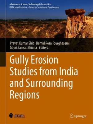
It is divided into three units. Unit I deals with the introduction of badland, types of badland and the process of badland formation. Unit II is devoted to a description of quantitative measurements. Unit III deals with the control and management processes related to various issues from different regions.
As such this book serves as a reference book for research activities in this area. It is an efficient guide for aspiring researchers in applied geography,explaining advanced techniques to help students recognize both simple and complex concepts.
| Toate formatele și edițiile | Preț | Express |
|---|---|---|
| Paperback (1) | 664.61 lei 6-8 săpt. | |
| Springer International Publishing – 14 dec 2020 | 664.61 lei 6-8 săpt. | |
| Hardback (1) | 576.50 lei 38-44 zile | |
| Springer International Publishing – 6 dec 2019 | 576.50 lei 38-44 zile |
Din seria Advances in Science, Technology & Innovation
- 18%
 Preț: 2114.60 lei
 - 20%
 Preț: 1081.52 lei
 - 18%
 Preț: 1254.36 lei
 - 18%
 Preț: 1243.29 lei
 - 18%
 Preț: 799.79 lei
 - 18%
 Preț: 1566.90 lei
 - 18%
 Preț: 2135.11 lei
 - 18%
 Preț: 1699.47 lei
 - 18%
 Preț: 1248.02 lei
 - 15%
 Preț: 653.14 lei
 - 15%
 Preț: 666.24 lei
 - 18%
 Preț: 1677.26 lei
 - 18%
 Preț: 1444.55 lei
 - 15%
 Preț: 653.14 lei
 - 18%
 Preț: 1248.20 lei
 - 18%
 Preț: 1233.83 lei
 - 18%
 Preț: 1565.29 lei
 - 18%
 Preț: 1403.52 lei
 - 18%
 Preț: 1121.76 lei
 - 18%
 Preț: 1400.35 lei
 - 18%
 Preț: 1392.46 lei
 - 18%
 Preț: 1121.76 lei
 - 18%
 Preț: 1405.09 lei
 - 15%
 Preț: 653.14 lei
 - 18%
 Preț: 1834.58 lei
 - 18%
 Preț: 948.92 lei
 - 15%
 Preț: 648.24 lei
 - 18%
 Preț: 1230.66 lei
 - 15%
 Preț: 704.69 lei
 - 20%
 Preț: 1167.33 lei
 - 18%
 Preț: 1866.00 lei
 - 18%
 Preț: 1128.08 lei
 - 18%
 Preț: 972.62 lei
 - 18%
 Preț: 967.40 lei
 - 18%
 Preț: 900.80 lei
 - 18%
 Preț: 1008.12 lei
 - 15%
 Preț: 646.62 lei
 - 18%
 Preț: 1128.08 lei
 - 18%
 Preț: 1402.35 lei
 - 18%
 Preț: 1576.37 lei
 - 15%
 Preț: 601.60 lei
 - 18%
 Preț: 1211.72 lei
 - 20%
 Preț: 673.17 lei
 - 15%
 Preț: 651.51 lei
 - 18%
 Preț: 1242.83 lei
 - 18%
 Preț: 1248.68 lei
 - 18%
 Preț: 1233.83 lei
 - 18%
 Preț: 1587.39 lei
 - 18%
 Preț: 1241.73 lei
 - 5%
 Preț: 1322.29 lei
Preț: 576.50 lei
Preț vechi: 720.63 lei
-20% Nou
Puncte Express: 865
Preț estimativ în valută:
110.33€ • 119.80$ • 92.67£
110.33€ • 119.80$ • 92.67£
Carte tipărită la comandă
Livrare economică 18-24 aprilie
Preluare comenzi: 021 569.72.76
Specificații
ISBN-13: 9783030232429
ISBN-10: 3030232425
Pagini: 190
Ilustrații: XXII, 480 p. 293 illus., 267 illus. in color.
Dimensiuni: 210 x 279 mm
Ediția:1st ed. 2020
Editura: Springer International Publishing
Colecția Springer
Seria Advances in Science, Technology & Innovation
Locul publicării:Cham, Switzerland
ISBN-10: 3030232425
Pagini: 190
Ilustrații: XXII, 480 p. 293 illus., 267 illus. in color.
Dimensiuni: 210 x 279 mm
Ediția:1st ed. 2020
Editura: Springer International Publishing
Colecția Springer
Seria Advances in Science, Technology & Innovation
Locul publicării:Cham, Switzerland
Cuprins
Spatial Extent, Formation Process, Reclaimability Classification System and Restoration Strategies of Gully and Ravine Lands in India.- Soil Disintegration Characteristics on Ephemeral Gully Collapsing in Lateritic Belt of West Bengal, India.- Modeling of Gully Erosion Based on Random Forest Using GIS and R.- Geomorphic Threshold and SCS-CN-Based Runoff and Sediment Yield Modelling in the Gullies of Dwarka–Brahmani Interfluve, West Bengal, India.- Assessing Gully Asymmetry Based on Cross-Sectional Morphology: A Case of Gangani Badland of West Bengal, India.- The Potential Gully Erosion Risk Mapping of River Dulung Basin, West Bengal, India Using AHP Method.- Application of Field-Monitoring Techniques to Determine Soil Loss by Gully Erosion in a Watershed in Deccan, India.- Gully Erosion Susceptibility Mapping Based on Bayesian Weight of Evidence.- Understanding the Morphology and Development of a Rill-Gully: An Empirical Study of Khoai Badland, West Bengal, India.- Estimation of Erosion Susceptibility and Sediment Yield in Ephemeral Channel Using RUSLE and SDR Model: Tropical Plateau Fringe Region, India.- Assessment of Potential Land Degradation in Akarsa Watershed, West Bengal, Using GIS and Multi-influencing Factor Technique.- Using Ground-Based Photogrammetry for Fine-Scale Gully Morphology Studies: Some Examples.- Effects of Grass on Runoff and Gully Bed Erosion: Concentrated Flow Experiment.- Water Flow-Induced Gully Erosion in Himalayan Watershed Cum Plateau and Alluvial Plains.- Influence of Road-Stream Crossing on the Initiation of Gully: Case Study from the Terai Region of Eastern India.- Land Degradation Processes of Silabati River Basin, West Bengal, India: A Physical Perspective.- Assessment of Gully Erosion and Estimation of Sediment Yield in Siddheswari River Basin, Eastern India, Using SWAT Model.- Role of Plant Roots to Control Rill-Gully Erosion: Hydraulic Flume Experiment.- Bamboo-Based Technology for Resource Conservation and Management of Gullied Lands in Central India.- Soil Erosion Protection on Hilly Regions Using Plant Roots: An Experimental Insight.- Planning, Designing and Construction of Series of Check Dams for Soil and Water Conservation in a Micro-watershed of Gujarat, India.- Impacts of Gully Erosion on River Water Quality and Fish Resources: A Case Study.- Gully Erosion in I. R. Iran: Characteristics, Processes, Causes, and Land Use.- Factors Affecting Gully-Head Activity in a Hilly Area Under a Semiarid Climate in Iran.- Topographic Threshold of Gully Erosion in Iran: A Case Study of Fars, Zanjan, Markazi and Golestan Provinces.- A Review on the Gully Erosion and Land Degradation in Iran.- Mapping and Preparing a Susceptibility Map of Gully Erosion Using the MARS Model.- Gully Erosion Susceptibility Assessment Through the SVM Machine Learning Algorithm (SVM-MLA).- Data Mining Technique (Maximum Entropy Model) for Mapping Gully Erosion Susceptibility in the Gorganrood Watershed, Iran.- Land Degradation and Community Resilience in Rural Mountain Area of Java, Indonesia.- Spatial Analysis and Prediction of Soil Erosion in a Complex Watershed of Cameron Highlands, Malaysia.
Notă biografică
Pravat Kumar Shit has received his PhD degree in 2013 at Vidyasagar University in India. He is an Assistant Professor in the Department of Geography, Raja N. L. Khan Women’s College, Gope Palace, Midnapore, West Bengal, India. He worked on applied geomorphology, environmental modeling, and published more than 35 international and national research articles in various journals. Dr. Shit's research focuses on soil erosion spatial modeling, badland geomorphology, gully morphology and natural resources mapping and modeling. His research work has been funded by the University Grants Commission (UGC), India. Dr. Shit is an associate editor and on the editorial boards of three international journals of geography and environment earth science.
Hamid Reza Pourghasemi is an Associate Professor of Watershed Management Engineering in the College of Agriculture, Shiraz University, Iran. He has a B.Sc. in Watershed Management Engineering from the University of Gorgan (2004), Iran; an M.Sc. in Watershed Management Engineering from Tarbiat Modares University (2008), Iran; and a PhD. in Watershed Management Engineering from the same University (Feb 2014).His main research interests are GIS-based spatial modeling using machine learning/data mining techniques in different fields such as landslide, flood, gully erosion, forest fire, land subsidence, species distribution modeling, and groundwater/hydrology. Also, Hamid Reza works on multi-criteria decision-making methods in natural resources and environment. He has published more than 90 peer-reviewed papers in high-quality journals, with three chapters in Springer. Also, he has published two books for Springer and Elsevier.
Gouri Sankar Bhunia has received his PhD degree from the University of Calcutta, India in 2015. His PhD dissertation focused on environmental control measures of infectious disease (Visceral leishmaniasis or kala-azar) using geospatial technology. His research interests include Kala-azar disease transmission modeling, data mining, and information retrieval using geospatial technology. Dr. Bhunia is an associate editor and on the editorial boards of three international journal in Health GIS and Geosciences. He works as a ‘Resource Scientist’ in Bihar Remote Sensing Application Centre, Patna in Bihar, India. He is recipient of the Senior Research Fellow (SRF) from Rajendra Memorial Research Institute of Medical Sciences (ICMR, India) and contributed to multiple entomological studies and research programs on Kala-azar disease transmission modelling and development of Customized GIS software for Kala-azar “risk” and “non-risk” area. Dr. Bhunia has published 40 articles in total including 21 articles in journals indexed in Scopus (h-index: 8).
Textul de pe ultima copertă
This book offers the scientific basis for the ample evaluation of badland management in India and some surrounding regions. It examines the processes operating in the headwaters and main channels of ephemeral rivers in lateritic environments of India. In particular, the book covers a range of vital topics in the areas of gully erosion and water to soil erosion at lateritic uplands regions of India and other regions in Asia. It explores the probable gully erosion modeling through Remote Sensing & GIS Techniques.
It is divided into three units. Unit I deals with the introduction of badland, types of badland and the process of badland formation. Unit II is devoted to a description of quantitative measurements. Unit III deals with the control and management processes related to various issues from different regions.
As such this book serves as a reference book for research activities in this area. It is an efficient guide for aspiring researchers in applied geography,explaining advanced techniques to help students recognize both simple and complex concepts.
Caracteristici
Includes coverage of current fieldwork investigations, modeling approaches, and management issues Discusses examples of current studies and evaluates contemporary modeling approaches Emphasis on laboratory as well as field measurement techniques for gully control
