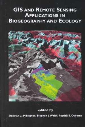
GIS and Remote Sensing Applications in Biogeography and Ecology: The Springer International Series in Engineering and Computer Science, cartea 626
Editat de Andrew C. Millington, Stephen J. Walsh, Patrick E. Osborneen Limba Engleză Hardback – 31 aug 2001
| Toate formatele și edițiile | Preț | Express |
|---|---|---|
| Paperback (1) | 946.87 lei 43-57 zile | |
| Springer Us – 13 noi 2012 | 946.87 lei 43-57 zile | |
| Hardback (1) | 955.08 lei 43-57 zile | |
| Springer Us – 31 aug 2001 | 955.08 lei 43-57 zile |
Din seria The Springer International Series in Engineering and Computer Science
- 24%
 Preț: 1041.97 lei
 - 20%
 Preț: 643.50 lei
 - 18%
 Preț: 1225.62 lei
 - 18%
 Preț: 965.02 lei
 - 20%
 Preț: 646.12 lei
 - 18%
 Preț: 948.79 lei
 - 20%
 Preț: 646.62 lei
 - 15%
 Preț: 637.46 lei
 - 20%
 Preț: 643.83 lei
 - 18%
 Preț: 949.23 lei
 - 20%
 Preț: 644.48 lei
 - 20%
 Preț: 994.92 lei
 - 20%
 Preț: 645.97 lei
 - 18%
 Preț: 946.87 lei
 - 20%
 Preț: 995.57 lei
 - 18%
 Preț: 956.99 lei
 - 20%
 Preț: 644.98 lei
 - 15%
 Preț: 649.54 lei
 - 18%
 Preț: 950.21 lei
 - 18%
 Preț: 1221.38 lei
 - 18%
 Preț: 957.62 lei
 - 15%
 Preț: 643.99 lei
 - 18%
 Preț: 948.47 lei
 - 18%
 Preț: 947.35 lei
 - 20%
 Preț: 1284.65 lei
 - 20%
 Preț: 1633.95 lei
 - 20%
 Preț: 1285.78 lei
Preț: 955.08 lei
Preț vechi: 1164.73 lei
-18% Nou
Puncte Express: 1433
Preț estimativ în valută:
182.77€ • 189.66$ • 152.77£
182.77€ • 189.66$ • 152.77£
Carte tipărită la comandă
Livrare economică 17-31 martie
Preluare comenzi: 021 569.72.76
Specificații
ISBN-13: 9780792374541
ISBN-10: 0792374541
Pagini: 333
Ilustrații: X, 333 p.
Dimensiuni: 155 x 235 x 26 mm
Greutate: 0.72 kg
Ediția:2001
Editura: Springer Us
Colecția Springer
Seria The Springer International Series in Engineering and Computer Science
Locul publicării:New York, NY, United States
ISBN-10: 0792374541
Pagini: 333
Ilustrații: X, 333 p.
Dimensiuni: 155 x 235 x 26 mm
Greutate: 0.72 kg
Ediția:2001
Editura: Springer Us
Colecția Springer
Seria The Springer International Series in Engineering and Computer Science
Locul publicării:New York, NY, United States
V-ar putea interesa
-
 Plant-Animal CommunicationH. Martin Schaefer-18%Preț: 337.83 lei411.78 lei
 -
 Biological Diversity: Frontiers in Measurement and AssessmentAnne E. Magurran-12%Preț: 364.67 lei413.28 lei
 -
 -12%Preț: 450.50 lei511.90 lei
 -
 Wytham Woods: Oxford's Ecological LaboratoryPeter Savill-12%Preț: 432.52 lei493.49 lei
 -
 Phase TransitionsRicard SoléPreț: 348.21 lei
 -
 Preț: 264.26 lei
 -
 -8%Preț: 537.71 lei584.46 lei
 -
 Artificial Reefs in Fisheries ManagementStephen A. Bortone-18%Preț: 1014.77 lei1237.53 lei
 -
 The Ecology of Browsing and GrazingIain J. Gordon-18%Preț: 946.87 lei1154.72 lei
 -
 How Likely is Extraterrestrial Life?J. Woods HalleyPreț: 381.98 lei
 -
 -24%Preț: 1082.78 lei1424.71 lei
Public țintă
ResearchCuprins
1. Introduction — Thinking Spatially.- 2. A Spectral Unmixing Approach to Leaf Area Index (LAI) Estimation at the Alpine Treeline Ecotone.- 3. The Utilization of Airborne Digital Multispectral Image Dynamics and Kinematic Global Positioning Systems for Assessing and Monitoring Salt Marsh Habitats in Southern California.- 4. Spatial Variability in Satellite-Derived Seasonal Vegetation Dynamics.- 5. Documenting Land-Cover History of a Humid Tropical Environment in Northeastern Costa Rica Using Time-Series Remotely Sensed Data.- 6. Patterns of Change in Land-Use and Land-Cover and Plant Biomass: Separating Intra- and Inter-Annual Signals in Monsoon-Driven Northeast Thailand.- 7. Barriers and Species Persistence in a Simulated Grassland Community.- 8. Feedback and Pattern in Computer Simulations of the Alpine Treeline Ecotone.- 9. Spatial Pattern and Dynamics of an Annual Woodland Herb.- 10. Spatial Analysis of Micro-Environmental Change and Forest Composition in Belize.- 11. The Radiate Capitulum Morph of Senecio Vulgaris L. within Sussex: the Use of GIS in Establishing Origins.- 12. A Geographical Information Science (GISci) Approach to Exploring Variation in the Bush Cricket Ephippiger Ephippiger.- 13. The GIS Representation of Wildlife Movements: A Framework.- 14. Stratified Sampling for Field Survey of Environmental Gradients in the Mojave Desert Ecoregion.- 15. Development of Vegetation Pattern in Primary Successions on Glacier Forelands in Southern Norway.- 16. Multi-Scale Analysis of Land-Cover Composition and Landscape Management of Public and Private Lands in Indiana.- 17. Shifting Cultivation Without Deforestation: A Case Study in the Mountains of Northwestern Vietnam.- 18. Linking Biogeography and Environmental Management in the Wetland Landscape of Coastal North Carolina The difference between nationwide and individual wetland permits.