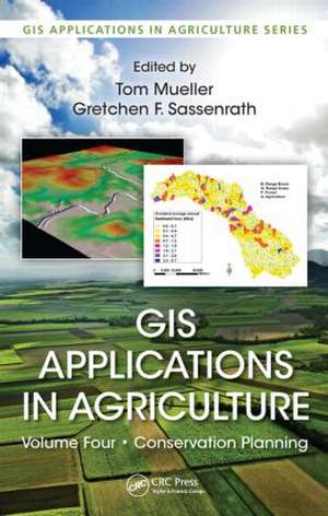
GIS Applications in Agriculture, Volume Four: Conservation Planning: GIS Applications in Agriculture
Editat de Tom Mueller, Gretchen F. Sassenrathen Limba Engleză Hardback – 2 mar 2015
GIS Applications in Agriculture, Volume 4: Conservation Planning presents approaches developed by leading researchers working at the intersection of conservation and spatial technologies. Among others, the technologies include global positioning systems (GPS), geographic information systems (GIS), Internet mapping technologies, remote sensing, and various modeling applications. These advances allow improved prediction of soil erosion and environmental effects, better prioritization of land for conservation initiatives and funding, and enhanced prediction of the impact of management practices on natural resources. They also facilitate the development of conservation management plans and improve the accessibility of conservation knowledge and tools.
The strategies presented are designed to provide the greatest benefit to preserving natural resources while reducing economic expenses. Each chapter includes a detailed background on the specific topic, with case studies describing the design and implementation of the solution. Readers are guided through step-by-step exercises to gain experience in executing the conservation practice. Substantial online data and modeling are available that can be immediately implemented or modified to suit users’ needs. The exercises are accessible enough to be used in the classroom, yet detailed enough for self-instruction by highly motivated professionals active in developing conservation plans.
Preț: 988.83 lei
Preț vechi: 1330.00 lei
-26% Nou
Puncte Express: 1483
Preț estimativ în valută:
189.27€ • 205.66$ • 159.09£
189.27€ • 205.66$ • 159.09£
Comandă specială
Livrare economică 31 martie-14 aprilie
Doresc să fiu notificat când acest titlu va fi disponibil:
Se trimite...
Preluare comenzi: 021 569.72.76
Specificații
ISBN-13: 9781439867228
ISBN-10: 1439867224
Pagini: 304
Ilustrații: 80 black & white illustrations, 17 colour illustrations, 25 black & white tables
Dimensiuni: 156 x 234 x 23 mm
Greutate: 0.56 kg
Ediția:1
Editura: CRC Press
Colecția CRC Press
Seria GIS Applications in Agriculture
ISBN-10: 1439867224
Pagini: 304
Ilustrații: 80 black & white illustrations, 17 colour illustrations, 25 black & white tables
Dimensiuni: 156 x 234 x 23 mm
Greutate: 0.56 kg
Ediția:1
Editura: CRC Press
Colecția CRC Press
Seria GIS Applications in Agriculture
Public țintă
Academic and Professional ReferenceCuprins
Geospatial Technologies for Conservation Planning: An Approach to Build More Sustainable Cropping Systems. Soil Surveys, Vegetation Indices, and Topographic Analysis for Conservation Planning. Identification and Analysis of Ravines in the Minnesota River Basin with Geographic Information System. Siting Multiple Conservation Practices in a Tile-Drained Watershed Using LiDAR Topographic Data. Erosion Modeling in 2D with Revised Universal Loss EquationVersion 2: A Tool for Conservation Planning. Application of Geographical Information System and Terrain Analysis for Designing Filter Strips. Modeling Landscape-Scale Nitrogen Management for Conservation. Use of Advanced Information Technologies for Water Conservation on Salt-Affected Soils. Resource Management in Rangeland. Landscape Tension Index. Prioritizing Land with Geographic Information System for Environmental Quality Incentives Program Funding. Integrating Land Use Change Influences in Watershed Model Simulations. Combining Landscape Segmentation and Agroecosystem Simulation Model. Spatial Economics Decision-Making Guide for Conservation Reserve Program Enrollment. Index.
Notă biografică
Tom Mueller, PhD, is an agronomic data researcher at John Deere and Company in Urbandale, Iowa. His work focuses on data analytics and introducing new technologies into the MyJohnDeere platform. Dr. Mueller has a passion for using geospatial tools and technologies for conservation planning and natural resource management.
Gretchen F. Sassenrath, PhD, is an associate professor of agronomy at Kansas State University Southeast Agricultural Research Center, Parsons, Kansas where she conducts research on integrated crop and animal production systems that improve agronomic productivity, enhance soil and water resources, and increase economic return for producers.
Gretchen F. Sassenrath, PhD, is an associate professor of agronomy at Kansas State University Southeast Agricultural Research Center, Parsons, Kansas where she conducts research on integrated crop and animal production systems that improve agronomic productivity, enhance soil and water resources, and increase economic return for producers.
Descriere
Recent advances in geospatial technologies now provide land managers with tools and resources to conserve soil and water resources more efficiently than has ever been possible before. This volume presents approaches developed by leading researchers working at the intersection of conservation and spatial technologies. The strategies are designed to provide the greatest benefit to preserving natural resources while reducing economic expenses. Each chapter includes a detailed background on the specific topic, with case studies describing the design and implementation of the solution. Readers are guided through step-by-step exercises to gain experience in executing the conservation practice.

