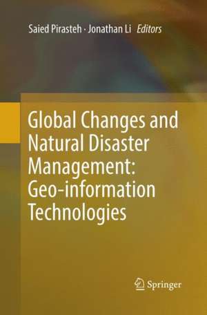
Global Changes and Natural Disaster Management: Geo-information Technologies
Editat de Saied Pirasteh, Jonathan Lien Limba Engleză Paperback – 18 iul 2018
This book presents ongoing research and ideas related to earth observations and global change, natural hazards and disaster management studies, with respect to geospatial information technology, remote sensing, and global navigation satellite systems. Readers will discover uses of advanced geospatial tools, spatiotemporal models, and earth observation systems. Chapters identify the international aspects of the coupled social, land and climate systems in global change studies, and consider such global challenges as agriculture monitoring, the smart city, and risk assessment.
The work presented here has been carefully selected, edited, and peer reviewed in order to advance research and development, as well as to encourage innovative applications of Geomatics technologies in global change studies. The book will appeal not only to academicians, but also to professionals, politicians and decision makers who wish to learn from the very latest and most innovative, quality research in this area of global change and natural disaster management.Contributions are drawn from revised submissions based on state-of-the-art papers from the 7th GiT4NDM - 5th EOGC, 2015 event.
| Toate formatele și edițiile | Preț | Express |
|---|---|---|
| Paperback (1) | 779.43 lei 39-44 zile | |
| Springer International Publishing – 18 iul 2018 | 779.43 lei 39-44 zile | |
| Hardback (1) | 792.04 lei 39-44 zile | |
| Springer International Publishing – 17 mar 2017 | 792.04 lei 39-44 zile |
Preț: 779.43 lei
Preț vechi: 1025.57 lei
-24% Nou
Puncte Express: 1169
Preț estimativ în valută:
149.15€ • 156.83$ • 123.24£
149.15€ • 156.83$ • 123.24£
Carte tipărită la comandă
Livrare economică 14-19 aprilie
Preluare comenzi: 021 569.72.76
Specificații
ISBN-13: 9783319847566
ISBN-10: 3319847562
Pagini: 228
Ilustrații: XV, 228 p. 94 illus., 79 illus. in color.
Dimensiuni: 155 x 235 mm
Ediția:Softcover reprint of the original 1st ed. 2017
Editura: Springer International Publishing
Colecția Springer
Locul publicării:Cham, Switzerland
ISBN-10: 3319847562
Pagini: 228
Ilustrații: XV, 228 p. 94 illus., 79 illus. in color.
Dimensiuni: 155 x 235 mm
Ediția:Softcover reprint of the original 1st ed. 2017
Editura: Springer International Publishing
Colecția Springer
Locul publicării:Cham, Switzerland
Cuprins
Part I. Land Use and Land Cover Change.- Examining the Effect of Land Use on the Spatiotemporal Dynamics of Urban Temperature in an Industrial City: A Landsat Imagery Analysis.- The study of Multi-Temporal Analysis of Urban Development and Environmental Changes of the City of Abu Dhabi.- CRF-based Simultaneous Segmentation and Classification of High-Resolution Satellite Images.- The Dynamic of Dike-Pond System in the Pearl River Delta during 1964-2012.- Part II. Agriculture Monitoring.- Effects of irrigation and nitrogen on maize growth and yield components.- A Review of the Effects of Drought on the Grain Yield in the Vays, Mollasani and Salamat Regions of the Khuzestan Province.- Part III. Smart City.- Communicating Disaster Risk Reduction through Web-map Applications.- Mapping sand dune fields in Abu Dhabi Emirate over the period of 1992-2013 using Landsat data.- Spatio–temporal Analysis and Image Registration for Studying Growth of Transportation Infrastructure in Sharjah City, UAE.- Part IV. Climate Change.- Assessment of the potential impacts of sea level rise on the Coastal Plain of Al Batinah, Sultanate of Oman.- Climate Change and Insecurity: An Examination of Gombe State’s Predicament in the North-Eastern Nigeria.- Climate Change and Forced Migration from Ngala and Kala-Balge LGAs, N.E. Borno State, Nigeria.- Part V. Risk Assessment.- Detection of Areas Associated with Flash Floods and Erosion Caused by Rainfall Storm Using Topographic Attributes, Hydrologic Indices, and GIS.- Collapse assessment of substandard concrete structures for seismic loss estimation of the building inventory in the UAE.- Slope Stability Risk Management in Open Pit Mines.- Part VI. Disaster Management.- Status of Spatial Analysis for Urban Emergency Management.- Experimental Study of the Mechanics of Gypsum Seam Hazard for Abu Dhabi.
Notă biografică
Saied Pirasteh is the Director of WIDM.Inc (www.widm.ca) Canada. He is also a Senior Scientist and the Assistant Head of the Mobile Mapping Lab at University of Waterloo. His research skills are in multi-disciplinary in applied geology and remote sensing & GIS applications including structural geology, exploration, and tectonic geomorphology, hydrology, watershed basin analysis, environmental issues and climate change, natural resources, natural hazards, and disaster management.
He obtained his Bachelor (1998), Master (2000), and PhD in 2004 from Aligarh Muslim University, India. He has supervised 14 PhD and MSc students internationally. He is also pursuing his second PhD in geography and environmental management (Applied LiDAR and Mobile Laser Scanning Systems) at the University of Waterloo. He is author/co-author of more than 150 publications in refereed journals, conference proceedings and books. He is currently the Editor-in-Chief of the International Geoinformatics Research and Development Journal (IGRDJ); and the founder of the International Association of Geo-information and Communication Technologies (GeoICT) Ontario, as well as International Conference on Geo-information Technologies for Natural Disaster Management (GiT4NDM). Jonathan Li is professor of geomatics at the Department of Geography and Environmental Management. He holds a Ph.D. degree in geomatics engineering from the University of Cape Town, South Africa in 2000. Prior to joining the University of Waterloo in 2007, he was on the faculty at Ryerson University and the University of Regina (2000-2006).
Professor Li’s research interests lie mainly in the areas of remote sensing and geographical information science. The focus is placed on use of the state-of-the-art Earth observation and mobile mapping systems to derive spatial and attribute information to support effective urban-suburban planning and environmental management activities; to extract geometric information of urban structures for developing theories and models of urban morphology; to detect land use and land cover changes to study spatiotemporal dynamics and consequences of urbanization as a major form of global changes.
Textul de pe ultima copertă
This book presents ongoing research and ideas related to earth observations and global change, natural hazards and disaster management studies, with respect to geospatial information technology, remote sensing, and global navigation satellite systems. Readers will discover uses of advanced geospatial tools, spatiotemporal models, and earth observation systems. Chapters identify the international aspects of the coupled social, land and climate systems in global change studies, and consider such global challenges as agriculture monitoring, the smart city, and risk assessment.
The work presented here has been carefully selected, edited, and peer reviewed in order to advance research and development, as well as to encourage innovative applications of Geomatics technologies in global change studies. The book will appeal not only to academicians, but also to professionals, politicians and decision makers who wish to learn from the very latest and most innovative, quality research in this area of global change and natural disaster management.
Contributions are drawn from revised submissions based on state-of-the-art papers from the 7th GiT4NDM - 5th EOGC, 2015 event.
Caracteristici
Brings the reader up to date with ongoing research and ideas related to earth observations and global change, natural hazards and disaster management studies Presents examples of various hazards and technologies used in different parts of the world describing and sharing knowledge Creates awareness to people about the future of the Earth Includes supplementary material: sn.pub/extras


