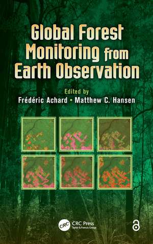
Global Forest Monitoring from Earth Observation: Earth Observation of Global Changes
Editat de Frederic Achard, Matthew C. Hansenen Limba Engleză Hardback – 19 noi 2012
Global Forest Monitoring from Earth Observation covers the very recent developments undertaken for monitoring forest areas from global to national levels using Earth observation satellite data. It describes operational tools and systems for monitoring forest ecosystems, discussing why and how researchers currently use remotely sensed data to study forest cover and loss over large areas. The book introduces the role of forests in providing ecosystem services and the need for monitoring their change over time, followed by an overview of the use of earth observation data to support forest monitoring. It discusses general methodological differences, including wall-to-wall mapping and sampling approaches, as well as data availability.
This book provides excellent coverage of the research and applications of forest monitoring, indicator mapping at coarse spatial resolution, sample-based assessments, and wall-to-wall mapping at medium spatial resolution using optical remote sensing datasets, such as MODIS and Landsat. It examines the use of radar imagery in forest monitoring and presents a number of operational systems, from Brazil’s PRODES and DETER products to Australia’s NCAS system. Written by leading global experts in the field, this book offers a launch point for future advances in satellite-based monitoring of global forest resources. It gives readers a deeper understanding of global forest monitoring methods and shows how state-of-the-art technologies may soon provide key data for creating more balanced policies.
Preț: 740.04 lei
Preț vechi: 1444.05 lei
-49% Nou
Puncte Express: 1110
Preț estimativ în valută:
141.61€ • 148.22$ • 117.86£
141.61€ • 148.22$ • 117.86£
Carte tipărită la comandă
Livrare economică 31 martie-14 aprilie
Preluare comenzi: 021 569.72.76
Specificații
ISBN-13: 9781466552012
ISBN-10: 1466552018
Pagini: 354
Ilustrații: 83 b/w images, 13 tables and Less than 100
Dimensiuni: 156 x 234 x 20 mm
Greutate: 0.66 kg
Ediția:New.
Editura: CRC Press
Colecția CRC Press
Seria Earth Observation of Global Changes
ISBN-10: 1466552018
Pagini: 354
Ilustrații: 83 b/w images, 13 tables and Less than 100
Dimensiuni: 156 x 234 x 20 mm
Greutate: 0.66 kg
Ediția:New.
Editura: CRC Press
Colecția CRC Press
Seria Earth Observation of Global Changes
Public țintă
Industry professionals, researchers, and academics working in the field of earth observation and global climate change; undergraduate and graduate students taking courses in forest ecology, remote sensing of forests, global environmental change, advanced remote sensing, land use, and land cover change; experts and scientists dealing with forest resource issues in relation to the UN Framework Convention on Climate Change; institutions dealing with regional or global programs on forestry, ecology, or climate issues; and other environmental scientists.Cuprins
Why Forest Monitoring Matters for People and the Planet. Role of Forests and Impact of Deforestation in the Global Carbon Cycle. Use of Earth Observation Technology to Monitor Forests over the Globe. Global Data Availability from US Satellites: Landsat and MODIS. Sampling Strategies for Forest Monitoring from Global to National Levels. Use of Coarse Resolution Imagery to Identify Hot Spots of Forest Loss at the Global Scale. Use of a Systematic Statistical Sample with Moderate Resolution Imagery to Assess Forest Cover Changes at Tropical to Global Scale. Monitoring Forest Loss and Degradation at National to Global Scales Using Landsat Data. The Brazilian Amazon Monitoring Program: PRODES and DETER Projects. Monitoring of Forest Degradation: A Review of Methods in the Amazon Basin. Use of Wall-to-Wall Moderate and High-Resolution Satellite Imagery to Monitor Forest Cover Across Europe. Monitoring US Forest Dynamics with Landsat. Long-Term Monitoring of Australian Land Cover Change Using Landsat Data: Development, Implementation, and Operation. Assessment of Burned Forest Areas over the Russian Federation from MODIS and Landsat-TM/ETM+ Imagery. Global Forest Monitoring with Radar (SAR) Data. Future Perspectives (Way Forward). Index.
Notă biografică
Dr. Frédéric Achard is a senior scientist at the Joint Research Centre (JRC), Ispra, Italy. Having joined the JRC in 1992, he started research over Southeast Asia in the framework of the TREES project. His current research interests include the development of Earth observation techniques for global and regional forest monitoring, and the assessment of the implications of forest cover changes in the tropics and boreal Eurasia on the global carbon budget. Dr. Achard received his Ph.D. in tropical ecology and remote sensing from Toulouse University, Toulouse, France, in 1989. He has co-authored more than 50 peer-reviewed papers in leading scientific journals including Nature, Science, International Journal of Remote Sensing, Forest Ecology and Management, Global Biogeochemical Cycles, and Remote Sensing of Environment.
Dr. Matthew C. Hansen is a professor in the Department of Geographical Sciences at the University of Maryland, College Park. He has a bachelor of electrical engineering degree from Auburn University, Alabama, USA. His graduate degrees include a master of engineering in civil engineering and a master of arts in geography from the University of North Carolina at Charlotte and a doctoral degree in geography from the University of Maryland, College Park, USA. His research specialization is in large area land cover monitoring using multi-spectral, multi-temporal, and multi-resolution remotely sensed data sets. He is an associate member of the MODIS (moderate resolution imaging spectroradiometer) Land Science Team and a member of the GOFC-GOLD Implementation Working Group.
Dr. Matthew C. Hansen is a professor in the Department of Geographical Sciences at the University of Maryland, College Park. He has a bachelor of electrical engineering degree from Auburn University, Alabama, USA. His graduate degrees include a master of engineering in civil engineering and a master of arts in geography from the University of North Carolina at Charlotte and a doctoral degree in geography from the University of Maryland, College Park, USA. His research specialization is in large area land cover monitoring using multi-spectral, multi-temporal, and multi-resolution remotely sensed data sets. He is an associate member of the MODIS (moderate resolution imaging spectroradiometer) Land Science Team and a member of the GOFC-GOLD Implementation Working Group.
Recenzii
"This book by Achard and Hansen is timely and most welcome ... . With the help of key international experts, this volume reviews achievements in using a range of satellite data sources and in applying latest developments in remote sensing science. ... this book also constitutes a good base for addressing future needs in terms of technology and novel applications. In addition, the information contained in the impressive list of contributions to this volume significantly adds to the scientific understanding of the role of forest in the earth system. Changes which are currently taking place in many forested areas of the world are rapid; the necessity of providing regular reviews such as the one presented here by Achard and Hansen is, indeed, critical."
—Jean P. Malingreau, Scientific Adviser, Joint Research Centre, European Commission
—Jean P. Malingreau, Scientific Adviser, Joint Research Centre, European Commission
Descriere
Covering recent developments in satellite observation data undertaken for monitoring forest areas from global to national levels, this book highlights operational tools and systems for monitoring forest ecosystems. It also tackles the technical issues surrounding the ability to produce accurate and consistent estimates of forest area changes, which are needed to report greenhouse gas emissions and removals from land use changes. Written by leading global experts in the field, this book offers a launch point for future advances in satellite-based monitoring of global forest resources. It gives readers a deeper understanding of monitoring methods and shows how state-of-art technologies may soon provide key data for creating more balanced policies.
