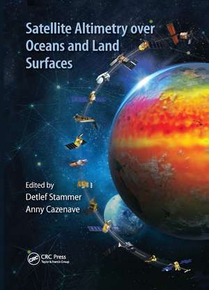
Satellite Altimetry Over Oceans and Land Surfaces: Earth Observation of Global Changes
Editat de Detlef Stammer, Anny Cazenaveen Limba Engleză Paperback – 12 dec 2019
| Toate formatele și edițiile | Preț | Express |
|---|---|---|
| Paperback (1) | 370.25 lei 6-8 săpt. | |
| CRC Press – 12 dec 2019 | 370.25 lei 6-8 săpt. | |
| Hardback (1) | 1363.28 lei 6-8 săpt. | |
| CRC Press – 25 oct 2017 | 1363.28 lei 6-8 săpt. |
Preț: 370.25 lei
Preț vechi: 477.20 lei
-22% Nou
Puncte Express: 555
Preț estimativ în valută:
70.86€ • 73.88$ • 58.89£
70.86€ • 73.88$ • 58.89£
Carte tipărită la comandă
Livrare economică 21 martie-04 aprilie
Preluare comenzi: 021 569.72.76
Specificații
ISBN-13: 9780367874841
ISBN-10: 0367874849
Pagini: 670
Dimensiuni: 178 x 254 x 36 mm
Greutate: 0.45 kg
Ediția:1
Editura: CRC Press
Colecția CRC Press
Seria Earth Observation of Global Changes
ISBN-10: 0367874849
Pagini: 670
Dimensiuni: 178 x 254 x 36 mm
Greutate: 0.45 kg
Ediția:1
Editura: CRC Press
Colecția CRC Press
Seria Earth Observation of Global Changes
Public țintă
Professional Practice & DevelopmentCuprins
Preface. Editors. Contributors. Satellite Radar Altimetry: Principle, Accuracy, and Precision. Wide-Swath Altimetry: A Review. In Situ Observations Needed to Complement, Validate, and Interpret Satellite Altimetry. Auxiliary Space-Based Systems for Interpreting Satellite Altimetry: Satellite Gravity. A 25-Year Satellite Altimetry-Based Global Mean Sea Level Record: Closure of the Sea Level Budget and Missing Components. Monitoring and Interpreting Mid-Latitude Oceans by Satellite Altimetry. Monitoring and Interpreting the Tropical Oceans by Satellite Altimetry. The High Latitude Seas and Arctic Ocean. The Southern Ocean. Ocean Eddies and Mesoscale Variability. Satellite Altimetry in Coastal Regions. Monitoring Waves and Surface Winds by Satellite Altimetry: Applications. Tides and Satellite Altimetry. Hydrological Applications of Satellite Altimetry: Rivers, Lakes, Man-Made Reservoirs, Inundated Areas. Applications of Satellite Altimetry to Study the Antarctic Ice Sheet. Advances in Imaging Small-Scale Seafloor and Sub-Seafloor Tectonic Fabric Using Satellite Altimetry. Ocean Modeling and Data Assimilation in the Context of Satellite Altimetry. Use of Satellite Altimetry for Operational Oceanography.Index.
Notă biografică
Detef Stammer is a professor of physical oceanography and Earth system remote sensing at the Universität Hamburg in Germany, where he is director of the Center für Erdsystemforschung und Nachhaltigkeit. His research interests include ocean and climate variability analyzed from ocean and climate data in combination with ocean and climate modes (assimilation). The use of satellite altimetry and other satellite observations for studies of ocean circulation, ocean dynamics, and mixing and eddy transports are central to his work. One such aspect is the use of altimeter data for quantitative testing of general ocean circulation models. He has published more than 180 articles in international journals and was the lead author of the Fifth Intergovernmental Panel on Climate Change Working Group I Assessment report. He has served on several national and international scientific committees and is fellow of the American Geophysical Union.
Anny Cazenave is senior scientist at the Laboratoire d’Etudes en Géophysique et Océanographie Spatiale, Centre National d’Etudes Spatiales, Toulouse, France, and director for Earth sciences at the International Space Science Institute, Bern, Switzerland. Her research deals with the applications of space techniques to geosciences (geodesy, gravity, and solid Earth geophysics; sea level variations and the study of climatic causes; global water cycle and land hydrology from space; and climate research). She has lengthy experience in using satellite altimetry for studying the marine geoid, land surface waters, and sea level. She has published more than 200 articles in international journals and has edited several books. She has contributed as P.I. or co-I in geodesy and oceanography for several space missions and has served as the lead author of the Intergovernmental Panel on Climate Change Working Group I (fourth and fifth assessment reports). She is fellow of the American Geophysical Union, a member of th
Recenzii
"Satellite Earth Observation is critical to understand planet processes, particularly those that are changing at human scales as a result of our interaction with natural cycles. Accurate measurements of oceans and ice heights are very important to understand the impacts of climate warming on oceans and coastal areas. Drs. Detlef Stammer and Anny Cazenave have gather an impressive list of scientists working on satellite altimetry to offer an excellent vision on the satellite altimeter missions and their relevant applications. A very recommended reading for oceanography, hydrology, climate and remote sensing students."
—Emilio Chuvieco, University of Alcalá, editor in chief of Remote Sensing of Environment, Alcalá de Henares, Spain
"This book will be for many years the central resource for users of satellite altimetry data. Anyone interested in how the measurements are accomplished and how they can be used in any of these scientific fields---including the greatly improved knowledge of the oceanic general circulation and its consequences---will find reading this book an essential step."
— Carl Wunsch, Harvard University, Cambridge, Massachusetts, USA
"This book is a timely update on the current state of knowledge on the use of space-based altimeters for the study of oceans, coasts, polar regions and inland water bodies. The book is comprehensive in treatment of all subjects related to space-based altimeters. There are about 90 global experts serving as co-authors. They have been in the forefront of advancing the science and technology of satellite altimeters and their application, including data assimilation and operational oceanography, during the past few decades. As such, the book and its contents benefit greatly from the knowledge, expertise and first-hand experience of its authors. The book can serve as a combination of text and reference for teaching and research, especially for graduate students and early career scholars
Descriere
Satellite remote sensing, in particular by radar altimetry, is a crucial technique for observations of the ocean surface and of many aspects of land surfaces, and of paramount importance for climate and environmental studies. It provides a state-of-the-art overview of the satellite altimetry techniques and related missions.


