Gravitational Atlas of Antarctica: Springer Geophysics
Autor Jaroslav Klokočník, Jan Kostelecký, Aleš Bezděken Limba Engleză Hardback – iun 2017
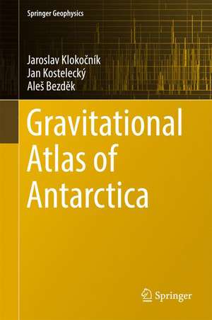
Due to their various degrees of sensitivity to the density contrasts of causative bodies under the Earth’s surface, these maps provide many details that have a range of potential geo-applications. They guide the reader through the entire continent, in segments divided by 30 degrees of longitude, and through geodetic latitudes of between 60 and 90 degrees south. Each segment is complemented by detailed zoom-in maps for selected localities of special interest.
| Toate formatele și edițiile | Preț | Express |
|---|---|---|
| Paperback (1) | 770.15 lei 38-44 zile | |
| Springer International Publishing – 2 aug 2018 | 770.15 lei 38-44 zile | |
| Hardback (1) | 781.06 lei 38-44 zile | |
| Springer International Publishing – iun 2017 | 781.06 lei 38-44 zile |
Din seria Springer Geophysics
- 18%
 Preț: 1270.92 lei
 - 18%
 Preț: 1223.55 lei
 - 18%
 Preț: 950.52 lei
 -
 Preț: 417.67 lei
 - 18%
 Preț: 1025.79 lei
 - 24%
 Preț: 629.56 lei
 - 19%
 Preț: 459.46 lei
 - 18%
 Preț: 779.89 lei
 - 18%
 Preț: 962.66 lei
 - 24%
 Preț: 952.93 lei
 - 15%
 Preț: 646.43 lei
 - 18%
 Preț: 946.21 lei
 - 15%
 Preț: 647.92 lei
 - 24%
 Preț: 860.15 lei
 - 20%
 Preț: 613.50 lei
 - 15%
 Preț: 642.51 lei
 - 24%
 Preț: 1170.15 lei
 - 15%
 Preț: 501.71 lei
 - 15%
 Preț: 649.39 lei
 - 18%
 Preț: 786.84 lei
 - 18%
 Preț: 780.19 lei
 - 19%
 Preț: 493.13 lei
 - 18%
 Preț: 950.21 lei
 - 18%
 Preț: 727.31 lei
 - 15%
 Preț: 656.89 lei
 - 15%
 Preț: 518.64 lei
 - 15%
 Preț: 662.80 lei
 - 18%
 Preț: 962.66 lei
 - 18%
 Preț: 892.74 lei
 - 18%
 Preț: 1126.17 lei
 - 18%
 Preț: 733.33 lei
 - 18%
 Preț: 962.49 lei
 - 15%
 Preț: 649.87 lei
 - 18%
 Preț: 962.18 lei
Preț: 781.06 lei
Preț vechi: 1027.71 lei
-24% Nou
Puncte Express: 1172
Preț estimativ în valută:
149.46€ • 156.44$ • 124.39£
149.46€ • 156.44$ • 124.39£
Carte tipărită la comandă
Livrare economică 26 martie-01 aprilie
Preluare comenzi: 021 569.72.76
Specificații
ISBN-13: 9783319566382
ISBN-10: 3319566385
Pagini: 113
Ilustrații: XI, 113 p. 189 illus. in color.
Dimensiuni: 155 x 235 mm
Greutate: 0.36 kg
Ediția:1st ed. 2017
Editura: Springer International Publishing
Colecția Springer
Seria Springer Geophysics
Locul publicării:Cham, Switzerland
ISBN-10: 3319566385
Pagini: 113
Ilustrații: XI, 113 p. 189 illus. in color.
Dimensiuni: 155 x 235 mm
Greutate: 0.36 kg
Ediția:1st ed. 2017
Editura: Springer International Publishing
Colecția Springer
Seria Springer Geophysics
Locul publicării:Cham, Switzerland
Cuprins
1. Introduction.- 2. Theory.- 2.1. Definitions.- 2.2. Comments on the theory.- 3. Data.- 3.1. Recent high-resolution gravitational model EIGEN 6C4.- 3.2. Bedrock topography model BEDMAP2.- 3.3. A combination of the gravity and bedrock topograhphy data RET 14.- 3.4. Other data.- 3.5. Practical guide to figures in our Atlas.- 4. Antarctica - a general look.- 5. Segments and selected details.- 6. Conclusion.- 7. Acknowledgements.- References.
Notă biografică
Jaroslav Klokočník (*1948 in Prague) is an emeritus professor and research worker in the field of space geodesy, satellite dynamics and geodynamics. He has published over 220 research papers and is the author or co-author of five books and of three class texts. He studied geodesy and cartography at the Faculty of Civil Engineering, Czech Technical University in Prague. He obtained his master‘s degree in 1971. Since 1972 we works at the Astronomical Institute, Czech Academy of Sciences, Ondřejov Observatory, where he defended PhD for astronomy in 1979 and DrSc for astronomy in 1996. Meantime he was also a lecturer at the Faculty (advanced course on satellite geodesy), where he received titles Associate Professor in 2000 and then in 2009 Professor of Theoretical and Space Geodesy. He was a consultant of several postdocs and a member of the Faculty’s committee for postdoctoral studies.
His specialisation involves the study of orbital resonances of artificial satellites and studies of the Earth’s gravity field, satellite altimetry and gradiometry, static as well as variable gravity field. Now, he is interested mostly in geo-applications of the recent Earth’s gravitational field models. He has been cooperating for a long time with several institutes in Germany, USA, Egypt, and elsewhere. He has also been interested in archaeoastronomy; he accomplished series of field measurements in Mesoamerica, Peru and China between 1997 and 2011.
Jan Kostelecký (*1946 in Prague) is a senior researcher in geodesy, space geodesy and geodynamics. He has published over 260 research articles and several books on a broad array in space geodesy. He studied geodesy and cartography at the Faculty of Civil Engineering, Czech Technical University in Prague, he obtained his master‘s degree in 1969. Then in 1971 he started to work as a researcher at the Research Institute of Geodesy and Cartography, Czech Republic, in this institute he has been working to this day. He obtained the PhD degree in 1983.
Simultaneously since 1983 he worked at the Faculty of Civil Engineering, Czech Technical University in Prague, since 1992 as an Associate Professor and since 1997 as a Professor of Theoretical and Space Geodesy, since 2011 he has become the Professor Emeritus. He is also active as a teacher at the Faculty of Mining and Geology, Technical University of Ostrava. His research is especially concerned with the determination and application of the gravity field of the Earth, geodynamics and the establishment of geodetic networks.
Aleš Bezděk (*1970 in Prague) is an academic worker in the field of astrodynamics and space geodesy. He studied physics and astronomy at the Charles University in Prague, where he obtained his master’s (1997) and PhD (2004) diplomas. Since 2001 he has been working at the Astronomical Institute, Czech Academy of Sciences. His research interests include orbital dynamics of low Earth artificial satellites, time‑variable gravity field, orbital resonances, nongravitational forces, atmospheric drag, space accelerometers, applied time series analysis. He co-authored twenty-six peer-reviewed journal articles, ten papers in conference proceedings, two monographs. He has been cooperating with researchers from France, Germany, Netherlands, USA and other countries.
Textul de pe ultima copertă
This book presents maps of Antarctica, exploring various aspects of its disturbing geopotential and based on the EIGEN 6C4 model, arguably the best gravitational field model currently available. It also provides the latest data on Antarctica’s bedrock topography according to Bedmap 2. In an extensive series of segment maps the book highlights (i) a gravity anomaly (disturbance), (ii) the Marussi tensor of the second derivatives of the disturbing geopotential, (iii) invariants and their ratios, (iv) the strike angle, and (v) virtual deformations.
Due to their various degrees of sensitivity to the density contrasts of causative bodies under the Earth’s surface, these maps provide many details that have a range of potential geo-applications. They guide the reader through the entire continent, in segments divided by 30 degrees of longitude, and through geodetic latitudes of between 60 and 90 degrees south. Each segment is complemented by detailed zoom-in maps for selected localities of special interest.
Due to their various degrees of sensitivity to the density contrasts of causative bodies under the Earth’s surface, these maps provide many details that have a range of potential geo-applications. They guide the reader through the entire continent, in segments divided by 30 degrees of longitude, and through geodetic latitudes of between 60 and 90 degrees south. Each segment is complemented by detailed zoom-in maps for selected localities of special interest.
Caracteristici
Presents the first complete atlas of Antarctica's gravitational information in high resolution Features numerous color figures showing each segment of the continent Serves a wide range of readers/users Includes supplementary material: sn.pub/extras


