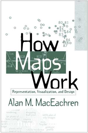
How Maps Work: Representation, Visualization, and Design
Autor Alan M. MacEachrenen Limba Engleză Paperback – 19 aug 2004
Now available in paperback for the first time, this classic work presents a cognitive-semiotic framework for understanding how maps work as powerful, abstract, and synthetic spatial representations. Explored are the ways in which the many representational choices inherent in mapping interact with information processing and knowledge construction, and how the resulting insights can be used to make informed symbolization and design decisions. A new preface to the paperback edition situates the book within the context of contemporary technologies. As the nature of maps continues to evolve, Alan MacEachren emphasizes the ongoing need to think systematically about the ways people interact with and use spatial information.
| Toate formatele și edițiile | Preț | Express |
|---|---|---|
| Paperback (1) | 473.13 lei 6-8 săpt. | |
| Guilford Publications – 19 aug 2004 | 473.13 lei 6-8 săpt. | |
| Hardback (1) | 699.44 lei 6-8 săpt. | |
| Guilford Publications – 30 iun 1995 | 699.44 lei 6-8 săpt. |
Preț: 473.13 lei
Nou
Puncte Express: 710
Preț estimativ în valută:
90.54€ • 92.73$ • 75.32£
90.54€ • 92.73$ • 75.32£
Carte tipărită la comandă
Livrare economică 18 martie-01 aprilie
Preluare comenzi: 021 569.72.76
Specificații
ISBN-13: 9781572300408
ISBN-10: 157230040X
Pagini: 513
Ilustrații: illustrations
Dimensiuni: 152 x 229 x 32 mm
Greutate: 0.78 kg
Ediția:Pbk.
Editura: Guilford Publications
Colecția Guilford Press
ISBN-10: 157230040X
Pagini: 513
Ilustrații: illustrations
Dimensiuni: 152 x 229 x 32 mm
Greutate: 0.78 kg
Ediția:Pbk.
Editura: Guilford Publications
Colecția Guilford Press
Public țintă
Professional Practice & Development and UndergraduateCuprins
1. Taking a Scientfic Approach to Improving Map Representation and Design
I. How Meaning Is Derived from Maps
2. An Information-Processing View of Vision and Visual Cognition
3. How Maps Are Seen
4. How Maps Are Understood:
Visual Array
Visual Description
Knowledge Schemata
Cognitive Representation
II. How Maps Are Imbued with Meaning
5. A Primer on Semiotics for Understanding Map Representation
6. A Functional Approach to Map Representation: The Semantics and Syntactics of Map Signs
7. A Lexical Approach to Map Representation: Map Pragmatics
III. How Maps Are Used: Applications in Geographic Thinking
8. GVIS: Facilitating Visual Thinking
9. GVIS: Relationships in Space and Time
10. GVIS: Should We Believe What We See?
Postscript
Notă biografică
Alan M. MacEachren is currently Professor of Geography and Director of the GeoVISTA Center at The Pennsylvania State University. In addition to researching cognitive and semiotic aspects of how maps work, he is active in the development of interactive systems for geographic visualization and in understanding and enabling group work with geospatial information and technologies. He is the author of Some Truth with Maps and coeditor of Visualization in Modern Cartography.
Recenzii
Should be required reading for anyone making maps.--C. E. Tiedemann, University of Illinois at Chicago
Alan MacEachren has made a significant and important contribution to our understanding of cartography. The map is as old as societies themselves and is a fundamental building block of human knowledge. This book should be mandatory reading for all those interested in the role of maps in the emerging information era.--D. R. F. Taylor, past president, International Cartographic Association
I believe this book to be a milestone in the literature of cartography. There have been texts on the history, on the production/design and to aid the teaching of maps and mapping but there has never been such a comprehensive and balanced examination of maps as tools....With its rich array of subtopics, levels of treatment and specialized sections worthy of deep quarrying, and also its extensive and fascinating range of illustrations, I believe that this book can command a wide and varied readership. It will certainly become a foundation stone in my own teaching and research library.--Michael Wood, Centre for Remote Sensing and Mapping Science, Department of Geography, University of Aberdeen, Scotland
In looking at maps as spatial representations that stimulate other spatial representations, Alan MacEachren provides an insightful and coherent examination of the cognitive mechanisms underlying map reading and map analysis. How Maps Work is a tour de force for academic cartography and other fields concerned with perceptual, cognitive, and metaphysical aspects of spatial information--a masterful synthesis of interest to anyone curious about the map as a unique and valuable tool for exploration, discovery, and hypothesis testing.--Mark Monmonier, Department of Geography, Syracuse University
-Alan MacEachren has made a significant and important contribution to our understanding of cartography. The map is as old as societies themselves and is a fundamental building block of human knowledge. This book should be mandatory reading for all those interested in the role of maps in the emerging information era.--D. R. F. Taylor, past president, International Cartographic Association
I believe this book to be a milestone in the literature of cartography. There have been texts on the history, on the production/design and to aid the teaching of maps and mapping but there has never been such a comprehensive and balanced examination of maps as tools....With its rich array of subtopics, levels of treatment and specialized sections worthy of deep quarrying, and also its extensive and fascinating range of illustrations, I believe that this book can command a wide and varied readership. It will certainly become a foundation stone in my own teaching and research library.--Michael Wood, Centre for Remote Sensing and Mapping Science, Department of Geography, University of Aberdeen, Scotland
In looking at maps as spatial representations that stimulate other spatial representations, Alan MacEachren provides an insightful and coherent examination of the cognitive mechanisms underlying map reading and map analysis. How Maps Work is a tour de force for academic cartography and other fields concerned with perceptual, cognitive, and metaphysical aspects of spatial information--a masterful synthesis of interest to anyone curious about the map as a unique and valuable tool for exploration, discovery, and hypothesis testing.--Mark Monmonier, Department of Geography, Syracuse University
This clearly is an important book....A thoughtful and thought-provoking intellectual treatise on the role of graphic representation in human perception, cognition, visualization, and communication. Although the vehicle for this journey is the geographic map, you will learn a great deal about yourself and your interaction with the environment along the way.
--URISA Journal, 6/23/2004ƒƒI used the book in a graduate seminar series....The book created a fabric for discussion which was rich enough and broad enough to support extensive and intensive scrutiny....I recommend it to mapping science and GIS professionals, to scientists working in computer vision, to everyone whose work involves creation of, or inference about, representations of spatial information.
--Environment and Planning B: Planning and Design, 6/23/2004Descriere
Now available in paperback for the first time, this classic work presents a cognitive-semiotic framework for understanding how maps work as powerful, abstract, and synthetic spatial representations. Explored are the ways in which the many representational choices inherent in mapping interact with information processing and knowledge construction, and how the resulting insights can be used to make informed symbolization and design decisions. A new preface to the paperback edition situates the book within the context of contemporary technologies. As the nature of maps continues to evolve, Alan MacEachren emphasizes the ongoing need to think systematically about the ways people interact with and use spatial information.


