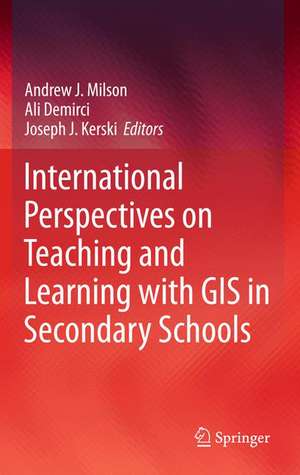
International Perspectives on Teaching and Learning with GIS in Secondary Schools
Editat de Andrew J. Milson, Ali Demirci, Joseph J. Kerskien Limba Engleză Hardback – 28 sep 2011
International Perspectives on Teaching and Learning with GIS in Secondary Schools brings together authors from 34 countries who profile the current status of GIS in secondary school teaching and learning in their country. Each chapter includes a summary of the country’s educational context, a case study illustrating how GIS is used in secondary schooling, and an assessment of the opportunities and challenges in teaching and learning with GIS now and in the future. The book demonstrates that GIS is not only a technological tool to be used in the classroom, but also a catalyst for motivation, encouragement, and cooperation in understanding and solving global problems.
The most up to date and extensive survey of GIS in the secondary education landscape, covering both principles and practice.
Professor David Maguire, Pro-Vice-Chancellor, Birmingham City University, UK
International Perspectives on Teaching andLearning With GIS in Secondary Schools is a highly relevant, critically important, reflective contribution to the literature, providing strong arguments supporting the inclusion for spatial studies for all in secondary school education.
Karl Donert, President, EUROGEO
This is an invaluable and inspirational examination of innovation in geospatial technologies in secondary schools around the world. Each chapter contains practical models for how to integrate powerful tools for spatial analysis into a range of subjects. It will be useful to classroom teachers and administrators seeking pathways to implementation and teacher educators considering how to prepare the next generation to use geospatial technologies.
Sarah Witham Bednarz, Department of Geography, Texas A&M University, College Station, TX, USA
| Toate formatele și edițiile | Preț | Express |
|---|---|---|
| Paperback (1) | 645.28 lei 6-8 săpt. | |
| SPRINGER NETHERLANDS – 28 noi 2014 | 645.28 lei 6-8 săpt. | |
| Hardback (1) | 649.87 lei 6-8 săpt. | |
| SPRINGER NETHERLANDS – 28 sep 2011 | 649.87 lei 6-8 săpt. |
Preț: 649.87 lei
Preț vechi: 764.55 lei
-15% Nou
Puncte Express: 975
Preț estimativ în valută:
124.37€ • 129.36$ • 102.67£
124.37€ • 129.36$ • 102.67£
Carte tipărită la comandă
Livrare economică 12-26 aprilie
Preluare comenzi: 021 569.72.76
Specificații
ISBN-13: 9789400721197
ISBN-10: 9400721196
Pagini: 225
Ilustrații: XXXIX, 353 p.
Dimensiuni: 155 x 235 x 20 mm
Greutate: 0.68 kg
Ediția:2012
Editura: SPRINGER NETHERLANDS
Colecția Springer
Locul publicării:Dordrecht, Netherlands
ISBN-10: 9400721196
Pagini: 225
Ilustrații: XXXIX, 353 p.
Dimensiuni: 155 x 235 x 20 mm
Greutate: 0.68 kg
Ediția:2012
Editura: SPRINGER NETHERLANDS
Colecția Springer
Locul publicării:Dordrecht, Netherlands
Public țintă
ResearchCuprins
About the Editors.- List of Contributors.- Acknowledgements.- Foreword.- List of Illustrations.-The World at their Fingertips: A New Age for Spatial Thinking.- Australia: Inquiry Learning with GIS to Simulate Coastal Storm Inundation.- Austria: Links between Research Institutions and Secondary Schools for Geoinformation Research and Practice.- Canada: Teaching Geography and the Social Sciences through Geotechnology across a Decentralized Curriculum Landscape.- Chile: GIS and the Reduction of the Digital Divide in the Pan-American World.- China: Teacher Preparation for GIS in the National Geography Curriculum.- Colombia: Development of a Prototype Web-based GIS Application for Teaching Geography.- Denmark: Early Adoption and Continued Progress of GIS for Education.- Dominican Republic: Prospects for the Incorporation of GIS into the School Curriculum.- Finland: Diffusion of GIS in Schools from Local Innovations to the Implementation of a National Curriculum.- France: Dogmatic Innovations, Innovative Teachers, and Parallel Experimentations.- Germany: Diverse GIS Implementations within a Diverse Educational Landscape.- Ghana: Prospects for Secondary School GIS Education in a Developing Country.- Hungary: GIS in Natural Science Teacher Training .- India: Localized Introduction of GIS in Elite Urban Private Schools and Prospects for Diffusion.- Japan: GIS-enabled Field Research and a Cellular Phone GIS Application in Secondary Schools.- Lebanon: A Personal Journey from Professional Development to GIS Implementation in an English Language Classroom.- Malta: GIS and Geography Teaching in the Context of Educational Reform.- The Netherlands: Introduction and Diffusion of GIS for Geography Education, 1980s to the Present.- New Zealand: Pioneer Teachers and the Implementation of GIS in Schools.- Norway: National Curriculum Mandates and the Promise of Web-based GIS Applications.- Portugal: Experimental Science Learning, WebGIS, and the ConTIG project.- Rwanda:Socioeconomic Transformation to a Knowledge-based Economy through the Integration of GIS in Secondary Schools.- Singapore: The Information Technology Masterplan and the Expansion of GIS for Geography Education.- South Africa: Teaching Geography with GIS across Diverse Technological Contexts.- South Korea: GIS Implementation Profiles among Secondary Geography Teachers.- Spain: Institutional Initiatives for Improving Geography Teaching with GIS.- Switzerland: Introducing Geo-Sensor Technologies and Cartographic Concepts through the Map Your World Project.- Taiwan: The Seed of GIS Falls Onto Good Ground.- Turkey: GIS for Teachers and the Advancement of GIS in Geography Education.- Uganda: Educational Reform, the Rural-Urban Digital Divide, and the Prospects for GIS in Schools.- United Arab Emirates: Building Awareness of GIS in Education through Government and University Outreach.- United Kingdom: Realizing the Potential for GIS in the School Geography Curriculum.- United States of America: Rugged Terrain and Fertile Ground for GIS in Secondary Schools.- Synthesis: The Future Landscape of GIS in Secondary Education.- Bibliography.- Index.
Recenzii
International Perspectives on Teaching and Learning With GIS in Secondary Schools is essential reading for anyone concerned with the vital role that geospatial information technologies must play in 21st Century global education. Through rich international examples, this book provides a clear and powerful overview of vital benefits, converging trends, and shared imperatives that mandate the integration of GIS and GIScience across the educational spectrum.
Lyn Malone
WORLD VIEWS: Spatial Technologies for Education
ESRI Authorized K-12 Trainer
Co-Coordinator, Rhode Island Geography Education Alliance
The most up to date and extensive survey of GIS in the secondary education landscape, covering both principles and practice.
Professor David Maguire, Pro-Vice-Chancellor, Birmingham City University, UK
International Perspectives on Teaching and Learning With GIS in Secondary Schools is a highly relevant, critically important, reflective contribution to the literature, providing strong arguments supporting the inclusion for spatial studies for all in secondary school education.
Karl Donert, President, EUROGEO
What do China, Finland, India, Norway, South Africa, Taiwan, Turkey and the UK have in common? GIS in the curriculum! Imagine comparing the national curricula of 33 countries spanning every populated continent, and "zooming in" to specific applications of GIS in each country. This book is a significant contribution to the field and the "known world" of GIS education in K-12 settings and beyond, providing the big picture, global insights and recommendations for the future.
Marsha Alibrandi, Fairfield University
This is an invaluable and inspirational examination of innovation in geospatial technologies in secondary schools around the world. Each chapter contains practical models for how to integrate powerful tools for spatial analysis into a range ofsubjects. It will be useful to classroom teachers and administrators seeking pathways to implementation and teacher educators considering how to prepare the next generation to use geospatial technologies.
Sarah Witham Bednarz, Department of Geography, Texas A&M University
From the reviews:
“An eagerly awaited volume editied by three GIS scholars, the new International Perspectives on Teaching and Learning with GIS in Secondary Schools is a comprehensive guide to the current state of Geographic Information Systems (GIS) in education globally. This is no small task, and its value to the GIS in education community is as broad as the book's scope. For educators, policy-makers, Geography and Teacher educators, this collection of 67 international contributors, with a foreword by Roger Tomlinson, Canadian "father" of GIS, the book commands an important niche on the library shelf of all geography educators. … this volume is one that certainly deserves to belong on the shelves of geography teachers and teacher educators, science teachers and teacher educators, and instructional technologies teachers and teacher educators. It would be most instructive to school administrators and policy-makers in any state, province, nation or district. With the teaching and learning of GIS in schools now fully in its third decade, an international comparative study such as this is immensely important for the future of geographic education. This compilation is a vital work and should be read by individuals in each school district today as we enter a new landscape of learning and teaching with geospatial technologies.” (Marsha Alibrandi, Review of International Geographical Education Online, Vol. 1 (2), 2011)
“Authors from 33 countries contributed, illustrating how students learn GIS and how instructors teach with GIS around the world. … The book offers evidence that GIS provides a strong geographic framework and critical thinking skills that willserve students well in the future. … The book ends with reflections on the progress made in teaching and learning with GIS over the past 20 years … and recommendations as to what needs to happen to meet the goal of engaging all students in thinking spatially.” (ArcWatch, February, 2012)
Textul de pe ultima copertă
This, the first publication to collate a broad international perspective on the pedagogical value of GIS technology in classrooms, offers an unprecedented range of expert views on the subject. Geographic Information Systems (GISs) are now ubiquitous and relatively inexpensive. They have revolutionized the way people explore and understand the world around them. The capability they confer allows us to capture, manage, analyze, and display geographic data in ways that were undreamt of a generation ago. GIS has enabled users to make decisions and solve problems as diverse as designing bus routes, locating new businesses, responding to emergencies, and researching climate change. GIS is also having a major impact in the classroom. Students and teachers around the world are using this significant emerging technology in the secondary school classroom to study social and scientific concepts and processes, to broaden their technical skills, and to engage in problem solving and decision making about local and global issues.
International Perspectives on Teaching and Learning with GIS in Secondary Schools brings together authors from 34 countries who profile the current status of GIS in secondary school teaching and learning in their country. Each chapter includes a summary of the country’s educational context, a case study illustrating how GIS is used in secondary schooling, and an assessment of the opportunities and challenges in teaching and learning with GIS now and in the future. The book demonstrates that GIS is not only a technological tool to be used in the classroom, but also a catalyst for motivation, encouragement, and cooperation in understanding and solving global problems.
The most up to date and extensive survey of GIS in the secondary education landscape, covering both principles and practice.Professor David Maguire, Pro-Vice-Chancellor, Birmingham City University, UK
International Perspectives on Teaching andLearning With GIS in Secondary Schools is a highly relevant, critically important, reflective contribution to the literature, providing strong arguments supporting the inclusion for spatial studies for all in secondary school education.
Karl Donert, President, EUROGEO
This is an invaluable and inspirational examination of innovation in geospatial technologies in secondary schools around the world. Each chapter contains practical models for how to integrate powerful tools for spatial analysis into a range of subjects. It will be useful to classroom teachers and administrators seeking pathways to implementation and teacher educators considering how to prepare the next generation to use geospatial technologies.
Sarah Witham Bednarz, Department of Geography, Texas A&M University, College Station, TX, USA
Caracteristici
Is the first book to capture an international perspective on the status of GIS in schools Include in each chapter at least one author who currently lives and works in the country profiled and can thus provide the most appropriate local perspective on the country Demonstrates that GIS is not only a technological tool to be used in the classroom, but it is also an avenue for motivation, encouragement, and cooperation in understanding and solving global problems Provides many different examples, ideas, and methods of using GIS and GPS in secondary schools from around the world. Features inquiry-based learning about current events using real-world data in a problem-solving, technology-driven environment
