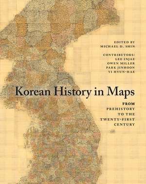
Korean History in Maps: From Prehistory to the Twenty-First Century
Editat de Michael D. Shin Autor Lee Injae, Owen Miller, Park Jinhoon, Yi Hyun-Haeen Limba Engleză Paperback – 14 dec 2014
| Toate formatele și edițiile | Preț | Express |
|---|---|---|
| Paperback (1) | 168.04 lei 3-5 săpt. | |
| Cambridge University Press – 14 dec 2014 | 168.04 lei 3-5 săpt. | |
| Hardback (1) | 605.27 lei 6-8 săpt. | |
| Cambridge University Press – 14 dec 2014 | 605.27 lei 6-8 săpt. |
Preț: 168.04 lei
Nou
Puncte Express: 252
Preț estimativ în valută:
32.16€ • 34.92$ • 27.01£
32.16€ • 34.92$ • 27.01£
Carte disponibilă
Livrare economică 01-15 aprilie
Preluare comenzi: 021 569.72.76
Specificații
ISBN-13: 9781107490239
ISBN-10: 1107490235
Pagini: 200
Ilustrații: 28 b/w illus. 100 colour illus. 27 tables
Dimensiuni: 220 x 275 x 15 mm
Greutate: 0.57 kg
Editura: Cambridge University Press
Colecția Cambridge University Press
Locul publicării:New York, United States
ISBN-10: 1107490235
Pagini: 200
Ilustrații: 28 b/w illus. 100 colour illus. 27 tables
Dimensiuni: 220 x 275 x 15 mm
Greutate: 0.57 kg
Editura: Cambridge University Press
Colecția Cambridge University Press
Locul publicării:New York, United States
Cuprins
Preface and acknowledgments; Korea today; Korea in Asia; The geography of the Korean peninsula; 1. Prehistoric Korea; 2. Joseon and early state formation; 3. The three kingdoms period; 4. The Northern and Southern states period; 5. Goryeo; 6. Joseon; 7. The late nineteenth century; 8. The Japanese occupation period; 9. The liberation period and the Korean war; 10. North Korea (Democratic People's Republic of Korea); 11. South Korea (Republic of Korea); Contributors; Appendix A. Chronology of the 'comfort women' issue; Appendix B. The Dok Island (Dokdo) issue; Appendix C. The sexagenary cycle; Index.
Recenzii
'Michael Shin and his colleagues have done us an essential and estimable service with this beautiful, fascinating and illuminating work. The illustrations are superb, and when accompanied by the authors' excellent commentary and analysis, Korean History in Maps becomes not just an invaluable book, but a keepsake. It opens new, sparkling and indelible images and windows on the entire Korean experience from (Old) Joseon to the present. The paucity of similar books, at least in English, makes this a milestone in the literature on Korean history.' Bruce Cumings, Gustavus F. and Ann M. Swift Distinguished Service Professor in History at the University of Chicago, and author of Korea's Place in the Sun: A Modern History
'A visual feast of Korean history and culture, Korean History in Maps is more than a cartographic journey, but a panoramic overview of the development of Korean civilization, full of lively images and helpful information. It will serve as a valuable reference source for classrooms at all levels.' Kyung Moon Hwang, University of Southern California
'This timely reference book is a great teaching tool … [It] begins with overviews of society, economy, culture, and politics and a chronology of major events. It includes attractive full-color maps, tables, charts, and plates. Appendixes and supplementary illustrations include up-to-date and useful statistics … the chronology includes compatible world history and political scenes during major events in Korean history. The book's sources are drawn from artifacts at the National Museum of Korea, the Kyujanggak Archives, [the] Dokdo Research Institute, the Seoul Museum of History, and the Library of Congress. Statistics are culled from the Bank of Korea and various academies in Korea and Europe. Photos of North Korea are from personal collections … Any researcher or student - undergraduate or graduate - will benefit from this reference book. Summing up: essential.' S. Freedman, Choice
Notă biografică
Descriere
A concise, beautifully illustrated historical atlas of Korean history, specifically designed for English-speaking students of Korean and East Asian history.
