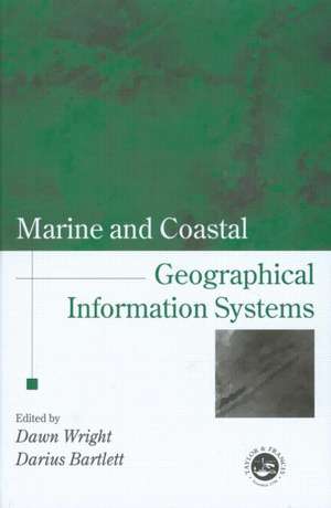
Marine and Coastal Geographical Information Systems: Research Monographs in GIS
Editat de Dawn J. Wright, Darius J. Barletten Limba Engleză Hardback – 23 dec 1999
Launched as a project to mark the UN International Year of the Ocean (1998) and supported by the International Geographical Union's Commission on Coastal Systems, this book covers progress and research in the marine and coastal realms, in the areas of theory, applications and empirical results. It is the first book of its kind to address basic and applied scientific problems in deep sea and coastal science using GIS and remote sensing technologies. It is designed for GIS and remote sensing specialists, but also for those with an interest in oceans, lakes and shores. Coverage ranges from seafloor spreading centres to Exclusive Economic Zones to microscale coastal habitats; and techniques include submersibles, computer modelling, image display, 3-D temporal data visualization, and development and application of new algorithms and spatial data structures. It illustrates the broad usage of GIS, image processing, and computer modelling in deep sea and coastal environments, and also addresses important institutional issues arising out of the use of these technologies.
| Toate formatele și edițiile | Preț | Express |
|---|---|---|
| Paperback (1) | 672.40 lei 6-8 săpt. | |
| CRC Press – 23 dec 1999 | 672.40 lei 6-8 săpt. | |
| Hardback (1) | 1797.45 lei 6-8 săpt. | |
| CRC Press – 23 dec 1999 | 1797.45 lei 6-8 săpt. |
Preț: 1797.45 lei
Preț vechi: 2192.02 lei
-18% Nou
Puncte Express: 2696
Preț estimativ în valută:
343.93€ • 359.10$ • 284.65£
343.93€ • 359.10$ • 284.65£
Carte tipărită la comandă
Livrare economică 05-19 aprilie
Preluare comenzi: 021 569.72.76
Specificații
ISBN-13: 9780748408627
ISBN-10: 0748408622
Pagini: 352
Dimensiuni: 156 x 234 x 22 mm
Greutate: 0.67 kg
Ediția:New.
Editura: CRC Press
Colecția CRC Press
Seria Research Monographs in GIS
ISBN-10: 0748408622
Pagini: 352
Dimensiuni: 156 x 234 x 22 mm
Greutate: 0.67 kg
Ediția:New.
Editura: CRC Press
Colecția CRC Press
Seria Research Monographs in GIS
Public țintă
ProfessionalCuprins
Series Introduction. Foreword: Michael F.Goodchild. Preface. Contrubutors. Down to the Sea in Ships: The Emergence of Marine GIS - Dawn Wright. Working on the Frontiers of Science: Applying GIS to the Coastal Zone - Darius J. Bartlett. Part One: Conceptual/ Technical Issues Data Models for Marine and Coastal Geographic Information Systems - Rongxing Li. An Algorithmic Approach to Marine GIS - Christopher Gold. Representations of Variability in Marine Environmental Data - Anne Lucas. Applying Spatio-Temporal Concepts to Correlative Data Analysis - Herman Varma. Linear Reference Data Models and Dynamic Segmentation: Application to Coastal and Marine Data - Andrew G. Sherin. Spatial Reasoning for Marine Geology and Geophysics - Dawn J. Wright. 2.5 and 3-D GIS for Coastal Geomorphology - Jonathan Raper Part Two: Applications Real-time GIS for Marine Applications - Gerald A. Hatcher Jr. and Norman Maher. Electronic Chart Disply and Information Systems (ECDIS): State-of-the-art in Nautical Charting - Robert Ward, Chris Roberts and Ron Furness. The National Oceanic and Atmospheric Administration's Vents Program GIS: Integration, Analysis and Distribution of Multidisciplinary Oceanographic Data - Christopher G. Fox and Andra M. Bobbitt. Integrated Geographical and Environmentally Remotely-Sensed Data on Marginal and Enclosed Basins - Vittorio Barale. Mapping Submarine Slope Failures - Brian G. McAdoo. Applications of GIS to Fisheries Management - Geoff J. Meaden. A User-Friendly Marine GIS for Multi-Dimensional Visualisation - Yafang Su. Active Techtonics: Data Acquisition and Analysis with Marine GIS - Chris Goldfinger Part Three: Institutional Issues Managing Marine and Coastal Data Sources: A National Oceonographic Data Centre Perspective on GIS - Bronwyn Cahill, Theresa Kennedy and Orla Ni. Significance of Coastal and Marine Geographical Information Systems within the Context of the United States National Geospatial Data Policies - Millington Locakwood and Cindy Fowler. GIS applications to Marine boundary Delimitations -Harold Palmer and Loin Pruett Information Quality Considerations for Coastal Data -Nancy Von Meyer, Kenneth E Foote and Donald J Huebner Epilogue - Darius J. Bartlett and Dawn J. Wright overview, brief history. Part 1: Conceptual/Technical Issue. Part 2: Applications. Part 3: Institutional Issues.
Notă biografică
Dawn J. Wright and Darius J. Bartlett
Descriere
Marine and coastal applications of GIS are finally gaining wide acceptance in scientific as well as GIS communities, and cover the fields of deep sea geology, chemistry and biology, and coastal geology, biology, engineering and resource management. Comprising rigorous contributions from a group of leading scholars in marine and coastal GIS, this book will inspire and stimulate continued research in this important new application domain.
Launched as a project to mark the UN International Year of the Ocean (1998) and supported by the International Geographical Union's Commission on Coastal Systems, this book covers progress and research in the marine and coastal realms, in the areas of theory, applications and empirical results. It is the first book of its kind to address basic and applied scientific problems in deep sea and coastal science using GIS and remote sensing technologies. It is designed for GIS and remote sensing specialists, but also for those with an interest in oceans, lakes and shores. Coverage ranges from seafloor spreading centres to Exclusive Economic Zones to microscale coastal habitats; and techniques include submersibles, computer modelling, image display, 3-D temporal data visualization, and development and application of new algorithms and spatial data structures. It illustrates the broad usage of GIS, image processing, and computer modelling in deep sea and coastal environments, and also addresses important institutional issues arising out of the use of these technologies.
Launched as a project to mark the UN International Year of the Ocean (1998) and supported by the International Geographical Union's Commission on Coastal Systems, this book covers progress and research in the marine and coastal realms, in the areas of theory, applications and empirical results. It is the first book of its kind to address basic and applied scientific problems in deep sea and coastal science using GIS and remote sensing technologies. It is designed for GIS and remote sensing specialists, but also for those with an interest in oceans, lakes and shores. Coverage ranges from seafloor spreading centres to Exclusive Economic Zones to microscale coastal habitats; and techniques include submersibles, computer modelling, image display, 3-D temporal data visualization, and development and application of new algorithms and spatial data structures. It illustrates the broad usage of GIS, image processing, and computer modelling in deep sea and coastal environments, and also addresses important institutional issues arising out of the use of these technologies.
