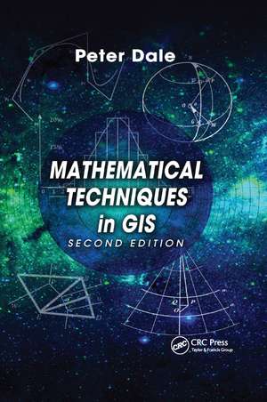
Mathematical Techniques in GIS
Autor Peter Daleen Limba Engleză Paperback – 10 dec 2019
See What’s New in the Second Edition:
- Summaries at the end of each chapter
- Worked examples of techniques described
- Additional material on matrices and vectors
- Further material on map projections
- New material on spatial correlation
- A new section on global positioning systems
Written for those who need to make use geographic information systems but have a limited mathematical background, this book introduces the basic statistical techniques commonly used in geographic information systems and explains best-fit solutions and the mathematics behind satellite positioning. By understanding the mathematics behind the gathering, processing, and display of information, you can better advise others on the integrity of results, the quality of the information, and the safety of using it.
| Toate formatele și edițiile | Preț | Express |
|---|---|---|
| Paperback (1) | 471.47 lei 6-8 săpt. | |
| CRC Press – 10 dec 2019 | 471.47 lei 6-8 săpt. | |
| Hardback (1) | 789.54 lei 6-8 săpt. | |
| CRC Press – 15 mai 2014 | 789.54 lei 6-8 săpt. |
Preț: 471.47 lei
Nou
Puncte Express: 707
Preț estimativ în valută:
90.24€ • 98.06$ • 75.85£
90.24€ • 98.06$ • 75.85£
Carte tipărită la comandă
Livrare economică 21 aprilie-05 mai
Preluare comenzi: 021 569.72.76
Specificații
ISBN-13: 9780367868468
ISBN-10: 0367868466
Pagini: 359
Dimensiuni: 156 x 234 x 19 mm
Greutate: 0.5 kg
Ediția:2nd edition
Editura: CRC Press
Colecția CRC Press
Locul publicării:Boca Raton, United States
ISBN-10: 0367868466
Pagini: 359
Dimensiuni: 156 x 234 x 19 mm
Greutate: 0.5 kg
Ediția:2nd edition
Editura: CRC Press
Colecția CRC Press
Locul publicării:Boca Raton, United States
Cuprins
Characteristics of Geographic Information. Numbers and Numerical Analysis. Algebra - Treating Numbers as Symbols. The Geometry of Common Shapes. Plane and Spherical Trigonometry. Differential and Integral Calculus. Matrices and Determinants. Vectors. Curves and Surfaces. Transformations. Map Projections. Basic Statistics. Correlation and Regression. Best-fit Solutions.
Notă biografică
Peter Dale is a professor in land information management at the University College London.
Recenzii
"The insight provided by this book is extremely valuable. It represents a significant effort to explain - in an interesting and pedagogical way - the basic mathematical techniques and principles underpinning the manipulation of geographical data. Modern technologies have made the "where" highly important, and computers and mobile devices provide all kind of sophisticated solutions to dealing with this issue. However, it is worth remembering that eventually only good data and good processing will provide reliable information. The mathematics behind this processing thereby becomes essential. This book enables an easy access to the rules and manipulations applied behind the scene. This book is needed."
––Stig Enemark, professor of land management, Department of Development and Planning, Aalborg University, Denmark
"… an excellent introduction to the mathematics behind these complexities. By having some understanding of the technology behind GIS users are better able to ensure the data and results from GIS are "fit for purpose" and can be safely used. … I enthusiastically encourage GIS users to read this book."
—Ian P. Williamson, Emeritus Professor, The University of Melbourne
"Professor Peter Dale is one of the great pioneers of the GIS and geomatics fields, having made seminal contributions to the development and application of the technology in support of natural resource management and land administration. His writing is richly informed by both a deep intellect and a wealth of experience."
—John McLaughlin, President Emeritus, University of New Brunswick
"…this text is an effective tool for teaching fundamental quantitative methods to its intended audience." —Photogrammetric Engineering & Remote Sensing, November 2016
Descriere
Explaining the fundamentals that support the manipulation and display of geographic information, this book focuses on basic mathematical techniques and reviews the characteristics of geographic information. The new edition contains end-of-chapter summaries, thorough revisions to every chapter, expanded information on computer graphics and spatia


