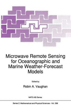
Microwave Remote Sensing for Oceanographic and Marine Weather-Forecast Models: Nato Science Series C:, cartea 298
Editat de Robin A. Vaughanen Limba Engleză Paperback – 20 sep 2011
Din seria Nato Science Series C:
- 24%
 Preț: 797.69 lei
 - 18%
 Preț: 957.62 lei
 - 18%
 Preț: 957.13 lei
 - 18%
 Preț: 1227.52 lei
 -
 Preț: 396.40 lei
 -
 Preț: 403.75 lei
 - 18%
 Preț: 1239.37 lei
 - 18%
 Preț: 1236.51 lei
 - 18%
 Preț: 1231.78 lei
 - 18%
 Preț: 1229.10 lei
 - 18%
 Preț: 1835.21 lei
 - 24%
 Preț: 1076.39 lei
 -
 Preț: 390.46 lei
 -
 Preț: 369.63 lei
 - 18%
 Preț: 1232.41 lei
 -
 Preț: 394.51 lei
 - 18%
 Preț: 1226.24 lei
 - 18%
 Preț: 1845.80 lei
 -
 Preț: 399.88 lei
 -
 Preț: 384.28 lei
 -
 Preț: 390.88 lei
 -
 Preț: 381.19 lei
 - 18%
 Preț: 1848.64 lei
 - 18%
 Preț: 951.14 lei
 - 18%
 Preț: 1230.35 lei
 - 18%
 Preț: 1236.51 lei
 -
 Preț: 401.03 lei
 -
 Preț: 406.25 lei
 - 18%
 Preț: 1230.84 lei
 -
 Preț: 418.34 lei
 - 18%
 Preț: 1223.74 lei
Preț: 395.25 lei
Nou
Puncte Express: 593
Preț estimativ în valută:
75.64€ • 82.13$ • 63.54£
75.64€ • 82.13$ • 63.54£
Carte tipărită la comandă
Livrare economică 22 aprilie-06 mai
Preluare comenzi: 021 569.72.76
Specificații
ISBN-13: 9789401067157
ISBN-10: 9401067155
Pagini: 420
Ilustrații: XII, 406 p.
Dimensiuni: 160 x 240 x 22 mm
Greutate: 0.59 kg
Ediția:Softcover reprint of the original 1st ed. 1990
Editura: SPRINGER NETHERLANDS
Colecția Springer
Seria Nato Science Series C:
Locul publicării:Dordrecht, Netherlands
ISBN-10: 9401067155
Pagini: 420
Ilustrații: XII, 406 p.
Dimensiuni: 160 x 240 x 22 mm
Greutate: 0.59 kg
Ediția:Softcover reprint of the original 1st ed. 1990
Editura: SPRINGER NETHERLANDS
Colecția Springer
Seria Nato Science Series C:
Locul publicării:Dordrecht, Netherlands
Public țintă
ResearchCuprins
1. On the Role of Science in Preparing Operational Uses of Earth Observations from Space.- 2. General Principles of Relevant Satellite Systems.- 3. Satellite Radar Altimeters.- 4. Measuring Ocean Waves with Altimeters and Synthetic Aperture Radars.- 5. The Scatterometer: Data and Applications.- 6. Sunglint and the Study of Near-Surface Windspeeds over the Oceans.- 7. Satellite Infrared Scanning Radiometers - AVHRR and ATSR/M.- 8. Handling Airborne Thematic Mapper Data.- 9. Microwave Radiometers.- 10. Microwave Atmospheric Sounding (Water Vapor and Liquid Water).- 11. In-situ Measurements for Validation of Microwave Data: Problems, Accuracies.- 12. Passive Microwave Satellite Imagery for Improved Rainfall Monitoring and Forecasting over Sea Areas.- 13. The Potential Impact of Advanced Spaceborne Microwave Sensors onto Marine Weather Nowcasting and Very Short Range Forecast.- 14. Desertification Studies.- 15. Integration of Satellite-Derived Products.- 16. The ERS-1 Satellite: Oceanography from Space.- 17. Wind Fields and Surface Fluxes.- Colour Section.- List Of Participants.
Recenzii
`This is an extremely informative and up-to-date book which should be on the shelf of those who will exploit the new microwave satellite data coming from the sensors during the 1990s.'
World Meteorological Oganization Bulletin, 40:1
World Meteorological Oganization Bulletin, 40:1
