
Remote Sensing Applications in Marine Science and Technology: Nato Science Series C:, cartea 106
Editat de A.P. Cracknellen Limba Engleză Hardback – 31 iul 1983
| Toate formatele și edițiile | Preț | Express |
|---|---|---|
| Paperback (1) | 1225.62 lei 6-8 săpt. | |
| SPRINGER NETHERLANDS – 8 dec 2011 | 1225.62 lei 6-8 săpt. | |
| Hardback (1) | 1231.78 lei 6-8 săpt. | |
| SPRINGER NETHERLANDS – 31 iul 1983 | 1231.78 lei 6-8 săpt. |
Din seria Nato Science Series C:
- 24%
 Preț: 797.69 lei
 - 18%
 Preț: 957.62 lei
 - 18%
 Preț: 957.13 lei
 - 18%
 Preț: 1227.52 lei
 -
 Preț: 396.40 lei
 -
 Preț: 403.75 lei
 - 18%
 Preț: 1239.37 lei
 - 18%
 Preț: 1236.51 lei
 - 18%
 Preț: 1229.10 lei
 - 18%
 Preț: 1835.21 lei
 - 24%
 Preț: 1076.39 lei
 -
 Preț: 390.46 lei
 -
 Preț: 369.63 lei
 - 18%
 Preț: 1232.41 lei
 -
 Preț: 394.51 lei
 - 18%
 Preț: 1226.24 lei
 - 18%
 Preț: 1845.80 lei
 -
 Preț: 399.88 lei
 -
 Preț: 384.28 lei
 -
 Preț: 390.88 lei
 -
 Preț: 381.19 lei
 - 18%
 Preț: 1848.64 lei
 - 18%
 Preț: 951.14 lei
 - 18%
 Preț: 1230.35 lei
 - 18%
 Preț: 1236.51 lei
 -
 Preț: 401.03 lei
 -
 Preț: 406.25 lei
 - 18%
 Preț: 1230.84 lei
 -
 Preț: 418.34 lei
 - 18%
 Preț: 1223.74 lei
Preț: 1231.78 lei
Preț vechi: 1502.17 lei
-18% Nou
Puncte Express: 1848
Preț estimativ în valută:
235.73€ • 255.97$ • 198.01£
235.73€ • 255.97$ • 198.01£
Carte tipărită la comandă
Livrare economică 22 aprilie-06 mai
Preluare comenzi: 021 569.72.76
Specificații
ISBN-13: 9789027716088
ISBN-10: 9027716080
Pagini: 482
Ilustrații: XII, 466 p.
Dimensiuni: 155 x 235 x 31 mm
Greutate: 0.85 kg
Ediția:1983
Editura: SPRINGER NETHERLANDS
Colecția Springer
Seria Nato Science Series C:
Locul publicării:Dordrecht, Netherlands
ISBN-10: 9027716080
Pagini: 482
Ilustrații: XII, 466 p.
Dimensiuni: 155 x 235 x 31 mm
Greutate: 0.85 kg
Ediția:1983
Editura: SPRINGER NETHERLANDS
Colecția Springer
Seria Nato Science Series C:
Locul publicării:Dordrecht, Netherlands
V-ar putea interesa
-
 AtlanticSimon WinchesterPreț: 107.76 lei
 -
 Vanished Ocean: How Tethys Reshaped the WorldDorrik Stow-15%Preț: 65.44 lei77.07 lei
 -
 -18%Preț: 948.16 lei1156.29 lei
 -
 -11%Preț: 504.76 lei567.14 lei
 -
 -9%Preț: 645.70 lei709.56 lei
 -
 -15%Preț: 644.49 lei758.23 lei
 -
 Tidal Inlets: Hydrodynamics and MorphodynamicsJ. van de Kreeke-14%Preț: 779.51 lei906.40 lei
 -
 -14%Preț: 834.04 lei969.81 lei
 -
 Modelling and Monitoring of Coastal Marine ProcessesRaj C. Murthy-15%Preț: 644.95 lei758.77 lei
 -
 Modelling Ocean Climate VariabilityArtem S. Sarkisyan-18%Preț: 958.38 lei1168.76 lei
 -
 United States as an Ocean NationMikkel Jorgensen-27%Preț: 934.96 lei1282.87 lei
 -
 -14%Preț: 945.80 lei1099.76 lei
 -
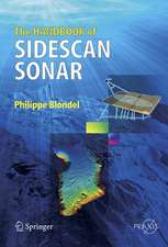 The Handbook of Sidescan SonarPhilippe Blondel-18%Preț: 1557.39 lei1899.26 lei
 -
 Dynamical OceanographyHenk A. DijkstraPreț: 402.98 lei
 -
 -18%Preț: 2498.94 lei3047.49 lei
 -
 Physical Oceanography of the Baltic SeaMatti Leppäranta-18%Preț: 1399.57 lei1706.79 lei
 -
 Tropical Circulation Systems and MonsoonsKshudiram Saha-24%Preț: 796.04 lei1047.42 lei
Public țintă
ResearchCuprins
1. Remote Measurement of the Ocean — An Overview.- 2. NOAA’s Activities in the Field of Marine Remote Sensing.- 3. University of Dundee Satellite Data Reception and Archiving Facility.- 4. Data Acquisition and Quality.- 5. Status and Future Plans for the First European Remote Sensing Satellite ERS-1.- 6. Digital Image Processing.- 7. Selected Topics of Coastal Zone Color Scanner (CZCS) Data Evaluation.- 8. Surface Wind Vector Measurements from Satellites.- 9. The Measurement of Oceanographic Parameters using Dekametric Radar.- 10. Remote Sensing via Meteor Trail.- 11. The Use of an Aeriel Infrared Survey in Indentifying Roof Structures of High “U” Value in an Extensive Building Complex.- 12. Sea Surface Temparature from Infrared Measurements.- 13. Remote Sensing of Biological Subtances.- 14. Ocean Color Studies in Arabian Sea.- 15. LANDSAT Application to Suspended Sediments Evaluation.- 16. Light Emerging from the Sea — Interpretation and Uses in Remote Sensing.- 17. Land into Sea Does Not Go.- 18. Detection of Marine Contours from LANDSAT Film and Tape.- 19. Airbone Remote Sensing and Experiments with Fluorescent Tracers.- 20. Oceanography from Space.- Colour Section.- List of Participants.