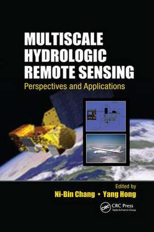
Multiscale Hydrologic Remote Sensing: Perspectives and Applications
Editat de Ni-Bin Chang, Yang Hongen Limba Engleză Paperback – 22 noi 2017
Illustrated in color, this book examines components in the hydrologic cycle with a range of space and time scales. Organized into five parts, it explores hydrologic remote sensing at the local, urban, watershed, and regional scales, as well as the continental and global scale. Contributors address questions such as
- What are the local, watershed, and regional differences in soil moisture and evapotranspiration when using different measurement methods and models?
- How can we fit the scenarios of global warming potential and the remote sensing products of snow water equivalent into hydrologic modeling to address the changing flood and drought conditions in a watershed?
- How can we fuse the images collected by different satellites to improve the accuracy of predictions at the global scale?
This book is a useful reference for students, professionals, scientists, and policy makers involved in the study of global change, hydrologic science, meteorology, climatology, biology, ecology, and the agricultural and forest sciences. It shows how hydrologic remote sensing technologies can be used more effectively to explore global change impacts and improve the design of hydrologic observatories.
| Toate formatele și edițiile | Preț | Express |
|---|---|---|
| Paperback (1) | 582.03 lei 6-8 săpt. | |
| CRC Press – 22 noi 2017 | 582.03 lei 6-8 săpt. | |
| Hardback (1) | 1403.55 lei 6-8 săpt. | |
| CRC Press – 23 mar 2012 | 1403.55 lei 6-8 săpt. |
Preț: 582.03 lei
Preț vechi: 684.74 lei
-15% Nou
Puncte Express: 873
Preț estimativ în valută:
111.38€ • 120.95$ • 93.56£
111.38€ • 120.95$ • 93.56£
Carte tipărită la comandă
Livrare economică 23 aprilie-07 mai
Preluare comenzi: 021 569.72.76
Specificații
ISBN-13: 9781138072572
ISBN-10: 1138072575
Pagini: 568
Ilustrații: Approximately 174 equations; 43 Tables, black and white; 219 Illustrations, black and white
Dimensiuni: 156 x 234 x 30 mm
Greutate: 0.83 kg
Ediția:1
Editura: CRC Press
Colecția CRC Press
ISBN-10: 1138072575
Pagini: 568
Ilustrații: Approximately 174 equations; 43 Tables, black and white; 219 Illustrations, black and white
Dimensiuni: 156 x 234 x 30 mm
Greutate: 0.83 kg
Ediția:1
Editura: CRC Press
Colecția CRC Press
V-ar putea interesa
-
 Human Factors in Multi-Crew Flight OperationsHarry W. Orlady-15%Preț: 487.99 lei574.10 lei
 -
 -15%Preț: 472.10 lei555.41 lei
 -
 Aquifer Test ModelingWilliam C. Walton-26%Preț: 369.42 lei499.35 lei
 -
 Advanced Onsite Wastewater Systems TechnologiesAnish R. Jantrania-15%Preț: 490.89 lei577.51 lei
 -
 Multilayered Aquifier Systems: Fundamentals and ApplicationsAlexander H. D. Cheng-15%Preț: 495.83 lei583.33 lei
 -
 Biofilms: Investigative Methods and ApplicationsHans-Curt Flemming-26%Preț: 371.11 lei500.30 lei
 -
 Pharmaceutical Unit Operations: CoatingKenneth E. Avis-15%Preț: 497.78 lei585.63 lei
 -
 -18%Preț: 1008.02 lei1229.30 lei
 -
 Mannall, C: Hospitality Supervision S/NVQ Level 3Clare Mannall-9%Preț: 318.86 lei351.14 lei
 -
 Finanzderivate - Schwerpunkt OptionenJan DittrichPreț: 64.42 lei
 -
 Preț: 108.11 lei
 -
 Preț: 65.39 lei
 -
 Stadtstrande: Sudseefeeling in Deutschen GrossstadtenStefanie KahlsPreț: 456.60 lei
 -
 Preț: 391.56 lei
 -
 Preț: 396.18 lei
Cuprins
Toward Multiscale Hydrologic Remote Sensing for Creating Integrated Hydrologic Observatories. Local-Scale Hydrological Remote Sensing: Advanced Ground Penetrating Radar for Soil Moisture Retrieval. Storm Impact on the Coastal Geomorphology and Current Field by Wave Field Image Sequences. Comparative Analysis of Surface Energy Balance Models for Actual Evapotranspiration Estimation through Remotely Sensed Images. Thermal Radiation and Energy Closure Assessment in Evapotranspiration Estimation for Remote Sensing Validation. Urban-Scale Hydrological Remote Sensing: Spatiotemporal Interactions between Soil Moisture, Vegetation Cover, and Evapotranspiration in the Tampa Bay Urban Region, Florida. Developing a Composite Indicator with Landsat Thematic Mapper/Enhanced Thematic Mapper Plus Images for Drought Assessment in a Coastal Urban Region. Watershed-Scale Hydrological Remote Sensing: Modeling Stream Flow Changes with the Aid of Multisourced Remote Sensing Data in a Poorly Gauged Watershed. MODIS-Based Snow Cover Products, Validation, and Hydrologic Applications. Modeling Snowmelt Runoff under Climate Change Scenarios Using MODIS-Based Snow Cover Products. Multispectral Satellite Data for Flood Monitoring and Inundation Mapping. Regional-Scale Hydrological Remote Sensing: Precipitation Estimate Using NEXRAD Ground-Based Radar Images: Validation, Calibration, and Spatial Analysis. Radar Polarimetry for Rain Estimation. Airborne Water Vapor Differential Absorption Lidar. Continental- and Global-Scale Hydrological Remote Sensing: Global Precipitation Estimation and Applications. Instantaneous Precipitation and Latent Heating Estimation over Land from Combined Spaceborne Radar and Microwave Radiometer Observations. Global Soil Moisture Estimation Using Microwave Remote Sensing. Microwave Vegetation Indices from Satellite Passive Microwave Sensors for Mapping Global Vegetation Cover. Remote Sensing and Modeling of Global Evapotranspiration. Validation of Gravity Recovery and Climate Experiment Data for Assessment of Terrestrial Water Storage Variations. Remote Sensing of Soil and Vegetation Moisture from Space for Monitoring Drought and Forest Fire Events. Index.
Notă biografică
Dr. Ni-Bin Chang is currently a professor with the Department of Civil, Environmental, and Construction Engineering at the University of Central Florida. He is also a senior member of the Institute of Electronics and Electrical Engineers (IEEE) and is affiliated with the IEEE Geoscience and Remote Sensing Society and the IEEE Computational Intelligence Society. He has earned the selectively awarded titles of Certificate of Leadership in Energy and Environment Design (LEED) in 2004, Board Certified Environmental Engineer (BCEE) in 2006, Diplomat of Water Resources Engineer (DWRE) in 2007, elected Member of the European Academy of Sciences (EAS) in 2008, elected Fellow of the American Society of Civil Engineers (ASCE) in 2009, and elected Fellow of the American Association for the Advancement of Science (AAAS) in 2011. He was one of the founders of International Society of Environmental Information Management and the former editor-in-chief of the Journal of Environmental Informatics. He is currently an editor, associate editor, or editorial board member of more than 30 international journals.
Dr. Yang Hong is currently an associate professor with the School of Civil Engineering and Environmental Sciences and Adjunct Faculty with the School of Meteorology at the University of Oklahoma. He directs the HyDROS Lab (Hydrometeorology and Remote Sensing Laboratory) at National Weather Center and also serves as the co-director of WaTER (Water Technology for Emerging Regions) center, faculty member with the Atmospheric Radar Research Center, and affiliated member of Center for Analysis and Prediction of Storms at the University of Oklahoma. He has served as Chair of the AGU-Hydrology Section Technique Committee on Precipitation (2008–2012) and as editor for three journals. He is the recipient of the NASA Award "for significant achievements in systematically promoting and accelerating the use of NASA scientific research results for societal benefits" by NASA Headquarter Administrator in 2008. He has extensively published in journals of remote sensing, hydrology, and hazards and has released several technologies to universities, governmental agencies, and private companies.
Dr. Yang Hong is currently an associate professor with the School of Civil Engineering and Environmental Sciences and Adjunct Faculty with the School of Meteorology at the University of Oklahoma. He directs the HyDROS Lab (Hydrometeorology and Remote Sensing Laboratory) at National Weather Center and also serves as the co-director of WaTER (Water Technology for Emerging Regions) center, faculty member with the Atmospheric Radar Research Center, and affiliated member of Center for Analysis and Prediction of Storms at the University of Oklahoma. He has served as Chair of the AGU-Hydrology Section Technique Committee on Precipitation (2008–2012) and as editor for three journals. He is the recipient of the NASA Award "for significant achievements in systematically promoting and accelerating the use of NASA scientific research results for societal benefits" by NASA Headquarter Administrator in 2008. He has extensively published in journals of remote sensing, hydrology, and hazards and has released several technologies to universities, governmental agencies, and private companies.
Descriere
Reflecting the current focus of hydrological sciences today, this color book discusses interdisciplinary issues in water resources research and remote sensing technology. It presents an exquisite arrangement of sensors, platforms, and problem-oriented features and covers all components of the hydrologic cycle, such as precipitation, soil moisture, evaporation, transpiration, lake and reservoir levels, terrestrial water storage, river discharge, and snow pack. Taking a multiscale approach, it addresses future concerns of hydrologic remote sensing under global change, including population growth, economic development and urbanization, and environmental degradation.