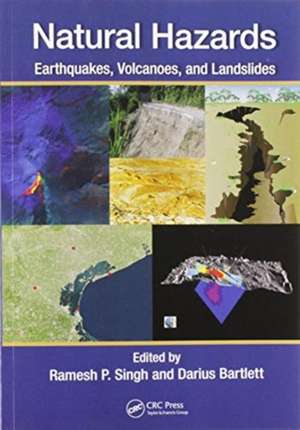
Natural Hazards: Earthquakes, Volcanoes, and Landslides
Editat de Ramesh Singh, Darius Bartletten Limba Engleză Paperback – 30 iun 2020
Combining reviews of theories and methods with analysis of case studies, the book gives readers research information and analyses on satellite geophysical data, radar imaging and integrated approaches. It focuses also on dust storms, coastal subsidence and remote sensing mapping. Some case studies explore the roles of remote sensing related to landslides and volcanoes. Overall, improved understanding of the processes leading to these hazardous events will help scientists predict their occurrence.
Features
- Provides information on the physics and physical processes of natural hazards, their monitoring and the mapping of damages associated with these hazards
- Explains how natural hazards are strongly associated with coupling between land–ocean–atmosphere
- Includes a comprehensive overview of the role of remote sensing in natural hazards worldwide
- Examines risk assessment in urban areas through numerical modelling and geoinformation technologies
- Demonstrates how data analysis can be used to aid in prediction and management of natural hazards
| Toate formatele și edițiile | Preț | Express |
|---|---|---|
| Paperback (1) | 331.17 lei 6-8 săpt. | |
| CRC Press – 30 iun 2020 | 331.17 lei 6-8 săpt. | |
| Hardback (1) | 1321.53 lei 3-5 săpt. | +54.76 lei 5-11 zile |
| CRC Press – 21 mar 2018 | 1321.53 lei 3-5 săpt. | +54.76 lei 5-11 zile |
Preț: 331.17 lei
Preț vechi: 385.43 lei
-14% Nou
Puncte Express: 497
Preț estimativ în valută:
63.39€ • 68.88$ • 53.28£
63.39€ • 68.88$ • 53.28£
Carte tipărită la comandă
Livrare economică 21 aprilie-05 mai
Preluare comenzi: 021 569.72.76
Specificații
ISBN-13: 9780367571917
ISBN-10: 0367571919
Pagini: 526
Dimensiuni: 178 x 254 x 32 mm
Greutate: 1.04 kg
Ediția:1
Editura: CRC Press
Colecția CRC Press
ISBN-10: 0367571919
Pagini: 526
Dimensiuni: 178 x 254 x 32 mm
Greutate: 1.04 kg
Ediția:1
Editura: CRC Press
Colecția CRC Press
Public țintă
Academic and Professional Practice & DevelopmentCuprins
Gujarat Earthquake: Ground Deformation.Gujarat Earthquake: Liquefaction.Earthquakes and Medical Complications.Utilization of satellite geophysical data as precursors for earthquake monitoring.Satellite radar imaging and its application to natural hazards.DEMETER Satellite and Detection of Earthquake Signals.TIR Anomaly as Earthquake Precursor.Stress Change and earthquake triggering by reservoirs: role of fluids.Earthquake Precursory Studies in India: An Integrated Approach.Geomorphic Features Associated with Erosion.Thar Desert: Source for Dust Storm.Coastal Subsidence: Causes, Mapping, and Monitoring.Subsidence Mapping Using InSAR.Earthquakes and Associated Landslides in Pakistan.Landslides in Jamaica: Distribution, Cause, Impact and Management.Landslides: Causes, Mapping, and Monitoring: Examples from Malaysia.Mapping and Monitoring of Landslides Using LiDAR.Radar Monitoring of Volcanic Activities.Active Volcanoes: Satellite Remote Sensing.Application of Thermal Remote Sensing to the Observation of Natural Hazards.
Notă biografică
Dr. Ramesh P. Singh is a Professor at the Department of Physics, Computational Science, and Engineering in Schmid College of Science, Chapman University, California. He is a member of several national and international societies. From 2001 to 2007 he was the Editor in Chief of the Journal of the Indian Society of Remote Sensing and since 2010 he has been the Editor in Chief of Geomatics, Natural Hazards and Risk journal published by Taylor and Francis Group. His research interests are: Natural Hazards, Early Warning of coastal earthquakes, Soil moisture, Landslides, Snow avalanches, Floods, Dust storms, Remote sensing applications, Geophysical Explorations, Atmospheric pollution and Mining Environment. He has received several Awards and Recognitions and has written numerous scientific articles.
Dr. Darius Bartlett is a Lecturer in Geography at University College Cork, Cork, Ireland. His experience includes: Geography Department First Year Science coordinator; Chair, Departmental Staff-Student Liaison Committee; Member and past Chair, Geography Department Safety Committee; Member of Geography Department Computer sub-committee; Member of Geography Department Science sub-committee; Member, Academic Board for Earth and Environmental Sciences; Coordinator of MSc in GIS and Remote Sensing programme 2009 - 2012; Coordinator of MSc in Applied Coastal and Marine Management 2014. His research interests are Geoinformatics; Geographical Information Systems; Coastal zone applications of GIS; Terrestrial Laser Scanning; spatial information infrastructures; geoinformatics for cultural heritage; cultural and societal aspects of GIS; the community and participatory use of geoinformatics; the role of information technologies and fieldwork respectively in the teaching of geography.
Dr. Darius Bartlett is a Lecturer in Geography at University College Cork, Cork, Ireland. His experience includes: Geography Department First Year Science coordinator; Chair, Departmental Staff-Student Liaison Committee; Member and past Chair, Geography Department Safety Committee; Member of Geography Department Computer sub-committee; Member of Geography Department Science sub-committee; Member, Academic Board for Earth and Environmental Sciences; Coordinator of MSc in GIS and Remote Sensing programme 2009 - 2012; Coordinator of MSc in Applied Coastal and Marine Management 2014. His research interests are Geoinformatics; Geographical Information Systems; Coastal zone applications of GIS; Terrestrial Laser Scanning; spatial information infrastructures; geoinformatics for cultural heritage; cultural and societal aspects of GIS; the community and participatory use of geoinformatics; the role of information technologies and fieldwork respectively in the teaching of geography.
Descriere
This book addresses relevant aspects of earthquakes, volcanoes, and landslides from a scientific and applied engineering perspective. It aims to provide information on the physics and physical processes, indicators, monitoring, mitigation, and geology of these natural hazards.
