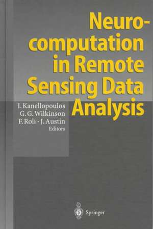
Neurocomputation in Remote Sensing Data Analysis: Proceedings of Concerted Actions "COMPARES" (Connectionist Methods for Pre-Processing and Analysis of Remote Sensing Data)
Editat de Ioannis Kanellopoulos, Graeme G. Wilkinson, Fabio Roli, James Austinen Limba Engleză Hardback – 17 sep 1997
| Toate formatele și edițiile | Preț | Express |
|---|---|---|
| Paperback (1) | 332.57 lei 6-8 săpt. | |
| Springer Berlin, Heidelberg – 21 dec 2012 | 332.57 lei 6-8 săpt. | |
| Hardback (1) | 584.71 lei 6-8 săpt. | |
| Springer Verlag – 17 sep 1997 | 584.71 lei 6-8 săpt. |
Preț: 584.71 lei
Preț vechi: 687.90 lei
-15% Nou
Puncte Express: 877
Preț estimativ în valută:
111.89€ • 119.64$ • 93.29£
111.89€ • 119.64$ • 93.29£
Carte tipărită la comandă
Livrare economică 17 aprilie-01 mai
Preluare comenzi: 021 569.72.76
Specificații
ISBN-13: 9783540633167
ISBN-10: 3540633162
Pagini: 284
Dimensiuni: 155 x 235 x 25 mm
Greutate: 0.59 kg
Editura: Springer Verlag
Colecția Springer
Locul publicării:Berlin, Heidelberg, Germany
ISBN-10: 3540633162
Pagini: 284
Dimensiuni: 155 x 235 x 25 mm
Greutate: 0.59 kg
Editura: Springer Verlag
Colecția Springer
Locul publicării:Berlin, Heidelberg, Germany
Public țintă
ResearchCuprins
Foreward - Introduction - Open Questions in Neurocomputing for Earth Observation - A Comparison of the Characterisation of Agricultural Land Using Singular Value Decomposition and Neural Networks - Land Cover Mapping from Remotely Sensed Data with a Neural Network: Accomodation Fuzziness - Geological Mapping Using Multi-Sensor Data: A Comparison of Methods - Application of Neural Networks and Order Statistics Filters to Speckle Noise Reduction in Remote Sensing Imaging - Neural Nets and Multichannel Image Processing Applications - Neural Networks for Classification of Ice Type Concentration from ERS-1 SAR Images. Classical Methods versus Neural Networks - A Neural Network Approach to Spectral Mixture Analysis - Comparison Between Systems of Image Interpretation - Feature Extraction for Neural Network Classifiers - Spectral Pattern Recognition by a Two-Layer Perceptron: Effects of Training Set Size - Comparison and Combination of Statistical and Neural Network Algorithms for Remote-Sensing Image Classification - Integrating the Alisa Classifier with Knowledge-Based Methods for Cadastral-Map Interpretation - A Hybrid Method for Preprocessing and Classification of SPOT Images - Testing some Connectionist Approaches for Thematic Mapping of Rural Areas - Using Artificial Recurrent Neural Nets to Identify Spectral and Spatial Patterns for Satellite Imagery Classification of Urban Areas - Dynamic Segmentation of Satellite Images Using Pulsed Coupled Neural Networks - Non-Linear Diffusion as a Neuron-Like Paradigm for Low-Level Vision - Application of the Constructive Mikado-Algorithm on Remotely Sensed Data - A Simple Neural Network Contextual Classifier - Optimising Neural Networks for Land Use Classification - High Speed Image Segmentation Using a Binary Neural Network - Efficient Processing and Analysis of Images Using Neural Networks - Selection of the Number of Clusters in Remote Sensing Images by Means of Neural Networks - A Comparative Study of Topological Feature Maps Versus Conventional Clustering for (Multi-Spectral) Scene. Identification in METEOSAT Imagery - Self Organised Maps: the Combined Utilisation of Feature and Novelty Detectors - Generalisation of Neural Network Based Segmentation. Results for Classification Purposes - Remote Sensing Applications which may be Addressed by Neural Networks Using Parallel Processing Technology - General Discussion
Descriere
Descriere de la o altă ediție sau format:
Since 1994 the European Commission has been supporting activities under the Environment and Climate programme of research and technological de velopment, with the aim of developing cost-effective applications of satellite Earth observation (EO) for both environmental monitoring and research. This action has included support to methodological research, aimed at the development and evaluation of new techniques forming part ofthe chain of processing needed to transform data into useful information. Wherever appropriate, the Commission has emphasised the coordination of ongoing research funded at the national level, through the mechanism of concerted actions. Concerted actions are flexible and efficient means to marshal efforts at the European level for a certain period. They are proposed by groups of researchers active in a given field who have identified the added value to be gained by European cooperation, whilst continuing to pursue their own individual projects. In view of the rapid developments in the field of neural network over the last 10 years, together with the growing interest ofthe Earth observation community in this approach as a tool for data interpretation, the Commission decided in 1995 to support the concerted action COMPARES, following a proposal from a group of acknowledged European experts.
Since 1994 the European Commission has been supporting activities under the Environment and Climate programme of research and technological de velopment, with the aim of developing cost-effective applications of satellite Earth observation (EO) for both environmental monitoring and research. This action has included support to methodological research, aimed at the development and evaluation of new techniques forming part ofthe chain of processing needed to transform data into useful information. Wherever appropriate, the Commission has emphasised the coordination of ongoing research funded at the national level, through the mechanism of concerted actions. Concerted actions are flexible and efficient means to marshal efforts at the European level for a certain period. They are proposed by groups of researchers active in a given field who have identified the added value to be gained by European cooperation, whilst continuing to pursue their own individual projects. In view of the rapid developments in the field of neural network over the last 10 years, together with the growing interest ofthe Earth observation community in this approach as a tool for data interpretation, the Commission decided in 1995 to support the concerted action COMPARES, following a proposal from a group of acknowledged European experts.
Caracteristici
Application of neural networks in remote sensing - Combination of advanced computing techniques and operational remote sensing needs - Presentation of state of the art techniques used across Europe for remote sensing data analysis, with a considerable range of applications - Comprehensive assessment of the potential role of neural computation in the processing of data from earth observation satellites.
