New Haven: Images of America (Arcadia Publishing)
Autor New Haven Area Heritage Associationen Limba Engleză Paperback – 31 ian 2011
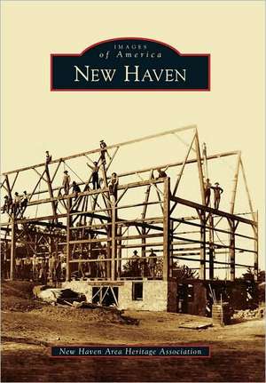
route from the Great Lakes to the Central Plains. The river itself carried the first travelers upstream to the short portage to the Mississippi watershed and the West. In the early 1800s, the Wabash and Erie Canal was started to provide a more reliable and even passage. Many came to work on it and settled, hacking out farmsteads from the dense, swampy forest. A canal lock nearby made a natural stopping and shipping point. In 1856, the Wabash Railroad superceded the canal with rapid all-weather transport and commerce flourished. The old canal towpath became a road, intersecting in the middle of the community with the Lincoln Highway, bringing in the automobile era. The local commuter age was born in the early 1900s with the interurban railroad from Lima, Ohio, to Fort Wayne, Indiana, providing hourly, fast service for jobs and shopping. This small, tree-lined city still shows clear marks of the ages and stages of transportation history that have given it life and form. Now greenway trails trace the old Indian paths along the river.
| Toate formatele și edițiile | Preț | Express |
|---|---|---|
| Paperback (1) | 132.54 lei 3-5 săpt. | |
| Arcadia Publishing (SC) – 31 ian 2011 | 132.54 lei 3-5 săpt. | |
| Hardback (1) | 181.89 lei 6-8 săpt. | |
| – | 181.89 lei 6-8 săpt. |
Din seria Images of America (Arcadia Publishing)
-
 Preț: 133.17 lei
 -
 Preț: 133.00 lei
 -
 Preț: 131.94 lei
 -
 Preț: 133.00 lei
 -
 Preț: 133.00 lei
 -
 Preț: 127.20 lei
 -
 Preț: 127.39 lei
 -
 Preț: 132.35 lei
 -
 Preț: 173.20 lei
 -
 Preț: 117.50 lei
 -
 Preț: 132.54 lei
 -
 Preț: 118.13 lei
 -
 Preț: 133.17 lei
 -
 Preț: 131.94 lei
 -
 Preț: 128.26 lei
 -
 Preț: 133.00 lei
 -
 Preț: 133.17 lei
 -
 Preț: 133.00 lei
 -
 Preț: 131.94 lei
 -
 Preț: 133.41 lei
 -
 Preț: 127.20 lei
 -
 Preț: 131.94 lei
 -
 Preț: 120.40 lei
 -
 Preț: 131.72 lei
 -
 Preț: 127.20 lei
 -
 Preț: 131.94 lei
 -
 Preț: 132.76 lei
 -
 Preț: 131.94 lei
 -
 Preț: 136.28 lei
 -
 Preț: 127.39 lei
 -
 Preț: 133.17 lei
 -
 Preț: 133.00 lei
 -
 Preț: 133.41 lei
 -
 Preț: 117.72 lei
 -
 Preț: 133.17 lei
 -
 Preț: 117.72 lei
 -
 Preț: 133.00 lei
 -
 Preț: 128.26 lei
 -
 Preț: 132.13 lei
 -
 Preț: 132.13 lei
 -
 Preț: 131.94 lei
 -
 Preț: 131.94 lei
 -
 Preț: 133.41 lei
 -
 Preț: 133.41 lei
 -
 Preț: 131.94 lei
 -
 Preț: 118.31 lei
 -
 Preț: 127.61 lei
 -
 Preț: 131.94 lei
 -
 Preț: 131.94 lei
 -
 Preț: 133.41 lei
Preț: 132.54 lei
Nou
Puncte Express: 199
Preț estimativ în valută:
25.36€ • 27.54$ • 21.31£
25.36€ • 27.54$ • 21.31£
Carte disponibilă
Livrare economică 02-16 aprilie
Preluare comenzi: 021 569.72.76
Specificații
ISBN-13: 9780738578002
ISBN-10: 0738578002
Pagini: 127
Dimensiuni: 168 x 235 x 8 mm
Greutate: 0.31 kg
Editura: Arcadia Publishing (SC)
Seria Images of America (Arcadia Publishing)
ISBN-10: 0738578002
Pagini: 127
Dimensiuni: 168 x 235 x 8 mm
Greutate: 0.31 kg
Editura: Arcadia Publishing (SC)
Seria Images of America (Arcadia Publishing)
Notă biografică
Descriere
Set near the south bank of the Maumee River, New Haven is on the route from the Great Lakes to the Central Plains. The river itself carried the first travelers upstream to the short portage to the Mississippi watershed and the West. In the early 1800s, the Wabash and Erie Canal was started to provide a more reliable and even passage. Many came to work on it and settled, hacking out farmsteads from the dense, swampy forest. A canal lock nearby made a natural stopping and shipping point. In 1856, the Wabash Railroad superceded the canal with rapid all-weather transport and commerce flourished. The old canal towpath became a road, intersecting in the middle of the community with the Lincoln Highway, bringing in the automobile era. The local commuter age was born in the early 1900s with the interurban railroad from Lima, Ohio, to Fort Wayne, Indiana, providing hourly, fast service for jobs and shopping. This small, tree-lined city still shows clear marks of the ages and stages of transportation history that have given it life and form. Now greenway trails trace the old Indian paths along the river.


