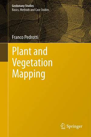
Plant and Vegetation Mapping: Geobotany Studies
Autor Franco Pedrottien Limba Engleză Hardback – 17 aug 2012
Geobotanical cartography is a field of thematic cartography that deals with the interpretation and representation, in the form of maps, of those spatial and temporal phenomena that pertain to flora, vegetation, vegetated landscapes, vegetation zones, and phytogeographical units. The production of a geobotanical map represents the last stage in a cognitive process that begins with observations in the field and continues with the collection of sample data, interpretation of the phenomena observed, and their appropriate cartographic representation; geobotanical cartography is closely tied to the concepts and scope of geobotany in general
| Toate formatele și edițiile | Preț | Express |
|---|---|---|
| Paperback (1) | 560.75 lei 38-44 zile | |
| Springer Berlin, Heidelberg – 23 aug 2016 | 560.75 lei 38-44 zile | |
| Hardback (1) | 651.51 lei 6-8 săpt. | |
| Springer Berlin, Heidelberg – 17 aug 2012 | 651.51 lei 6-8 săpt. |
Din seria Geobotany Studies
- 15%
 Preț: 643.00 lei
 - 20%
 Preț: 566.77 lei
 - 15%
 Preț: 636.80 lei
 - 15%
 Preț: 704.04 lei
 - 19%
 Preț: 550.79 lei
 - 15%
 Preț: 638.24 lei
 - 15%
 Preț: 649.06 lei
 - 20%
 Preț: 589.58 lei
 - 18%
 Preț: 961.10 lei
 - 15%
 Preț: 644.95 lei
 - 15%
 Preț: 662.80 lei
 - 15%
 Preț: 640.24 lei
 - 18%
 Preț: 945.30 lei
 - 18%
 Preț: 948.61 lei
 - 18%
 Preț: 1009.22 lei
 - 18%
 Preț: 890.37 lei
 - 24%
 Preț: 784.08 lei
 - 19%
 Preț: 459.25 lei
 - 18%
 Preț: 1115.77 lei
 - 18%
 Preț: 1115.46 lei
Preț: 651.51 lei
Preț vechi: 766.49 lei
-15% Nou
Puncte Express: 977
Preț estimativ în valută:
124.71€ • 135.50$ • 104.82£
124.71€ • 135.50$ • 104.82£
Carte tipărită la comandă
Livrare economică 21 aprilie-05 mai
Preluare comenzi: 021 569.72.76
Specificații
ISBN-13: 9783642302343
ISBN-10: 3642302343
Pagini: 308
Ilustrații: XIII, 294 p.
Dimensiuni: 155 x 235 x 22 mm
Greutate: 0.73 kg
Ediția:2013
Editura: Springer Berlin, Heidelberg
Colecția Springer
Seria Geobotany Studies
Locul publicării:Berlin, Heidelberg, Germany
ISBN-10: 3642302343
Pagini: 308
Ilustrații: XIII, 294 p.
Dimensiuni: 155 x 235 x 22 mm
Greutate: 0.73 kg
Ediția:2013
Editura: Springer Berlin, Heidelberg
Colecția Springer
Seria Geobotany Studies
Locul publicării:Berlin, Heidelberg, Germany
Public țintă
ResearchCuprins
Geobotanical Mapping and its Levels of Study.- Mapping Populations.- Mapping Synusiae.- Chorological Maps.- Mapping Vegetation.- Types of Vegetation Maps.- Examples of Vegetation Maps.- Mapping Systems of Dynamically Related Communities.- Phytogeographical Mapping.- Mapping Vegetation Zones and Belts.- Mapping Plant Biodiversity.- Applied Geobotanical Mapping.- Geobotanical Mapping in Italy.- Mapping Environments.
Recenzii
From the reviews:
“A welcome addition to the literature and its translator, the North American Elgene Box, has acquitted himself well in making it accessible to biogeographers and others. … this is a balanced overview of plant, as well as vegetation, mapping. … it provides a wealth of examples of how its forms of data, analytical results and concepts have been made spatially explicit in maps of various kinds.” (John Rodwell, Frontiers of Biogeography, Vol. 5 (3), 2013)
“A welcome addition to the literature and its translator, the North American Elgene Box, has acquitted himself well in making it accessible to biogeographers and others. … this is a balanced overview of plant, as well as vegetation, mapping. … it provides a wealth of examples of how its forms of data, analytical results and concepts have been made spatially explicit in maps of various kinds.” (John Rodwell, Frontiers of Biogeography, Vol. 5 (3), 2013)
Textul de pe ultima copertă
The book is concerned principally with geobotanical mapping.
Geobotany is a broad science that deals with the study of species and of vegetation communities in relation to the environment; it includes other, perhaps more familiar sciences, such as plant geography, plant ecology, and chorology, and phytosociology (plant sociology).
Geobotanical cartography is a field of thematic cartography that deals with the interpretation and representation, in the form of maps, of those spatial and temporal phenomena that pertain to flora, vegetation, vegetated landscapes, vegetation zones, and phytogeographical units.
The production of a geobotanical map represents the last stage in a cognitive process that begins with observations in the field and continues with the collection of sample data, interpretation of the phenomena observed, and their appropriate cartographic representation; geobotanical cartography is closely tied to the concepts and scope of geobotany in general
Caracteristici
First title in the new series Concerned with geobotanical mapping Provides fundamental concepts in geobotanical cartography Includes supplementary material: sn.pub/extras


