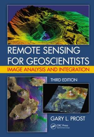
Remote Sensing for Geoscientists: Image Analysis and Integration, Third Edition
Autor Gary L. Prosten Limba Engleză Hardback – 13 dec 2013
See What’s New in the Second Edition:
- Broader coverage to include integration of multiple remote sensing technologies
- Expanded with significant new illustrations in color and reviews of new satellites and sensors
- Analysis of imagery for geobotanical remote sensing, remote geochemistry, modern analogs to ancient environments, and astrogeology
The many examples of geologic mapping on other planets and the moon highlight how to analyze planetary surface processes, map stratigraphy, and locate resources. The book then examines remote sensing and the public, geographic information systems and Google Earth, and how imagery is used by the media, in the legal system, in public relations, and by individuals.
Readers should come away with a good understanding of what is involved in image analysis and interpretation and should be ableto recognize and identify geologic features of interest. Having read this book, they should be able to effectively use imagery in petroleum, mining, groundwater, surface water, engineering, and environmental projects.
| Toate formatele și edițiile | Preț | Express |
|---|---|---|
| Paperback (1) | 613.45 lei 6-8 săpt. | |
| CRC Press – 12 dec 2019 | 613.45 lei 6-8 săpt. | |
| Hardback (1) | 1036.43 lei 6-8 săpt. | |
| CRC Press – 13 dec 2013 | 1036.43 lei 6-8 săpt. |
Preț: 1036.43 lei
Preț vechi: 1379.29 lei
-25% Nou
Puncte Express: 1555
Preț estimativ în valută:
198.33€ • 212.07$ • 165.36£
198.33€ • 212.07$ • 165.36£
Carte tipărită la comandă
Livrare economică 17 aprilie-01 mai
Preluare comenzi: 021 569.72.76
Specificații
ISBN-13: 9781466561748
ISBN-10: 1466561742
Pagini: 704
Ilustrații: 543 black & white illustrations, 543 colour illustrations, 19 black & white tables
Dimensiuni: 178 x 254 x 30 mm
Greutate: 1.66 kg
Ediția:Revizuită
Editura: CRC Press
Colecția CRC Press
ISBN-10: 1466561742
Pagini: 704
Ilustrații: 543 black & white illustrations, 543 colour illustrations, 19 black & white tables
Dimensiuni: 178 x 254 x 30 mm
Greutate: 1.66 kg
Ediția:Revizuită
Editura: CRC Press
Colecția CRC Press
Cuprins
Section 1: Initiating Projects. Project Flow and Obtaining Data. Photointerpretation Tools and Techniques. Remote Sensing Systems. Section 2: Exploration Remote Sensing. Recognizing Rock Types. Recognizing Structure. Spectral Stratigraphy. Remote Geochemistry (new). Modern Analogs (new). Exploration Case Histories. Section 3: Exploitation and Engineering Remote Sensing. Exploitation Remote Sensing. Surface and Groundwater Hydrology. Logistics and Engineering. Section 4: Environmental Remote Sensing. Environmental Baselines and Monitoring. Geobotannical Remote Sensing (new). Environmental Hazards, Arctic/Glacial Change, and Global Warming (new). Section 5: Astrogeology (new). Section 6: Remote Sensing for the General Public (new). GIS, GPS, and Mapping (new). Public Relations. News Media. Legal Aspects.
Recenzii
"… a well organized and highly readable overview of many of the most powerful and significant applications of "practical" remote sensing. … The book is sure to clarify concepts both old and new while stimulating interest in the new. … The great difficulty in a book of this type is to stay relevant in a world of ever changing technology. The author has done an excellent job in doing this, in a clear and readable manner. I feel that this book will become the standard reference for practitioners and students alike."
—Dr Ralph N.Baker, Independent Consulting Geologist, Houston, Texas
"… provides an earth scientist with a very efficient, one-stop information shop that covers not only the standard reflected light, thermal, and radar systems, but also the very important geophysical sensors such as potential field, EM, GPR, side-scan sonar, etc. … an important contribution for earth scientists trying to understand how remote sensing imagery and vegetation can be used to create better maps of the earth’s geology."
—James Ellis, Ellis GeoSpatial
"Dr. Prost has clearly and thoroughly explained the wide variety of methods and applications … Geoscientists will find this comprehensive guide to the interpretation and integration of remote sensing data to be a welcome addition to their personal libraries."
—Dr. Dietmar (Deet) Schumacher, Vice President for Geosciences and technology, E&P Field Services
"A new book by Prost is an amazing guide to the field of remote sensing, and it will remain so for years. Difficult to imagine, but the author was able to collect so huge amount of information that his writing can be judged as an ultimate reference volume irrespectively of which particular technique the reader is interested in. Well, it was almost impossible to achieve such brilliance, but this has been done successfully.
Speaking generally, the reviewer cannot imagine a book on remote sensing better than that written by Prost."
—Dmitry A. Ruban, Rostov am Don, Paläontologie Allgemein
Descriere
This book is an updated and expanded version of the existing text that explains what remote sensing is and how to use it in the earth sciences. It serves as a how-to guide and reference for those requiring remote sensing to assist with geologic mapping, landform analysis, petroleum and mineral exploration, groundwater development, civil engineering projects, and geohazard and environmental monitoring. Each section is illustrated with project case histories that describe how to map geology, find oil and gas, locate mineral deposits.
