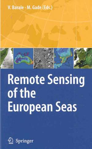
Remote Sensing of the European Seas
Editat de Vittorio Barale, Martin Gadeen Limba Engleză Hardback – 31 mar 2008
| Toate formatele și edițiile | Preț | Express |
|---|---|---|
| Paperback (1) | 950.48 lei 6-8 săpt. | |
| SPRINGER NETHERLANDS – 19 oct 2010 | 950.48 lei 6-8 săpt. | |
| Hardback (1) | 966.27 lei 6-8 săpt. | |
| SPRINGER NETHERLANDS – 31 mar 2008 | 966.27 lei 6-8 săpt. |
Preț: 966.27 lei
Preț vechi: 1178.38 lei
-18% Nou
Puncte Express: 1449
Preț estimativ în valută:
184.90€ • 197.72$ • 154.16£
184.90€ • 197.72$ • 154.16£
Carte tipărită la comandă
Livrare economică 17 aprilie-01 mai
Preluare comenzi: 021 569.72.76
Specificații
ISBN-13: 9781402067716
ISBN-10: 1402067712
Pagini: 535
Ilustrații: XXI, 514 p.
Dimensiuni: 155 x 235 x 25 mm
Greutate: 1.04 kg
Ediția:2008
Editura: SPRINGER NETHERLANDS
Colecția Springer
Locul publicării:Dordrecht, Netherlands
ISBN-10: 1402067712
Pagini: 535
Ilustrații: XXI, 514 p.
Dimensiuni: 155 x 235 x 25 mm
Greutate: 1.04 kg
Ediția:2008
Editura: SPRINGER NETHERLANDS
Colecția Springer
Locul publicării:Dordrecht, Netherlands
Public țintă
ResearchCuprins
to Remote Sensing of the European Seas.- The European Marginal and Enclosed Seas: An Overview.- Remote Sensing of the European Seas: A Historical Outlook.- Visible & Thermal Infrared Passive/Active Remote Sensing.- Ocean Colour Remote Sensing of the Optically Complex European Seas.- Case Studies of Optical Remote Sensing in the Barents Sea, Black Sea and Caspian Sea.- Variations in the Phytoplankton of the North-Eastern Atlantic Ocean: From the Irish Sea to the Bay of Biscay.- Optical Remote Sensing of the North Sea.- Optical Remote Sensing Applications in the Baltic Sea.- Open Waters Optical Remote Sensing of the Mediterranean Sea.- Optical Remote Sensing of Intertidal Flats.- Visible and Infrared Remote Sensing of the White Sea Bio-Geo-Chemistry and Hydrology.- Remote Sensing of Coastal Upwelling in the North-Eastern Atlantic Ocean.- On the Use of Thermal Images for Circulation Studies: Applications to the Eastern Mediterranean Basin.- Current Tracking in the Mediterranean Sea Using Thermal Satellite Imagery.- The Next Generation of Multi-Sensor Merged Sea Surface Temperature Data Sets for Europe.- Laser Remote Sensing of the European Marine Environment: LIF Technology and Applications.- Microwave Passive/Active Remote Sensing.- Microwave Radiometry and Radiometers for Ocean Applications.- Microwave Aperture Synthesis Radiometry: Paving the Path for Sea Surface Salinity Measurement from Space.- Sea Ice Parameters from Microwave Radiometry.- to Microwave Active Techniques and Backscatter Properties.- Scatterometer Applications in the European Seas.- Radar Altimetry: Introduction and Application to Air-Sea Interaction.- 15 Years of Altimetry at Various Scales over the Mediterranean.- Can we Reconstruct the 20th Century Sea Level Variability in the Mediterranean Sea on the Basis of Recent Altimetric Measurements?.- Internal Waves Generated in the Straits of Gibraltar and Messina: Observations from Space.- High Resolution Wind Field Retrieval from Synthetic Aperture Radar: North Sea Examples.- Satellite Imaging for Maritime Surveillance of the European Seas.- Oil Spill Detection in Northern European Waters: Approaches and Algorithms.- The Use of Satellite Imagery from Archives to Monitor Oil Spills in the Mediterranean Sea.- Sea Ice Monitoring in the Arctic and Baltic Sea Using SAR.- SAR Observation of Rip Currents off the Portuguese Coast.- Current Measurements in European Coastal Waters and Rivers by Along-Track InSAR.- Wave and Current Observations in European Waters by Ground-Based X-Band Radar.- Nautical Radar Measurements in Europe: Applications of WaMos II as a Sensor for Sea State, Current and Bathymetry.- Land-Based Over-the-Horizon Radar Techniques for Monitoring the North-East Atlantic Coastal Zone.- Multi-Sensor Techniques.- Multi-Sensor Observations of Meso-Scale Features in European Coastal Waters.- Multi-Sensor Remote Sensing of Coastal Discharge Plumes: A Mediterranean Test Site.- Sea Ice Monitoring in the European Arctic Seas Using a Multi-Sensor Approach.
Textul de pe ultima copertă
The enclosed and marginal seas surrounding the European continent exhibit a wide spectrum of environmental traits, ranging from sub-polar to sub-tropical climates, from shallow continental shelves to deep oceanic basins, from pristine marine reserves to regions impacted by countless economic and recreational activities. Understanding the inner workings of these seas – aiming to reconcile the conflicting needs of protecting their ecological balance and exploiting their natural resources – requires adequate observation systems, integrating both in situ and remote sensing techniques. This volume reviews the current potential of Earth Observations, while devoting particular attention to applications dealing with the issues, peculiarities and special challenges posed by the European Seas. The assessment of surface parameters by means of passive techniques – which measure reflected visible and near-infrared sunlight, or surface emissions in the thermal infrared or microwave spectral regions – is addressed. Active techniques – which use transmitted impulses of visible or microwave radiation, for a subsequent evaluation of the signal returned by the water surface – are covered as well. An in-depth analysis of the specific merits and drawbacks of each spectral region, and of both passive and active techniques, provides clues to help compose the unique mosaic of dynamical and bio-geo-chemical features of the European Seas.
Audience:
Scientists and researchers working in the field of Earth and Marine Science. Lecturers and tutors, as well as (graduate) students, in the same field. Academic Libraries.
Audience:
Scientists and researchers working in the field of Earth and Marine Science. Lecturers and tutors, as well as (graduate) students, in the same field. Academic Libraries.
Caracteristici
Focus on the issues, peculiarities and special challenges of the European Seas Complete and thorough review of the current Earth Observations potential Section devoted to multi-technique assessments of the marine environment
