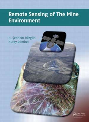
Remote Sensing of the Mine Environment
Autor H. Şebnem Düzgün, Nuray Demirelen Limba Engleză Hardback – 12 aug 2011
Following a general introduction to remote sensing principles and image analysis, mine subsidence monitoring, slope stability monitoring, reclamation planning and implementation, and post-closure mine and land use analysis are explained and illustrated. With the help of case studies, the techniques and tools presented are demonstrated.
With an increasing importance of sustainable mining, this accurate text is intended for the education of university students in mining, civil, geological and environmental engineering. Researchers and professionals in these disciplines may find it beneficial as well to guide their professional monitoring investigations.
| Toate formatele și edițiile | Preț | Express |
|---|---|---|
| Paperback (1) | 456.63 lei 6-8 săpt. | |
| CRC Press – 31 mai 2017 | 456.63 lei 6-8 săpt. | |
| Hardback (1) | 1100.64 lei 6-8 săpt. | |
| CRC Press – 12 aug 2011 | 1100.64 lei 6-8 săpt. |
Preț: 1100.64 lei
Preț vechi: 1481.01 lei
-26% Nou
Puncte Express: 1651
Preț estimativ în valută:
210.60€ • 219.89$ • 174.30£
210.60€ • 219.89$ • 174.30£
Carte tipărită la comandă
Livrare economică 04-18 aprilie
Preluare comenzi: 021 569.72.76
Specificații
ISBN-13: 9780415878791
ISBN-10: 0415878799
Pagini: 220
Ilustrații: Illustrations, maps
Dimensiuni: 174 x 246 x 16 mm
Greutate: 0.59 kg
Ediția:1
Editura: CRC Press
Colecția CRC Press
ISBN-10: 0415878799
Pagini: 220
Ilustrații: Illustrations, maps
Dimensiuni: 174 x 246 x 16 mm
Greutate: 0.59 kg
Ediția:1
Editura: CRC Press
Colecția CRC Press
Public țintă
Postgraduate, Professional, and UndergraduateCuprins
Introduction to Mine Environmental Monitoring. Principles of Remote Sensing. Interpretation of Remotely Sensed Imagery. Integration of Remote Sensing with GIS. Remote Sensing in Mine Subsistence Monitoring. Remote Sensing in Slope Stability Monitoring. Remote Sensing in Mine Reclamation Planning. Monitoring of Post Mine Land use/cover with Remote Sensing.
Recenzii
"The book illustrates an interdisciplinary attempt by the authors to link together the fields of mining, geotechnical, environmental and geomatics engineering; a very difficult and ambitious task. The authors succeeded, at least partially, in achieving their goal. They provided an enormous amount of information on the principles of remote sensing technology and its use in solving some problems in mining areas. ... the book is informative, well organized and easy to read. ... Summarizing, some parts of the book may be useful in introductory courses at the undergraduate level for students of mining, geo-engineering, geomatics, geology, and environmental studies."
—Adam Chrzanowski and Anna Szostak-Chrzanowski, Geomatica, Vol. 66, No. 1, 2012
—Adam Chrzanowski and Anna Szostak-Chrzanowski, Geomatica, Vol. 66, No. 1, 2012
Descriere
Comprehensive in scope, this volume provides an introduction to monitoring the environmental impacts of mining activities, such as mine subsidence monitoring, slope stability monitoring, reclamation planning and implementation, and post closure mine monitoring. Featuring self-contained chapters, it discusses in detail the necessary principles and techniques. The book is enhanced by illustrative case studies demonstrating how to apply different remote sensing data, as well as techniques for different mine monitoring purposes.
