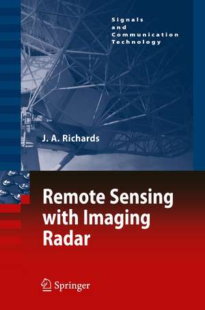
Remote Sensing with Imaging Radar: Signals and Communication Technology
Autor John A. Richardsen Limba Engleză Paperback – 14 mar 2012
| Toate formatele și edițiile | Preț | Express |
|---|---|---|
| Paperback (1) | 948.61 lei 6-8 săpt. | |
| Springer Berlin, Heidelberg – 14 mar 2012 | 948.61 lei 6-8 săpt. | |
| Hardback (1) | 952.89 lei 3-5 săpt. | |
| Springer Berlin, Heidelberg – 28 oct 2009 | 952.89 lei 3-5 săpt. |
Din seria Signals and Communication Technology
- 18%
 Preț: 952.89 lei
 - 18%
 Preț: 1559.80 lei
 - 17%
 Preț: 361.80 lei
 - 18%
 Preț: 811.61 lei
 - 15%
 Preț: 585.26 lei
 - 18%
 Preț: 727.97 lei
 - 15%
 Preț: 585.90 lei
 -
 Preț: 393.35 lei
 - 20%
 Preț: 1002.73 lei
 - 15%
 Preț: 641.71 lei
 - 20%
 Preț: 338.92 lei
 - 18%
 Preț: 1579.66 lei
 - 18%
 Preț: 896.08 lei
 - 18%
 Preț: 847.11 lei
 - 18%
 Preț: 1234.77 lei
 - 18%
 Preț: 905.54 lei
 - 15%
 Preț: 646.43 lei
 - 20%
 Preț: 662.48 lei
 - 15%
 Preț: 641.20 lei
 - 18%
 Preț: 1847.84 lei
 - 18%
 Preț: 946.24 lei
 - 18%
 Preț: 1241.10 lei
 - 20%
 Preț: 649.43 lei
 - 20%
 Preț: 993.28 lei
 - 18%
 Preț: 940.57 lei
 - 18%
 Preț: 1389.30 lei
 - 20%
 Preț: 1003.50 lei
 - 18%
 Preț: 953.52 lei
 - 20%
 Preț: 1001.16 lei
 - 18%
 Preț: 1415.36 lei
 - 15%
 Preț: 653.33 lei
 - 15%
 Preț: 645.60 lei
 - 15%
 Preț: 637.28 lei
 - 18%
 Preț: 948.79 lei
 - 18%
 Preț: 945.62 lei
 - 18%
 Preț: 836.36 lei
 - 18%
 Preț: 1225.46 lei
 - 15%
 Preț: 635.01 lei
 - 15%
 Preț: 639.25 lei
 - 15%
 Preț: 646.30 lei
 - 15%
 Preț: 639.25 lei
 - 15%
 Preț: 712.36 lei
 - 20%
 Preț: 1006.12 lei
 - 18%
 Preț: 970.56 lei
Preț: 948.61 lei
Preț vechi: 1156.84 lei
-18% Nou
Puncte Express: 1423
Preț estimativ în valută:
181.52€ • 197.79$ • 152.95£
181.52€ • 197.79$ • 152.95£
Carte tipărită la comandă
Livrare economică 24 aprilie-08 mai
Preluare comenzi: 021 569.72.76
Specificații
ISBN-13: 9783642261138
ISBN-10: 3642261132
Pagini: 384
Ilustrații: XIX, 361 p.
Dimensiuni: 155 x 235 x 20 mm
Greutate: 0.54 kg
Ediția:2009
Editura: Springer Berlin, Heidelberg
Colecția Springer
Seria Signals and Communication Technology
Locul publicării:Berlin, Heidelberg, Germany
ISBN-10: 3642261132
Pagini: 384
Ilustrații: XIX, 361 p.
Dimensiuni: 155 x 235 x 20 mm
Greutate: 0.54 kg
Ediția:2009
Editura: Springer Berlin, Heidelberg
Colecția Springer
Seria Signals and Communication Technology
Locul publicării:Berlin, Heidelberg, Germany
Public țintă
ResearchCuprins
The Imaging Radar System.- The Radiation Framework.- The Technology of Radar Imaging.- Correcting and Calibrating Radar Imagery.- Scattering from Earth Surface Features.- Interferometric and Tomographic SAR.- Bistatic SAR.- Radar Image Interpretation.- Passive Microwave Imaging.
Recenzii
From the reviews:
“This treatise is mostly targeted at Earth scientists, remote-sensing practitioners, and senior undergraduate or graduate students. … the book successfully provides clear insights into all key concepts without resorting to complex mathematical tools. … This book addresses with outstanding clarity all of the main issues associated with the physics, technology, and use of radar as an imaging tool for remote sensing. … an excellent reference and a rich source of information for remote-sensing scientists, users, and students.” (Sebastiano B. Serpico, IEEE Geoscience and Remote Sensing Society Newsletter, June, 2012)
“This treatise is mostly targeted at Earth scientists, remote-sensing practitioners, and senior undergraduate or graduate students. … the book successfully provides clear insights into all key concepts without resorting to complex mathematical tools. … This book addresses with outstanding clarity all of the main issues associated with the physics, technology, and use of radar as an imaging tool for remote sensing. … an excellent reference and a rich source of information for remote-sensing scientists, users, and students.” (Sebastiano B. Serpico, IEEE Geoscience and Remote Sensing Society Newsletter, June, 2012)
Textul de pe ultima copertă
This book treats the technology of radar imaging for remote sensing applications in a manner suited to the mathematical background of most earth scientists. It assumes no prior knowledge of radar on the part of the reader; instead it commences with a development of the essential concepts of radar before progressing through to a detailed coverage of contemporary ideas such as polarimetry and interferometry.
Because the technology of radar imaging is potentially complex the first chapter provides a framework against which the rest of the book is set. Together, the first four chapters present the technical foundations for remote sensing with imaging radar. Scattering concepts are then covered so that the reader develops the knowledge necessary for interpreting radar data, itself the topic of a later chapter which draws together the current thinking in the analysis of radar imagery.
The treatment is based on the assumption that the radars of interest are, in general, multi-polarised. Polarisation synthesis and polarised interferometric SAR are among the topics covered, as are tomography and the various forms of interferometry. A full chapter is given to bistatic radar, which is now emerging as an imaging technology with enormous potential and flexibility in remote sensing. The book concludes with a summary of passive microwave imaging.
A set of appendices is included that provide supplementary material, among which is an overview of the rather complicated process of image formation with synthetic aperture radar, and summaries of some of the mathematical procedures important for a full appreciation of radar as a remote sensing technology.
Caracteristici
Develops the technology of radar imaging in a manner suited to the mathematical background of most earth scientists – no deep knowledge Emphasises the application of imaging radar in the context of remote sensing


