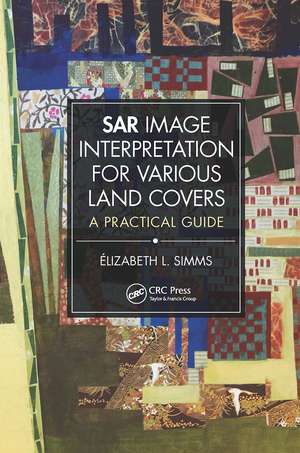
SAR Image Interpretation for Various Land Covers: A Practical Guide
Autor Elizabeth Simmsen Limba Engleză Paperback – 21 ian 2023
Features:
- Provides ready access to any type of information for an image interpretation problem related to current LULC classification schemes.
- Presents scalable geographic information interpreted at a regional scale and land cover ensembles that can also be interpreted locally.
- Provides comparative examples of images acquired from X- and C-band, opposed look directions, near- and far-range incidence angles, like- and cross-polarization modes.
- Includes practical explanations easily transferred to individual’s research projects.
Designed as "visual dictionary," SAR Image Interpretation for Various Land Covers: A Practical Guide, is an excellent introduction to the visual interpretation of SAR images for numerous types of LULC. Both practitioners and students will familiarize themselves with and expand their knowledge of geographic information conveyed from radar images while government agencies and businesses that use LULC-related data for emergency response cases of for urban and regional planning, will find this book invaluable.
| Toate formatele și edițiile | Preț | Express |
|---|---|---|
| Paperback (1) | 296.01 lei 6-8 săpt. | |
| CRC Press – 21 ian 2023 | 296.01 lei 6-8 săpt. | |
| Hardback (1) | 788.77 lei 6-8 săpt. | |
| CRC Press – 16 dec 2019 | 788.77 lei 6-8 săpt. |
Preț: 296.01 lei
Preț vechi: 339.79 lei
-13% Nou
Puncte Express: 444
Preț estimativ în valută:
56.65€ • 58.52$ • 47.15£
56.65€ • 58.52$ • 47.15£
Carte tipărită la comandă
Livrare economică 26 martie-09 aprilie
Preluare comenzi: 021 569.72.76
Specificații
ISBN-13: 9781032474939
ISBN-10: 1032474939
Pagini: 154
Ilustrații: 94
Dimensiuni: 156 x 234 mm
Greutate: 0.29 kg
Ediția:1
Editura: CRC Press
Colecția CRC Press
ISBN-10: 1032474939
Pagini: 154
Ilustrații: 94
Dimensiuni: 156 x 234 mm
Greutate: 0.29 kg
Ediția:1
Editura: CRC Press
Colecția CRC Press
Public țintă
Academic and Professional Practice & DevelopmentCuprins
Introduction. Synthetic Aperture Radar Images: An Overview. Image Interpretation Keys. Regional Land Cover Descriptions. Large Scale Geographical Ensembles. Image Acquisition Specifications into Effect. Annotated Literature. Conclusions. References.
Notă biografică
Élizabeth L. Simms is Associate Professor in the Department of Geography at Memorial University. She received her MSc degree from the Université de Sherbrooke and completed her PhD from the Université de Montréal. She worked for the Application Division of the Canada Centre for Remote Sensing on research projects related to the ocean, coastal environment, agriculture, and natural resource monitoring. In 1990, she joined the Department of Geography, Memorial University. Her academic activities include teaching courses in remote sensing, introductory geography information sciences, field methods, research design, and quantitative methods. Dr. Simms is currently coordinator of the Diploma in Geographic Information Sciences. Dr. Simms supervised graduate students in research based on radar and multispectral images, applied to mapping of coastal ice, boundary environments such as the coastal zone, Arctic tree line and glacier ice margins. Her research interest include developing teaching material to assist with learning of land use and land cover interpretation from RADARSAT-2 and COSMO- SkyMed images, developed area intensity classification from synthetic aperture radar, and the evaluation of remote sensing classification schemes for the representation of landscape features described through Aboriginal language.
Descriere
Written as an introduction to the visual interpretation of synthetic aperture radar (SAR) images for most types of land use and land cover (LULC), this book will help practitioners and students to familiarize themselves with, and to expand their knowledge of, geographic information data conveyed from radar images and unique context of terrains.
