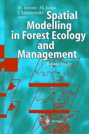
Spatial Modelling in Forest Ecology and Management: A Case Study
Editat de Martin Jansen, Michael Judas, Joachim Saborowskien Limba Engleză Hardback – 31 iul 2002
| Toate formatele și edițiile | Preț | Express |
|---|---|---|
| Paperback (1) | 638.11 lei 6-8 săpt. | |
| Springer Berlin, Heidelberg – 8 oct 2012 | 638.11 lei 6-8 săpt. | |
| Hardback (1) | 698.62 lei 6-8 săpt. | |
| Springer Verlag – 31 iul 2002 | 698.62 lei 6-8 săpt. |
Preț: 698.62 lei
Preț vechi: 821.91 lei
-15% Nou
Puncte Express: 1048
Preț estimativ în valută:
133.69€ • 140.22$ • 111.29£
133.69€ • 140.22$ • 111.29£
Carte tipărită la comandă
Livrare economică 01-15 aprilie
Preluare comenzi: 021 569.72.76
Specificații
ISBN-13: 9783540433576
ISBN-10: 3540433570
Pagini: 225
Dimensiuni: 167 x 241 x 14 mm
Greutate: 0.47 kg
Editura: Springer Verlag
Colecția Springer Verlag
Locul publicării:Germany
ISBN-10: 3540433570
Pagini: 225
Dimensiuni: 167 x 241 x 14 mm
Greutate: 0.47 kg
Editura: Springer Verlag
Colecția Springer Verlag
Locul publicării:Germany
Cuprins
1 Abstract.- 2 Introduction.- 3 Study areas and basic data.- 3.1 Study areas.- 3.2 Basic data.- 4 Statistical methods for regionalization of ecological state variables.- 4.1 Ordinary Kriging.- 4.2 Trend surface prediction.- 4.3 Kriging with trend.- 4.4 Crossvalidation.- 5 Spatial prediction of climate, soil, and macrofauna.- 5.1 Geomorphological and topoclimatic predictors derived from a DEM ..- Schulz, Mues, Jansen, Judas, Saborowski.- 5.2 Regionalization of climatic elements in Lower Saxony.- Mues, Jansen, Sloboda, Radler, Saborowski.- 5.3 Regionalization of soil chemical variables in the Harz mountains.- Jansen, Eberl, Beese.- 5.4 Regionalization of macrofauna populations.- Judas, Schaefer.- 6 Spatial models for site evaluation and forest planning.- 6.1 Forecast classification for the mapping of forest site properties.- Schulz, Judas.- 6.2 Modelling of forest growth areas in Lower Saxony.- Jansen, StUber, Wachter, Schulz, Schmidt, Saborowski, Mues, Eberl, Sloboda.- 6.3 Modelling of natural woodland communities in the Harz mountains.- Jansen, Schmidt, StUber, Wachter, Naeder, Weckesser, Knauft.- 7 GIS based investigations of effects of the LÖWE program in the Harz mountains.- 7.1 Scenarios of long-term forest stand development in the Harz mountains.- Jansen, Schulz, Konitzer, Sloboda.- 7.2 Economic effects of the LÖWE program in the Harz mountains.- Konitzer, Bitter, jansen.- List of Figures.- List of Tables.
Recenzii
From the reviews:
"This book focuses on the integration of spatial statistics, GIS-technology, ecosystem studies, and scenario modelling. Its main aim is to extend the information gained at the stand level to larger spatial scales, i.e. to forest districts, forest landscapes or to the total area of Lower Saxony. … This book is an indispensable tool for scientists and those involved in forest management." (Annals of Forest Science, Issue 1, 2003)
"This book focuses on the integration of spatial statistics, GIS-technology, ecosystem studies, and scenario modelling. Its main aim is to extend the information gained at the stand level to larger spatial scales, i.e. to forest districts, forest landscapes or to the total area of Lower Saxony. … This book is an indispensable tool for scientists and those involved in forest management." (Annals of Forest Science, Issue 1, 2003)
Textul de pe ultima copertă
In this book, GIS-based geomorphological, statistical, and geostatistical methods are used to improve the ecological site description of forest areas. Possibilities and limitations of the regionalization of climatic, soil, and macrofauna point measurements are presented. The resulting maps of indicators provide a broad and precise basis for forest planning and are essential for an integration of ecological and economic aspects of forest management.The applicability for forest practice is exemplified by the delimitation of forest site classes and of forest growth districts as well as the modelling of potential natural woodland communities. A scenario technique was used to simulate the forest stand development in the Harz mountains and to reveal the economic and ecological results of new management guidelines that are favoured by the forest administration. Spatial modelling and GIS-based information and planning systems provide improved data bases that are valuable instruments to describe the consequences of different management guidelines. Thus, they make a major contribution to a fruitful discussion about sustainable forest management.
Caracteristici
The focus of the book is the integration of spatial statistics, GIS-technology, ecosystem studies, and scenario modelling It extends the information gained at the stand level to larger spacial scales


