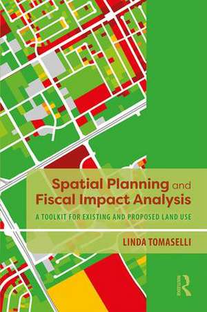
Spatial Planning and Fiscal Impact Analysis: A Toolkit for Existing and Proposed Land Use
Autor Linda Tomasellien Limba Engleză Hardback – 18 feb 2019
This book will provide readers with guidance as to how to conduct the Spatial Method in their own cities. The book will provide an overview of the history of fiscal analysis, and demonstrate the advantages of the Spatial Method to other methods, taking the reader step by step through the process, from analyzing city financial reports, determining and developing the factors that are needed to model the flows of revenues and expenditures, and then estimating fiscal impact at the parcel level. The result is a summary of detailed land use categories and neighborhoods that will be invaluable to city planners and public administration officials everywhere.
| Toate formatele și edițiile | Preț | Express |
|---|---|---|
| Paperback (1) | 327.63 lei 6-8 săpt. | |
| Taylor & Francis – 22 feb 2019 | 327.63 lei 6-8 săpt. | |
| Hardback (1) | 769.37 lei 6-8 săpt. | |
| Taylor & Francis – 18 feb 2019 | 769.37 lei 6-8 săpt. |
Preț: 769.37 lei
Preț vechi: 1030.44 lei
-25% Nou
Puncte Express: 1154
Preț estimativ în valută:
147.26€ • 153.15$ • 123.40£
147.26€ • 153.15$ • 123.40£
Carte tipărită la comandă
Livrare economică 13-27 martie
Preluare comenzi: 021 569.72.76
Specificații
ISBN-13: 9781138387942
ISBN-10: 1138387940
Pagini: 300
Ilustrații: 2 Line drawings, color; 22 Line drawings, black and white; 17 Halftones, color; 77 Halftones, black and white; 118 Tables, black and white; 118 Illustrations, black and white
Dimensiuni: 152 x 229 x 21 mm
Greutate: 0.74 kg
Ediția:1
Editura: Taylor & Francis
Colecția Routledge
Locul publicării:Oxford, United Kingdom
Public țintă
Postgraduate, Professional, Professional Practice & Development, and UndergraduateCuprins
Chapter 1 Spatial Planning and Fiscal Impact Analysis Method Chapter 2 A Survey of Fiscal Impact Analysis Methods Chapter 3 A Comparison of the Spatial Fiscal Impact Method to Other Methods Chapter 4 Preliminary Financial Analysis Chapter 5 Compiling the Parcel_Factor Shapefile Attributes Chapter 6 Determining Fiscal Allocation Multipliers Chapter 7 Calculating Existing Fiscal Impact Chapter 8 Analyzing School Fiscal Impact Chapter 9 Projecting Fiscal Impact Chapter 10 Marginal Impacts and Sprawl Chapter 11 Working Toward an Enterprise Spatial Planning and Fiscal Impact Analysis System Chapter 12 Summary of the Spatial Planning and Fiscal Impact Analysis Method Appendix A Creating Address-Matching File for Parcels Appendix B Allocating Public Safety Data to Parcels Appendix C Determining Local Road Frontage for Parcels Appendix D Reconciling Census Blocks with Parcels Appendix E Using Census Data to Estimate Adult and School-Age Population by Parcel Appendix F Modeling Fiscal Impact Using ArcGIS Model Builder
Notă biografică
Linda Tomaselli has a BA, MA and PhD in Geography from the University of Minnesota, USA, and has over 40 years of experience as a planner and GIS specialist. She recognized early on that cities needed a better way to measure fiscal impact. With the financial help of the National Science Foundation, she has developed a spatial methodology for estimating fiscal impact of existing development that could be used to project future impacts and develop a city’s "information infrastructure."
Descriere
The Spatial Fiscal Impact Analysis Method is an innovative approach to measure fiscal impact and project the future costs of a proposed development, recognizing that all revenues and expenditures are spatially related.


