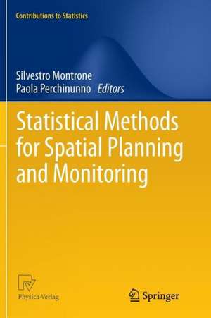
Statistical Methods for Spatial Planning and Monitoring: Contributions to Statistics
Editat de Silvestro Montrone, Paola Perchinunnoen Limba Engleză Paperback – 9 noi 2014
One of the earliest and most famous definition of spatial planning was “a geographical expression to the economic, social, cultural and ecological policies of society”: borrowing from this point of view, this text shows how an interdisciplinary approach is an effective way to an harmonious integration of national policies with regional and local analysis.
A wide range of spatial models and techniques is, also, covered: spatial data mining, point processes analysis, nearest neighbor statistics and cluster detection, Fuzzy Regression model and local indicators of spatial association; all of these tools provide the policy-maker with a valuable support to policy development.
| Toate formatele și edițiile | Preț | Express |
|---|---|---|
| Paperback (1) | 380.84 lei 6-8 săpt. | |
| Springer – 9 noi 2014 | 380.84 lei 6-8 săpt. | |
| Hardback (1) | 388.13 lei 6-8 săpt. | |
| Springer – 24 oct 2012 | 388.13 lei 6-8 săpt. |
Din seria Contributions to Statistics
-
 Preț: 391.99 lei
 - 20%
 Preț: 332.89 lei
 - 15%
 Preț: 639.08 lei
 -
 Preț: 376.85 lei
 - 15%
 Preț: 664.61 lei
 - 15%
 Preț: 642.36 lei
 - 18%
 Preț: 792.19 lei
 -
 Preț: 389.70 lei
 - 18%
 Preț: 792.81 lei
 - 18%
 Preț: 1382.21 lei
 -
 Preț: 402.38 lei
 -
 Preț: 403.53 lei
 - 18%
 Preț: 943.73 lei
 -
 Preț: 374.37 lei
 - 18%
 Preț: 955.88 lei
 - 15%
 Preț: 653.33 lei
 -
 Preț: 383.71 lei
 - 15%
 Preț: 645.28 lei
 -
 Preț: 384.86 lei
 - 15%
 Preț: 637.59 lei
 - 15%
 Preț: 641.71 lei
 - 15%
 Preț: 649.71 lei
 - 5%
 Preț: 669.72 lei
 -
 Preț: 379.30 lei
 - 18%
 Preț: 942.76 lei
 -
 Preț: 393.35 lei
 - 18%
 Preț: 951.91 lei
 -
 Preț: 386.99 lei
 - 20%
 Preț: 651.75 lei
 - 15%
 Preț: 640.71 lei
 - 15%
 Preț: 640.37 lei
 - 15%
 Preț: 639.08 lei
 - 18%
 Preț: 944.67 lei
 - 15%
 Preț: 641.20 lei
 - 15%
 Preț: 638.57 lei
 - 18%
 Preț: 943.43 lei
 -
 Preț: 385.47 lei
 - 18%
 Preț: 945.47 lei
 -
 Preț: 388.52 lei
Preț: 380.84 lei
Nou
Puncte Express: 571
Preț estimativ în valută:
72.88€ • 77.93$ • 60.76£
72.88€ • 77.93$ • 60.76£
Carte tipărită la comandă
Livrare economică 18 aprilie-02 mai
Preluare comenzi: 021 569.72.76
Specificații
ISBN-13: 9788847056077
ISBN-10: 8847056071
Pagini: 168
Ilustrații: X, 158 p.
Dimensiuni: 155 x 235 x 9 mm
Greutate: 0.25 kg
Ediția:2013
Editura: Springer
Colecția Springer
Seria Contributions to Statistics
Locul publicării:Milano, Italy
ISBN-10: 8847056071
Pagini: 168
Ilustrații: X, 158 p.
Dimensiuni: 155 x 235 x 9 mm
Greutate: 0.25 kg
Ediția:2013
Editura: Springer
Colecția Springer
Seria Contributions to Statistics
Locul publicării:Milano, Italy
Public țintă
ResearchCuprins
1. Geographical Disparities in Mortality Rates: Spatial Data Mining and Bayesian Hierarchical Modeling.- 2. A Fuzzy Approach to Ward’s Method of Classification: an Application Case To the Italian University System.- 3. Geostatistics and the Role of Variogram in Time Series Analysis: a Critical Review.- 4. Geostatistics and GIS: Tools for Environmental Risk Assessment.- 5. Socio-Economic Zoning: Comparing Two Statistical Methods.- 6. A Geostatistical Approach to Measure Shrinking Cities: the Case of Taranto.- 7. Social Identity as Determinant of Real Estate Economy in Manhattan.
Recenzii
From the book reviews:
“The book presents solid and accessible strategies and provides the policy maker with a valued support to policy development. … All the chapters in this book are organized and well presented. Each paper begins with an introduction and concludes with a list of references. The intended audience for this book is presumably policy makers. However, researchers and graduate students who are involved with spatial modeling can also benefit from this book.” (S. E. Ahmed, Technometrics, Vol. 56 (1), January, 2014)
“The book presents solid and accessible strategies and provides the policy maker with a valued support to policy development. … All the chapters in this book are organized and well presented. Each paper begins with an introduction and concludes with a list of references. The intended audience for this book is presumably policy makers. However, researchers and graduate students who are involved with spatial modeling can also benefit from this book.” (S. E. Ahmed, Technometrics, Vol. 56 (1), January, 2014)
Textul de pe ultima copertă
The book aims to investigate methods and techniques for spatial statistical analysis suitable to model spatial information in support of decision systems. Over the last few years there has been a considerable interest in these tools and in the role they can play in spatial planning and environmental modelling.
One of the earliest and most famous definition of spatial planning was “a geographical expression to the economic, social, cultural and ecological policies of society”: borrowing from this point of view, this text shows how an interdisciplinary approach is an effective way to an harmonious integration of national policies with regional and local analysis.
A wide range of spatial models and techniques is, also, covered: spatial data mining, point processes analysis, nearest neighbor statistics and cluster detection, Fuzzy Regression model and local indicators of spatial association; all of these tools provide the policy-maker with a valuable support to policy development.
Caracteristici
Direct correspondence between the proposal statistical methods and land related problems Illustration of several techniques of spatial data analysis Real estate valuation and related support and planning policies
