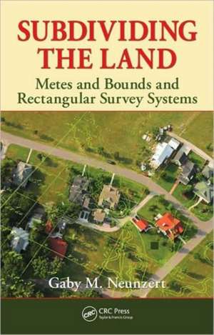
Subdividing the Land: Metes and Bounds and Rectangular Survey Systems
Autor Gaby M. Neunzerten Limba Engleză Hardback – 11 noi 2010
Each state has its own property laws, but the book's material is generic enough to be applicable across the entire United States and even Canada. Taking into account that local laws may be influenced by many factors, the book also covers the roots of English property laws and the effects of French, Spanish, and Mexican legacies. The author discusses topics such as water law, mining claims, and the Metes and Bounds and Torrens system of property registry. He provides a section of basic legal concepts applicable to land transactions and a glossary of special or semi-technical terms.
Unlike most other topics related to surveying, there is no math associated with the topics given; yet the subjects can be complex and tricky. Subdividing the Land is a resource of many interrelated topics, and thus presents a knowledge base for land surveyors and the background for handling many types of land transactions conducted by real estate agents, engineers, architects, and lawyers.
| Toate formatele și edițiile | Preț | Express |
|---|---|---|
| Paperback (1) | 460.90 lei 6-8 săpt. | |
| CRC Press – 10 dec 2019 | 460.90 lei 6-8 săpt. | |
| Hardback (1) | 552.37 lei 6-8 săpt. | |
| CRC Press – 11 noi 2010 | 552.37 lei 6-8 săpt. |
Preț: 552.37 lei
Preț vechi: 763.52 lei
-28% Nou
Puncte Express: 829
Preț estimativ în valută:
105.69€ • 110.36$ • 87.28£
105.69€ • 110.36$ • 87.28£
Carte tipărită la comandă
Livrare economică 15-29 aprilie
Preluare comenzi: 021 569.72.76
Specificații
ISBN-13: 9781439827475
ISBN-10: 1439827478
Pagini: 172
Ilustrații: 57 b/w images, 5 tables and N/A
Dimensiuni: 156 x 234 x 18 mm
Greutate: 0.44 kg
Ediția:1
Editura: CRC Press
Colecția CRC Press
ISBN-10: 1439827478
Pagini: 172
Ilustrații: 57 b/w images, 5 tables and N/A
Dimensiuni: 156 x 234 x 18 mm
Greutate: 0.44 kg
Ediția:1
Editura: CRC Press
Colecția CRC Press
Public țintă
Students taking a course on land surveying, geomatics, or real estate; practitioners aspiring to become surveyors, civil engineers, real estate agents or lawyers specializing in real estate; peoples who have a professional relationship with land surveying and geomatics planning to take the professional exams, i.e. surveyors, civil engineers, realtors.Cuprins
Metes and Bounds Surveys. U.S. Rectangular Survey System. Surveying Roots. Mining Claims and Related Items. Water Laws. Some Legal Concepts and Definitions. Glossary. Bibliography and Other Resources. Index.
Descriere
Ideally, every tract of land has a description on paper and a physical survey on the ground. When boundary disputes arise, all parties concerned must quickly learn the vocabulary and processes involved with real estate. Written for anyone working in real estate transactions, Subdividing the Land: Metes and Bounds and Rectangular Survey Systems provides this essential background. It defines key legal terms and the structure of the U.S. Land Survey System and offers many illustrations and tables that clearly explain the concepts.
