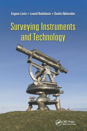
Surveying Instruments and Technology
Autor Leonid Nadolinets, Eugene Levin, Daulet Akhmedoven Limba Engleză Paperback – 12 dec 2019
| Toate formatele și edițiile | Preț | Express |
|---|---|---|
| Paperback (1) | 352.95 lei 6-8 săpt. | |
| CRC Press – 12 dec 2019 | 352.95 lei 6-8 săpt. | |
| Hardback (1) | 878.82 lei 6-8 săpt. | |
| CRC Press – 12 iun 2017 | 878.82 lei 6-8 săpt. |
Preț: 352.95 lei
Preț vechi: 454.60 lei
-22% Nou
Puncte Express: 529
Preț estimativ în valută:
67.55€ • 69.68$ • 57.17£
67.55€ • 69.68$ • 57.17£
Carte tipărită la comandă
Livrare economică 05-19 martie
Preluare comenzi: 021 569.72.76
Specificații
ISBN-13: 9780367877408
ISBN-10: 0367877406
Pagini: 252
Dimensiuni: 156 x 234 mm
Greutate: 0.45 kg
Ediția:1
Editura: CRC Press
Colecția CRC Press
Locul publicării:Boca Raton, United States
ISBN-10: 0367877406
Pagini: 252
Dimensiuni: 156 x 234 mm
Greutate: 0.45 kg
Ediția:1
Editura: CRC Press
Colecția CRC Press
Locul publicării:Boca Raton, United States
Cuprins
Preface. Acknowledgment. Authors. Chapter 1 Introduction. Chapter 2 Levels. Chapter 3 Theodolites. Chapter 4 Electronic Distance Measurer (EDM). Chapter 5 Total Stations. Chapter 6 Global Navigation Satellite Systems (GNSS). Chapter 7 Obtaining and Processing Unmanned Aerial Vehicle (UAV) Data for Surveying and Mapping. Index.
Notă biografică
Leonid Nadolinets lives in Moscow, Russia. Nadolinets has devoted his life to studying and developing surveying instruments. His PhD thesis covered topical surveying instrument developing. Nadolinets has worked as a research fellow at many research institutes in Russia and abroad. He has also attended training courses arranged by leading surveying manufacturers from the United States, Europe, Japan, and China. Currently, Nadolinets heads a consulting company that develops and maintains surveying instruments.
Eugene Levin is the program chair of surveying engineering and associate professor at the School of Technology at Michigan Technological University. Levin also directs the Integrated Geospatial Technology graduate program. He received an MS degree in astrogeodesy from Siberian State Geodetic Academy in 1982 and a PhD in photogrammetry from Moscow State Land Organization University in 1989. He has more than 30 years of experience in academia and the geospatial industry in the United States, Israel, and Russia. He has held research and management positions with several academic institutions and high-tech companies, including the Research Institute of Applied Geodesy, Omsk Agricultural Academy, Rosnitc "Land," Ness Technologies, Physical Optics Corporation, Digital Map Products, American GNC, and Future Concepts. He has served as a principal investigator and project manager for multiple award-winning government programs.
Eugene Levin is the program chair of surveying engineering and associate professor at the School of Technology at Michigan Technological University. Levin also directs the Integrated Geospatial Technology graduate program. He received an MS degree in astrogeodesy from Siberian State Geodetic Academy in 1982 and a PhD in photogrammetry from Moscow State Land Organization University in 1989. He has more than 30 years of experience in academia and the geospatial industry in the United States, Israel, and Russia. He has held research and management positions with several academic institutions and high-tech companies, including the Research Institute of Applied Geodesy, Omsk Agricultural Academy, Rosnitc "Land," Ness Technologies, Physical Optics Corporation, Digital Map Products, American GNC, and Future Concepts. He has served as a principal investigator and project manager for multiple award-winning government programs.
Recenzii
"I am impressed by the detail of this book. Not only has this book provided the history of surveying equipment, but also the reason and technological advances that made this changes. It is also pleasing to see the corresponding mathematics and the accuracies that have evolved to accommodate societies’ needs along with equipment companies. It is not difficult to imagine this book will be a good reference in classroom and surveying research as well."
—Yushin Ahn, Michigan Technological University, USA
"While existing literature in recent years has been concentrating on computer processing of the developments in surveying, the book adds the area of instrumentation and its use, which so far has been missing and is not accessible elsewhere. The international authors ought to be congratulated on this effort to fill the void. They have added clear illustrations of the detailed components of instrumentation and the use of these tools. The book will serve as a fundamental reference in modern survey literature for students and practitioners in civil engineering and geoinformatics."
— Gottfried Konecny, Leibniz University Hannover, Germany
Descriere
Surveyor’s Instruments and Technology gives surveying students and practitioners profound understanding of how surveying instruments are designed and operated based on surveying instrument functionality. The book includes the required basic knowledge of accurate measurements of distances and angles from theoretical principles to advanced
