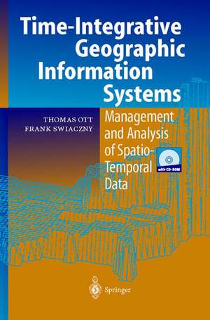
Time-Integrative Geographic Information Systems: Management and Analysis of Spatio-Temporal Data
Autor Thomas Ott, Frank Swiacznyen Limba Engleză Hardback – 27 feb 2001
| Toate formatele și edițiile | Preț | Express |
|---|---|---|
| Paperback (1) | 638.24 lei 43-57 zile | |
| Springer Berlin, Heidelberg – 3 oct 2012 | 638.24 lei 43-57 zile | |
| Hardback (1) | 643.00 lei 43-57 zile | |
| Springer Berlin, Heidelberg – 27 feb 2001 | 643.00 lei 43-57 zile |
Preț: 643.00 lei
Preț vechi: 756.47 lei
-15% Nou
Puncte Express: 965
Preț estimativ în valută:
123.05€ • 127.69$ • 102.85£
123.05€ • 127.69$ • 102.85£
Carte tipărită la comandă
Livrare economică 17-31 martie
Preluare comenzi: 021 569.72.76
Specificații
ISBN-13: 9783540410164
ISBN-10: 3540410163
Pagini: 252
Ilustrații: XIV, 234 p.
Dimensiuni: 155 x 235 x 20 mm
Greutate: 0.49 kg
Ediția:2001
Editura: Springer Berlin, Heidelberg
Colecția Springer
Locul publicării:Berlin, Heidelberg, Germany
ISBN-10: 3540410163
Pagini: 252
Ilustrații: XIV, 234 p.
Dimensiuni: 155 x 235 x 20 mm
Greutate: 0.49 kg
Ediția:2001
Editura: Springer Berlin, Heidelberg
Colecția Springer
Locul publicării:Berlin, Heidelberg, Germany
Public țintă
ResearchCuprins
1 Introduction.- 1.1 The relationship of space and time.- 1.2 Targets and contents of the book.- 1.3 Further Reading.- 2 Conceptualising real world entities in spatio-temporal GIS.- 2.1 The geographer’s perspective on space and time.- 2.2 Modelling the real world in Geographic Information Systems.- 2.3 The representation of space in GIS.- 2.4 Integration of external models in Geographic Information Systems.- 2.5 Spatio-temporal dimensions in GIS.- 3 Integrating time in Geographic Information Systems.- 3.1 Different types of time.- 3.2 Conceptualising time in GIS.- 3.3 Event and database time.- 3.4 Version management.- 3.5 Types of temporal databases.- 4 Implementation of time in GIS.- 4.1 Implementation problems.- 4.2 Project design.- 4.3 Implementation constraints.- 4.3.2 Spatio-temporal GIS approaches.- 5 Processing and analysis of temporal data inside a GIS.- 5.1 Common GIS analysis functions.- 5.2 Spatial and thematic queries.- 5.3 Temporal queries.- 5.4 Process analysis and simulation.- 6 The visualization of spatio-temporal processes.- 6.1 Basic concepts of spatio-temporal visualisation.- 6.2 Displaying time on a map.- 6.3 Multidimensional GIS.- 6.4 GIS and Multimedia.- 7 Examples.- 7.1 Building a historical GIS.- 7.2 Studying historical transport networks.- 7.3 Exploring cultural landscape change.- 7.4 Working with cadastres.- 7.5 Predicting wildfires.- 7.6 Mapping urban growth.- 7.7 Reconstructing archaeological excavations.- 7.8 Mining for business data.- 8 Conclusion.- 8.1 Summary.- 8.2 Outlook.- 9 Appendix.- 9.1 Research bibliography.- 9.2 Internet links.- CD-ROM with examples / code from the book.
Recenzii
From the reviews of the first edition:
"The integration of time in predominantly spatially driven and static geographical information systems (GIS) has been biased towards theoretical concepts rather than practical solutions. This book by Ott and Swiaczny provides a new addition to the small but growing collection of textbooks that are available on temporal GIS. … This book will be of use to graduate students and senior undergraduate students … . Professionals whose work involves the development of spatiotemporal databases will find interest in this book." (Suzana Dragicevic, Environment and Planning B: Planning and Design, Vol. 30, 2003)
"The integration of time in predominantly spatially driven and static geographical information systems (GIS) has been biased towards theoretical concepts rather than practical solutions. This book by Ott and Swiaczny provides a new addition to the small but growing collection of textbooks that are available on temporal GIS. … This book will be of use to graduate students and senior undergraduate students … . Professionals whose work involves the development of spatiotemporal databases will find interest in this book." (Suzana Dragicevic, Environment and Planning B: Planning and Design, Vol. 30, 2003)
Textul de pe ultima copertă
The book deals with the integration of temporal information in Geographic Information Systems. The main purpose of an historical or time-integrative GIS is to reproduce spatio- temporal processes or sequents of events in the real world in the form of a model. The model thus making them accessible for spatial query, analysis and visualization. This volume reflects both theoretical thoughts on the interrelations of space and time, as well as practical examples taken from various fields of application (e.g. business data warehousing, demographics, history and spatial analysis).
Caracteristici
This book combines theoretical insight with practical tips for successful GIS projects


