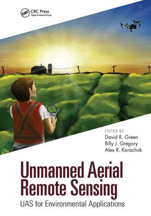
Unmanned Aerial Remote Sensing: UAS for Environmental Applications
Editat de David R. Green, Billy J. Gregory, Alexander Karachoken Limba Engleză Paperback – 21 feb 2023
Unmanned Aerial Remote Sensing: UAS for Environmental Applications is an excellent resource for any practitioner utilising remote sensing and other geospatial technologies for environmental applications, such as conservation, research, and planning. Students and academics in information science, environment and natural resources, geosciences, and geography will likewise find this comprehensive book a useful and informative resource.
Features
- Provides necessary theoretical foundations for pertinent subject matter areas
- Introduces the role and value of UAVs for geographical data acquisition and the ways to acquire and process the data
- Provides a synthesis of ongoing research and a focus on the use of technology for small-scale image and spatial data acquisition in an environmental context
- Written by experts of the technology who bring together UAS tools and resources for environmental specialists.
| Toate formatele și edițiile | Preț | Express |
|---|---|---|
| Paperback (1) | 307.62 lei 6-8 săpt. | |
| CRC Press – 21 feb 2023 | 307.62 lei 6-8 săpt. | |
| Hardback (1) | 911.72 lei 6-8 săpt. | |
| CRC Press – 31 iul 2020 | 911.72 lei 6-8 săpt. |
Preț: 307.62 lei
Preț vechi: 345.64 lei
-11% Nou
Puncte Express: 461
Preț estimativ în valută:
58.87€ • 61.54$ • 49.75£
58.87€ • 61.54$ • 49.75£
Carte tipărită la comandă
Livrare economică 07-21 martie
Preluare comenzi: 021 569.72.76
Specificații
ISBN-13: 9781032474342
ISBN-10: 1032474343
Pagini: 364
Ilustrații: 162
Dimensiuni: 178 x 254 x 20 mm
Greutate: 0.84 kg
Ediția:1
Editura: CRC Press
Colecția CRC Press
ISBN-10: 1032474343
Pagini: 364
Ilustrații: 162
Dimensiuni: 178 x 254 x 20 mm
Greutate: 0.84 kg
Ediția:1
Editura: CRC Press
Colecția CRC Press
Public țintă
Academic and Professional Practice & DevelopmentCuprins
1. Introduction 2. From Radio-Controlled Model Aircraft to Drones 3. Aquatic Vegetation Monitoring with UAS 4. Unmanned Aerial Vehicles for Riverine Environments 5. Low-Cost UAVs for Environmental Monitoring, Mapping, and Modelling of the Coastal Zone 6. Unmanned Aerial System Applications to Coastal Environments 7. UAV Image Acquisition Using Structure from Motion to Visualise a Coastal Dune System 8. Monitoring, Mapping, and Modelling Saltmarsh with UAVs 9. Autonomous UAV-Based Insect Monitoring 10. UAV Imagery to Monitor, Map, and Model a Vineyard Canopy to Aid in the Application of Precision Viticulture to Small-Area Vineyards 11. Forest Ecosystem Monitoring Using Unmanned Aerial Systems 12. Monitoring Oil and Gas Pipelines with Small UAV Systems 13. Drone-Based Imaging in Archaeology: Current Applications and Future Prospects 14. Unmanned Aerial System (UAS) Applications in the Built Environment: Towards Automated Building Inspection Procedures Using Drones 15. The Application of UAVs to Inform Coastal Area Management 16. From Land to Sea: Monitoring the Underwater Environment with Drone Technology 17. A Question of UAS Ground Control: Frequency and Distribution 18. Launch and Recovery System for Improved Fixed-Wing UAV Deployment in Complex Environments 19. Epilogue
Notă biografică
David R. Green is the Director of the Aberdeen Institute for Coastal Science and Management (AICSM), Director of the M.Sc. Degree Programme in Geographical Information Systems, and Director of the UAV Centre for Environmental Monitoring and Mapping (UCEMM) (www.abdn.ac.uk/research/ucemm) at the Department of Geography and Environment, University of Aberdeen, Scotland, United Kingdom. He is past Chairman of the Association for Geographic Information (AGI); past Editor in Chief of The Cartographic Journal; past-President of the EUCC–The Coastal and Marine Union; past-Vice-Chair of the European Centre for Nature Conservation Scientific Committee (ECNC); Currently a Director and Chair of EGCP Ltd., and Chair of the CoastGIS 2018 Conference. He is a specialist in the environmental applications of geospatial technologies with interests in geographical information systems, remote sensing (terrestrial and bathymetric), cartography/digital mapping, Internet and mobile GIS, coastal and marine resource management, hydrography, marine spatial planning (MSP), and UAV technology. He has published a number of books on Coastal Zone Management and Geographical Information Systems (GIS). David is also Editor in Chief of the Journal of Coastal Conservation, Planning and Management (Springer).
Billy J. Gregory is a powerboat instructor, sailing instructor, skier and CAA qualified commercial drone pilot. Having flown fixed-wing radio-controlled model aircraft for many years, he began flying small multi-rotor UAVs. As an associate of UCEMM (UAV Centre for Environmental Monitoring and Mapping) at the Department of Geography and Environment, University of Aberdeen, Scotland, United Kingdom (www.abdn.ac.uk/research/ucemm) he has been involved with a number of UAV-based research projects and helps to train both MSc and PhD students looking to use drones in their projects. In 2018 he set up DroneLite (www.dronelite.co.uk) a small drone company which is based in Forres, Scotland, UK. He continues to combine his interests in watersport activities with flying both multi-rotor and fixed-wing drones for a variety of aerial photographic and video projects, and participating in small drone workshops, training events, and conference organisation.
Alex Karachok was born in Toronto, Ontario. He has many hobbies, the most significant being geology and photography. Alex acquired his first mini-camera in 2011 and his fist drone in 2014. From there, he has developed a passion for photography. In 2018, he was astounded by one his scout leaders flying a Mavic pro. This led him to eventually selling his new game console for a DJI Spark. He now lives with his parents, younger sister and dog in Oakville, Ontario. He owns a DJI Osmo Pocket and edits his own footage from both the drone and the Osmo hoping to become a filmmaker and to use drones in the field of geology. Alex is also an associate of UCEMM (UAV Centre for Environmental Monitoring and Mapping) (www.abdn.ac.uk/research/ucemm) at the Department of Geography and Environment, University of Aberdeen, Scotland, United Kingdom focusing on raising awareness and educating school age pupils in safe, legal and responsible drone flying. He is also an Honorary Pilot for DroneLite.
Descriere
In response to the rapidly evolving technology and applications UAS technology, this book discusses both UAV and similar systems’ platforms and environmental applications. The platforms and sensors provide the setting while the applications chapters are focused on the environment from monitoring to mapping. The book also addresses the constraint
