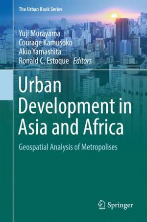
Urban Development in Asia and Africa: Geospatial Analysis of Metropolises: The Urban Book Series
Editat de Yuji Murayama, Courage Kamusoko, Akio Yamashita, Ronald C. Estoqueen Limba Engleză Hardback – 11 apr 2017
| Toate formatele și edițiile | Preț | Express |
|---|---|---|
| Paperback (1) | 1390.89 lei 3-5 săpt. | |
| Springer Nature Singapore – 25 iul 2018 | 1390.89 lei 3-5 săpt. | |
| Hardback (1) | 1165.44 lei 38-44 zile | |
| Springer Nature Singapore – 11 apr 2017 | 1165.44 lei 38-44 zile |
Din seria The Urban Book Series
- 15%
 Preț: 655.27 lei
 - 15%
 Preț: 640.06 lei
 - 15%
 Preț: 643.16 lei
 - 18%
 Preț: 1007.35 lei
 - 15%
 Preț: 648.56 lei
 - 18%
 Preț: 1003.38 lei
 - 15%
 Preț: 642.18 lei
 - 18%
 Preț: 963.15 lei
 - 18%
 Preț: 948.92 lei
 - 15%
 Preț: 649.87 lei
 - 18%
 Preț: 731.59 lei
 - 18%
 Preț: 783.50 lei
 - 18%
 Preț: 894.46 lei
 - 18%
 Preț: 897.02 lei
 - 15%
 Preț: 648.24 lei
 - 18%
 Preț: 949.42 lei
 - 18%
 Preț: 731.10 lei
 - 15%
 Preț: 649.87 lei
 - 15%
 Preț: 639.37 lei
 - 18%
 Preț: 950.52 lei
 - 15%
 Preț: 644.95 lei
 - 15%
 Preț: 640.06 lei
 - 18%
 Preț: 1126.52 lei
 - 15%
 Preț: 645.60 lei
 - 15%
 Preț: 649.87 lei
 - 18%
 Preț: 1415.66 lei
 - 15%
 Preț: 647.73 lei
 - 18%
 Preț: 793.32 lei
 - 18%
 Preț: 892.90 lei
 - 15%
 Preț: 659.70 lei
 - 18%
 Preț: 1004.99 lei
 - 15%
 Preț: 645.79 lei
 - 18%
 Preț: 735.84 lei
 - 20%
 Preț: 564.40 lei
 - 18%
 Preț: 892.90 lei
 - 18%
 Preț: 952.09 lei
 - 15%
 Preț: 641.71 lei
 - 18%
 Preț: 1009.70 lei
 - 18%
 Preț: 1401.61 lei
 - 18%
 Preț: 1109.16 lei
 - 15%
 Preț: 648.24 lei
 - 18%
 Preț: 726.37 lei
 - 18%
 Preț: 728.28 lei
 - 18%
 Preț: 894.46 lei
 - 18%
 Preț: 1000.24 lei
 - 15%
 Preț: 640.06 lei
 - 18%
 Preț: 998.66 lei
 - 15%
 Preț: 657.90 lei
Preț: 1165.44 lei
Preț vechi: 1533.47 lei
-24% Nou
Puncte Express: 1748
Preț estimativ în valută:
223.01€ • 233.43$ • 185.61£
223.01€ • 233.43$ • 185.61£
Carte tipărită la comandă
Livrare economică 27 martie-02 aprilie
Preluare comenzi: 021 569.72.76
Specificații
ISBN-13: 9789811032400
ISBN-10: 9811032408
Pagini: 504
Ilustrații: X, 424 p. 206 illus., 185 illus. in color.
Dimensiuni: 155 x 235 x 27 mm
Greutate: 0.89 kg
Ediția:1st ed. 2017
Editura: Springer Nature Singapore
Colecția Springer
Seria The Urban Book Series
Locul publicării:Singapore, Singapore
ISBN-10: 9811032408
Pagini: 504
Ilustrații: X, 424 p. 206 illus., 185 illus. in color.
Dimensiuni: 155 x 235 x 27 mm
Greutate: 0.89 kg
Ediția:1st ed. 2017
Editura: Springer Nature Singapore
Colecția Springer
Seria The Urban Book Series
Locul publicării:Singapore, Singapore
Cuprins
Importance of Remote Sensing and Land Change Modeling for Urbanization Studies.- Methodology.- Rapid Urbanization in Developing Asia and Africa.- Beijing Metropolitan Area.- Manila Metropolitan Area.- Jakarta Metropolitan Area.- Hanoi Metropolitan Area.- Bangkok Metropolitan Area.- Yangon Metropolitan Area.- Dhaka Metropolitan Area.- Kathmandu Metropolitan Area.- Tehran Metropolitan Area.- Dakar Metropolitan Area.- Bamako Metropolitan Area.- Nairobi Metropolitan Area.- Lilongwe Metropolitan Area.- Harare Metropolitan Area.- Johannesburg Metropolitan Area.- Trends and Spatial Patterns of Urbanization in Asia and Africa: A comparative analysis.- Future of Metropolises in Developing Asia and Africa.
Notă biografică
Yuji Murayama, professor, Division of Spatial Information Science, Faculty of Life and Environmental Sciences, University of Tsukuba, Japan. His expertise and fields of interest include GIS, spatial analysis, urban geography, and transportation geography. Publications: Murayama Y. ed. (2012). Progress in Geospatial Analysis. Tokyo: Springer, 291 pp. Murayama Y. and Thapa R. B., eds. (2011). Spatial Analysis and Modeling in Geographical Transformation Process: GIS-Based Application. Dordrecht: Springer, 300 pp. Kamusoko C., Mundia C. N., and Murayama Y. eds. (2011). Recent Advances in Remote Sensing and GIS in Sub-Sahara Africa. New York: Nova Publishers, 211 pp. Murayama Y. and Du G. eds. (2005). Cities in Global Perspective: Diversity and Transition. Tokyo: College of Tourism, Rikkyo University with IGU Commission, 626 pp. Murayama Y. (2000). Japanese Urban System. Dordrecht: Kluwer, 271 pp.
Courage Kamusoko, researcher, Asia Air Survey, Japan. His expertise includes land use/cover change modelling, and the design and implementation of geospatial database management systems. His primary research involves analyses of remotely sensed images, land use/cover modelling, and machine learning. In addition to his focus on geospatial research and consultancy, he has dedicated time to teaching practical machine learning for geospatial analysis and modelling. Publication: Kamusoko C., Mundia C. N., and Murayama Y. eds. (2011). Recent Advances in Remote Sensing and GIS in Sub-Sahara Africa. New York: Nova Publishers, 211 pp.
Akio Yamashita, assistant professor, Division of Regional Geography, Faculty of Life and Environmental Sciences, University of Tsukuba, Japan. His expertise includes geography, GIS, and study of urban environmental issues. Papers published: Yamashita A. (2014). “Aspects of water environmental issues in Jakarta due to its rapid urbanization.” Tsukuba Geoenvironmental Sciences, 10, 43–50. Yamashita A. (2011). “Comparative analysis on land use distributions and their changes in Asian mega cities.” In: Taniguchi M. ed. Groundwater and Subsurface Environments: Human Impacts in Asian Coastal Cities, Springer, 61–81.
Ronald C. Estoque, researcher, Faculty of Life and Environmental Sciences, University of Tsukuba, Japan. His research interests include the applications of geospatial technologies such as remote sensing and GIS, as well as social-ecological approaches, for landscape sustainability studies. One of his most recent research articles, entitled “Quantifying landscape pattern and ecosystem service value changes in four rapidly urbanizing hill stations of Southeast Asia”, is published in Landscape Ecology (2016), 31, 1481–1507. His other major research articles are published in Cities, ISPRS International Journal of Geo-Information, Applied Geography, Landscape and Urban Planning,AMBIO, GIScience & Remote Sensing, Geocarto International, Ecological Indicators, and Land Use Policy.
Textul de pe ultima copertă
This book examines the urban growth trends and patterns of various rapidly growing metropolitan regions in developing Asian and African nations from the perspective of geography. State-of-the-art geospatial tools and techniques, including geographic information system/science and remote sensing, were used to facilitate the analysis. In addition to the empirical results, the methodological approaches employed and discussed in this book showcase the potential of geospatial analysis, e.g. land-change modeling for improving our understanding of the trends and patterns of urban growth in Asia and Africa. Furthermore, given the complexity of the urban growth process across the world, issues raised in this book will contribute to the improvement of future geospatial analysis of urban growth in the developing regions. This book is written for researchers, academicians, practitioners, and graduate students. The inclusion of the origin and brief history of each of the selected metropolitan regions, including the analysis of their urban primacy, spatiotemporal patterns of urban land-use changes, driving forces of urban development, and implications for future sustainable development, makes the book an important reference for various related studies.
Caracteristici
Showcases 15 cases of metropolitan regions across Asia and Africa Analyzes the urban growth trends and patterns using state-of-the-art geospatial tools and techniques Provides abundant empirical results and methodological approaches to introduce the potential of geospatial analysis Includes supplementary material: sn.pub/extras
