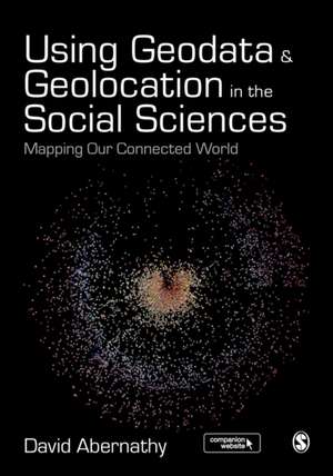
Using Geodata and Geolocation in the Social Sciences: Mapping our Connected World
Autor David Abernathyen Limba Engleză Paperback – noi 2016
Using Geodata and Geolocation in the Social Sciences: Mapping our Connected World provides an engaging and accessible introduction to the Geoweb with clear, step-by-step guides for:
- Capturing Geodata from sources including GPS, sensor networks and Twitter
- Visualizing Geodata using programmes including QGIS, GRASS and R
| Toate formatele și edițiile | Preț | Express |
|---|---|---|
| Paperback (1) | 474.93 lei 6-8 săpt. | |
| SAGE Publications – noi 2016 | 474.93 lei 6-8 săpt. | |
| Hardback (1) | 822.87 lei 6-8 săpt. | |
| SAGE Publications – 10 noi 2016 | 822.87 lei 6-8 săpt. |
Preț: 474.93 lei
Nou
Puncte Express: 712
Preț estimativ în valută:
90.89€ • 94.54$ • 75.03£
90.89€ • 94.54$ • 75.03£
Carte tipărită la comandă
Livrare economică 14-28 aprilie
Preluare comenzi: 021 569.72.76
Specificații
ISBN-13: 9781473908185
ISBN-10: 1473908183
Pagini: 344
Dimensiuni: 170 x 242 x 16 mm
Greutate: 0.64 kg
Ediția:First Edition
Editura: SAGE Publications
Colecția Sage Publications Ltd
Locul publicării:London, United Kingdom
ISBN-10: 1473908183
Pagini: 344
Dimensiuni: 170 x 242 x 16 mm
Greutate: 0.64 kg
Ediția:First Edition
Editura: SAGE Publications
Colecția Sage Publications Ltd
Locul publicării:London, United Kingdom
Recenzii
It will provide students and researchers in social science and humanities with a solid foundation for handling quantitative data from
the geoweb.
Having an understanding of geography is essential for scholars across all the disciplines in the Social Sciences following the data revolution, the rise of 'big data' and the increasing salience of utilising naturally occurring data as a way of augmenting our understanding of how we interact in the social world. In response to this, Abernathy provides a truly accessible and interdisciplinary introduction to geodata and geolocation covering both the conceptual and the practical. It is a must read for students or researchers looking to make the most of the spatial elements of their data.
This book provide an insightful perspective on the geoweb, exploring a diverse range of applied geodata examples. Applications tackle interesting and current data issues, such as crowdsourced geographic data and harvesting geolocated social media information for assisting geospatial decision-making. This allows for relatively technical concepts to be highly accessible to the reader. The work-through examples link effectively to geostatistical analysis of data providing an excellent basis for communicating fundamental notions of the geoweb to students. This book provides a great primer for better understanding geolocated information.
Using Geodata and Geolocation in the Social Sciences” is a much-needed text book for anyone interested in understanding what the geoweb is, how it works and how it is shaping our interactions with places, people and objects. This very well-written book provides a clear overview of the historical, technological and intellectual foundations of the geoweb. It fills a gap in academic literature by combining the practical aspects of collecting, processing and visualizing a range of geodata with a more critical perspective on the economic, social and political implications the geoweb is having on our daily lives.
David Abernathy recognizes that, regardless of our participation in the geoweb, we increasingly live our lives within it. This important text begins from such a premise, that in order to intervene and make change in the geoweb, we must understand its situation — its context — while also experimenting with the techniques and technologies that make its proliferation possible. Organized into two parts, this book charts our cyborgian world, giving readers access to the fantastic histories of our geoweb present and the concepts necessary to build expertise in their use. Technologies and concepts in the geospatial sciences have undergone rapid change. Abernathy captures a moment in this dynamism, and provides readers with key handles into this phenomenon from the perspective of the social sciences. Far from simply a technical handbook on the geoweb, this book enables a more critical understanding of the issues associated with the proliferation of the geoweb in everyday life, for some, as well as the implications of the uneven access to such surveillant innovations.
This book provides an engaging and accessible introduction to the Geoweb, with clear, step-by-step guides for capturing Geodata from sources including GPS, sensor networks and Twitter. The perfect guide for students and teachers looking to incorporate location based data into their social science research.
The balance between theory and technical instructions is good and the book will encourage students and researchers to explore more available tools to create and communicate spatial data.
Cuprins
Introduction: The Power of Where
A Brief History of the Geoweb
“Big Geodata”: Managing Spatial Data in a Connected Age
Citizen Cartographers: Neogeography, VGI and the Democratization of Data Production
Challenges of the Geoweb: Data Accuracy, Privacy, and Surveillance
Introduction to Geodata: Types of Geodata; [see p. 9] How do we Identify and Gather Location-Based Data?
Capturing Absolute Location with the Global Positioning System
Geocoding, Geotagging & Geoparsing
Social Media Geodata: Capturing Location-Based Twitter Data
Mapping the Emerging Internet of Things
Visualizing Data in Geographic Information Systems with QGIS
Working with Geodata in GRASS
Working with Geodata in R
Web Mapping
Epilogue: Weaving the Geoweb
Descriere
Covering context, concepts, and theories, as well as the practice of how to capture and visualize Geodata, this full-colour text introduces readers to the Geoweb and how best to incorporate location-based data into research.
