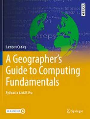
A Geographer's Guide to Computing Fundamentals: Python in ArcGIS Pro: Springer Textbooks in Earth Sciences, Geography and Environment
Autor Jamison Conleyen Limba Engleză Paperback – noi 2023
Section I starts with the principles of scripting and programming with Python. Section II introduces the ArcPy module and elements specific to ArcGIS Pro. This section focuses on data structures, and how they are used andimplemented within Python. Section III uses the topic of algorithms to guide the student through creating tools to add functionality to ArcGIS Pro. The last section, Section IV, builds upon section III to guide the student to developing and sharing projects and Python packages to include external open-source code and share the Python code as an open-source package.
This text will prepare students for a long-term ability to do GIS programming, whether in industry or academic research. This comes from the author’s observations of students who have learned GIS programming in one platform, such as VBA in ArcMap, struggle to apply that knowledge to a new platform, such as Python in ArcGIS Pro, because the content was presented too closely with a specific platform. The integration of exercises with conceptual content, along with the choice of chapter content, serves this goal of preparing students for working in a dynamic, rapidly changing technology field.
| Toate formatele și edițiile | Preț | Express |
|---|---|---|
| Paperback (1) | 397.38 lei 6-8 săpt. | |
| Springer International Publishing – noi 2023 | 397.38 lei 6-8 săpt. | |
| Hardback (1) | 512.38 lei 3-5 săpt. | |
| Springer International Publishing – noi 2022 | 512.38 lei 3-5 săpt. |
Din seria Springer Textbooks in Earth Sciences, Geography and Environment
- 15%
 Preț: 541.07 lei
 - 17%
 Preț: 464.85 lei
 - 17%
 Preț: 503.23 lei
 - 13%
 Preț: 358.04 lei
 - 15%
 Preț: 620.41 lei
 -
 Preț: 449.74 lei
 -
 Preț: 397.68 lei
 - 17%
 Preț: 463.55 lei
 -
 Preț: 508.54 lei
 -
 Preț: 512.38 lei
 - 17%
 Preț: 361.69 lei
 - 17%
 Preț: 370.14 lei
 - 17%
 Preț: 528.26 lei
 - 17%
 Preț: 526.71 lei
 -
 Preț: 361.46 lei
 - 13%
 Preț: 459.26 lei
 -
 Preț: 367.40 lei
 - 15%
 Preț: 665.91 lei
 -
 Preț: 489.30 lei
 - 15%
 Preț: 706.16 lei
 - 19%
 Preț: 522.96 lei
 - 15%
 Preț: 714.81 lei
 -
 Preț: 453.42 lei
 - 19%
 Preț: 447.96 lei
 - 15%
 Preț: 590.63 lei
 - 15%
 Preț: 644.63 lei
 - 15%
 Preț: 721.37 lei
 - 23%
 Preț: 625.31 lei
 - 18%
 Preț: 751.29 lei
 - 19%
 Preț: 624.25 lei
 - 19%
 Preț: 578.97 lei
 - 15%
 Preț: 590.95 lei
 - 24%
 Preț: 1134.05 lei
 - 19%
 Preț: 418.86 lei
 -
 Preț: 481.34 lei
 - 24%
 Preț: 684.56 lei
 - 15%
 Preț: 661.32 lei
 -
 Preț: 438.49 lei
Preț: 397.38 lei
Nou
Puncte Express: 596
Preț estimativ în valută:
76.04€ • 79.55$ • 63.17£
76.04€ • 79.55$ • 63.17£
Carte tipărită la comandă
Livrare economică 02-16 aprilie
Preluare comenzi: 021 569.72.76
Specificații
ISBN-13: 9783031085000
ISBN-10: 3031085000
Pagini: 267
Ilustrații: XII, 267 p. 110 illus., 88 illus. in color.
Dimensiuni: 210 x 279 mm
Greutate: 0.64 kg
Ediția:1st ed. 2022
Editura: Springer International Publishing
Colecția Springer
Seria Springer Textbooks in Earth Sciences, Geography and Environment
Locul publicării:Cham, Switzerland
Cuprins
Chapter 1. Introduction to Scripting and Programming.- Chapter 2. Basics of programming—Variables, Operators, & Statements.- Chapter 3. Basics of programming—Control Structures.- Chapter 4. Basics of programming—Functions and Objects.- Chapter 5. Reading a Python Script.- Chapter 6. Debugging.- Chapter 7. Introduction to ArcPy.- Chapter 8. Basics of accessing data in ArcGIS.- Chapter 9. Rasters.- Chapter 10. Tables and Cursors.- Chapter 11. Vectors and Geometries.- Chapter 12. Mapping--symbologies.- Chapter 13. Mapping—layouts.- Chapter 14. Creating custom tools.- Chapter 15. Error Handling.- Chapter 16. Creating Custom Classes.- Chapter 17. Putting it all together.- Chapter 18. ArcPy for Web GIS using ArcGIS Online.- Chapter 19. Incorporating External Packages.- Chapter 20. Using Multiple Python Files.- Chapter 21. Developing a Custom Python Package.
Notă biografică
Dr. Jamison Conley serves as an Associate Professor in West Virginia University's Department of Geology and Geography. He teaches courses in Geographic Information Science, with a focus on spatial analysis and programming. His research currently analyzes access to health care within West Virginia. This book is based on graduate and undergraduate courses he has taught at West Virginia University.
Textul de pe ultima copertă
This upper-undergraduate textbook teaches students programming in GIS using a mix of computer science theory and hands-on activities, with the aim of empowering students to understand fundamentals and apply their knowledge beyond the specific examples in the book. Each of the book’s twenty-one chapters integrates instructional material with exercises in ArcGIS Pro. In doing so, this book combines the strengths of workbooks and theoretical textbooks to provide a holistic and comprehensive text. Each chapter concludes with an unguided task that ensures students have learned the broader principles explained therein. In addition to its unique format, the book covers oft-neglected topics such as debugging, creating a program from scratch, and managing metadata.
Section I starts with the principles of scripting and programming with Python. Section II introduces the ArcPy module and elements specific to ArcGIS Pro. This section focuses on data structures, and how they are usedand implemented within Python. Section III uses the topic of algorithms to guide the student through creating tools to add functionality to ArcGIS Pro. The last section, Section IV, builds upon section III to guide the student to developing and sharing projects and Python packages to include external open-source code and share the Python code as an open-source package. This text will prepare students for a long-term ability to do GIS programming, whether in industry or academic research. This comes from the author’s observations of students who have learned GIS programming in one platform, such as VBA in ArcMap, struggle to apply that knowledge to a new platform, such as Python in ArcGIS Pro, because the content was presented too closely with a specific platform. The integration of exercises with conceptual content, along with the choice of chapter content, serves this goal of preparing students for working in a dynamic, rapidly changing technology field.
Section I starts with the principles of scripting and programming with Python. Section II introduces the ArcPy module and elements specific to ArcGIS Pro. This section focuses on data structures, and how they are usedand implemented within Python. Section III uses the topic of algorithms to guide the student through creating tools to add functionality to ArcGIS Pro. The last section, Section IV, builds upon section III to guide the student to developing and sharing projects and Python packages to include external open-source code and share the Python code as an open-source package. This text will prepare students for a long-term ability to do GIS programming, whether in industry or academic research. This comes from the author’s observations of students who have learned GIS programming in one platform, such as VBA in ArcMap, struggle to apply that knowledge to a new platform, such as Python in ArcGIS Pro, because the content was presented too closely with a specific platform. The integration of exercises with conceptual content, along with the choice of chapter content, serves this goal of preparing students for working in a dynamic, rapidly changing technology field.
Caracteristici
Offers exercises integrated into theoretical text, giving students a robust and applied knowledge of GIS programming Emphasizes often-neglected topics such as debugging, metadata management, and collaboration Contains chapter-by-chapter Electronic Supplementary Material for use in exercises
