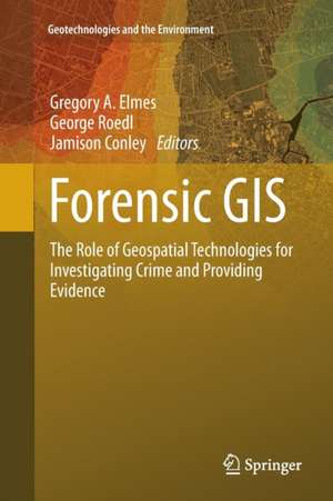
Forensic GIS: The Role of Geospatial Technologies for Investigating Crime and Providing Evidence: Geotechnologies and the Environment, cartea 11
Editat de Gregory A. Elmes, George Roedl, Jamison Conleyen Limba Engleză Paperback – 23 aug 2016
| Toate formatele și edițiile | Preț | Express |
|---|---|---|
| Paperback (1) | 945.79 lei 6-8 săpt. | |
| SPRINGER NETHERLANDS – 23 aug 2016 | 945.79 lei 6-8 săpt. | |
| Hardback (1) | 951.77 lei 6-8 săpt. | |
| SPRINGER NETHERLANDS – 23 iul 2014 | 951.77 lei 6-8 săpt. |
Din seria Geotechnologies and the Environment
- 15%
 Preț: 649.71 lei
 - 18%
 Preț: 1408.89 lei
 - 18%
 Preț: 1007.49 lei
 - 18%
 Preț: 945.79 lei
 - 20%
 Preț: 566.50 lei
 - 18%
 Preț: 952.09 lei
 - 18%
 Preț: 948.92 lei
 - 15%
 Preț: 652.31 lei
 - 18%
 Preț: 951.77 lei
 - 15%
 Preț: 639.25 lei
 - 15%
 Preț: 652.17 lei
 - 24%
 Preț: 746.98 lei
 - 24%
 Preț: 778.70 lei
 - 18%
 Preț: 952.72 lei
 - 18%
 Preț: 968.34 lei
 - 24%
 Preț: 790.70 lei
 - 18%
 Preț: 995.63 lei
 - 18%
 Preț: 886.92 lei
 - 5%
 Preț: 1106.69 lei
 - 18%
 Preț: 1215.04 lei
 - 15%
 Preț: 636.12 lei
 - 18%
 Preț: 967.08 lei
 - 15%
 Preț: 530.42 lei
Preț: 945.79 lei
Preț vechi: 1153.39 lei
-18% Nou
Puncte Express: 1419
Preț estimativ în valută:
180.97€ • 188.95$ • 149.78£
180.97€ • 188.95$ • 149.78£
Carte tipărită la comandă
Livrare economică 04-18 aprilie
Preluare comenzi: 021 569.72.76
Specificații
ISBN-13: 9789402401226
ISBN-10: 9402401229
Pagini: 320
Ilustrații: X, 310 p. 91 illus., 67 illus. in color.
Dimensiuni: 155 x 235 x 17 mm
Greutate: 0.45 kg
Ediția:Softcover reprint of the original 1st ed. 2014
Editura: SPRINGER NETHERLANDS
Colecția Springer
Seria Geotechnologies and the Environment
Locul publicării:Dordrecht, Netherlands
Cuprins
Introduction: Concepts, Principles and Definitions.- Geospatial Technologies in the Courtroom.- Spatial Tracking Applications.- Spatial Technology Applications.- Using Near Repeat Analysis for Investigating Mortgage Fraud and Predatory Lending.- State Registration of Sex Offenders: Public Notification, Web Mapping & Spatial Issues.- The SDIK Police Model: How to Make the Invisible Visible.- Spatial Analysis of Fear of Crime and Police Calls for Service: An Example and Implications for Community Policing.- Police Use of Force: The Spatial Distribution of Force Factors.- Mapping Spatio-Temporal Patterns of Liquor Law Violation Citations During Oktoberfest in the College Town of La Crosse, Wisconsin.- A Web-based GIS for Crime Mapping and Decision Support.- Use of Geographically Weighted Regression on Ecology of Crime, Response to Hurricane in Miami, Florida.- Delineating Legal Forest Boundaries to Combat Illegal Forest Encroachments: A Case Study in Murree Forest Division, Pakistan.-Annotated Bibliography.- Index.
Notă biografică
Prof. Gregory A. Elmes is professor of Geography at the West Virginia University since 1994 and co-director of the West Virginia State GIS Technical Center since 1995. He has more than 30 years of experience in Geographical Information Systems and how to apply GIS techniques to societal issues (public health, industries, archeology, public safety, forensic…). He supervised many master and PhD students and is a very active scientist in the field.
George W. Roedl is PhD candidate at the West Virginia University and is specialized in Geographic Information Systems/Science, remote sensing, computer cartography. He has additional expertise in the role and application of geospatial technologies to disaster management and forensic analysis/investigation, including the legal aspects of geospatial technologies within the modern courtroom. He won more than 10 awards for his various researches and papers and is very active in the field (teaching, committees, publications).
Prof. Jamison F. Conley is assistant Professor of Geography at the West Virginia University. He is an international expert on statistics, algorithms and techniques for the analysis of spatial data. One of his interesting projects is spatial analysis of crime events, community surveys and physical neighborhood disorder to help understanding the dynamics of spatial patterns of crime. He also works on the interaction between toxic pollutant and public health and also on spatial patterns related to coffee fair trade. He has won many awards for his research and is actively involved in teaching and scientific committees.
Textul de pe ultima copertă
A variety of disciplines and professions have embraced geospatial technologies for collecting, storing, manipulating, analyzing, and displaying spatial data to investigate crime, prosecute and convict offenders, exonerate suspects, and submit evidence in civil lawsuits. The applications, acceptability and relevance, and procedural legality of each geospatial technologies vary. The purpose of this book is to explain the nature of geospatial technologies, demonstrate a variety of geospatial applications used to investigate and litigate civil and criminal activities, and to provide a reference of current acceptability of geospatial technology in the production of evidence. This book is an introductory overview designed to appeal to researchers and practitioners across disciplinary boundaries. The authors of this book are researchers and practitioners across disciplines and professions, experts in the field.
Caracteristici
Written for researchers, practitioners and students Includes real case studies First and only book discussing the use of geospatial technologies in crime investigation and litigation Discusses a wide range of technologies and applications Provides current information on legal considerations for geospatial technologies in investigation and litigation Includes supplementary material: sn.pub/extras
