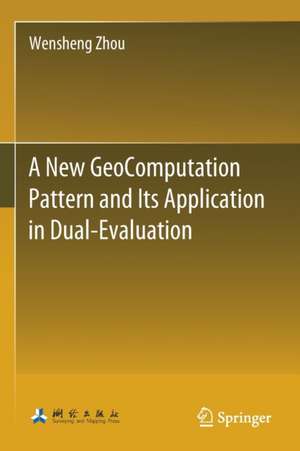
A New GeoComputation Pattern and Its Application in Dual-Evaluation
Autor Wensheng Zhouen Limba Engleză Paperback – 26 apr 2022
This book introduces Document As System (DAS), a new GeoComputation pattern, which is also a new GIS application pattern. It uses the GeoComputation language (G language) to describe and execute complex spatial analysis model in the MS Word environment, which solves the bottleneck problem of GIS application, makes GIS become a popular tool for spatial data analysis from the spatial data visualization tool, and plays an important role in the wide application of GIS technology. This book systematically introduces the theory related to the new GeoComputation pattern and the application example in the “dual-evaluation” of territorial and spatial planning, which can be used as a learning and reference manual for GIS related professionals and business personnel engaged in the “dual-evaluation” of territorial and spatial planning.
| Toate formatele și edițiile | Preț | Express |
|---|---|---|
| Paperback (1) | 925.53 lei 6-8 săpt. | |
| Springer Nature Singapore – 26 apr 2022 | 925.53 lei 6-8 săpt. | |
| Hardback (1) | 931.40 lei 6-8 săpt. | |
| Springer Nature Singapore – 25 apr 2021 | 931.40 lei 6-8 săpt. |
Preț: 925.53 lei
Preț vechi: 1128.70 lei
-18% Nou
Puncte Express: 1388
Preț estimativ în valută:
177.16€ • 185.97$ • 146.34£
177.16€ • 185.97$ • 146.34£
Carte tipărită la comandă
Livrare economică 30 ianuarie-13 februarie 25
Preluare comenzi: 021 569.72.76
Specificații
ISBN-13: 9789813364349
ISBN-10: 9813364343
Ilustrații: XIX, 277 p. 155 illus., 82 illus. in color.
Dimensiuni: 155 x 235 mm
Greutate: 0.42 kg
Ediția:1st ed. 2021
Editura: Springer Nature Singapore
Colecția Springer
Locul publicării:Singapore, Singapore
ISBN-10: 9813364343
Ilustrații: XIX, 277 p. 155 illus., 82 illus. in color.
Dimensiuni: 155 x 235 mm
Greutate: 0.42 kg
Ediția:1st ed. 2021
Editura: Springer Nature Singapore
Colecția Springer
Locul publicării:Singapore, Singapore
Cuprins
Foreword.- Preface.- Part I The Theory of a New GC Pattern.- Research background.- Relevant Research.- The New GC Pattern.- GeoComputation Language.- Part II The Practice of the New GC Pattern.- Implementation of G language.- Dual evaluation system of Territorial and Spatial planning.- Part III The Dual-evaluation geocomputation model.- Individual Evaluation.- Integrated Evaluation.- Optional Evaluations.- Comparative Analysis.- Map Analysis.- Appendix Layer Style of Thematic Map.
Notă biografică
Wensheng Zhou is Ph.D., Associate Professor, School of Architecture, Tsinghua University, and Deputy Director of key scientific research base, State Administration of Cultural Relics. In 1990, he obtained a master’s degree in engineering surveying from Wuhan University of Surveying and Mapping Technology, and a Ph.D. degree in cartography and geographic information engineering from Wuhan University in 2003. In the same year, he joined the School of Architecture of Tsinghua University as a postdoctoral student and left the University in 2005. He mainly engaged in the application research of spatial information technology in urban and rural planning and cultural heritage protection. He has published more than 70 papers and more than 20 software copyrights, presided over the compilation of one national standard and four industry standards. Representative achievements include theory and practice of open WebGIS (Science Press 2007), Tsinghua geodesign system (2013sr160411). He proposes anovel GeoComputing pattern and GeoComputing language. The “dual-evaluation” system of territorial and spatial planning developed based on this new GeoComputing pattern has been applied in more than 100 units in more than 30 provinces of China.
Textul de pe ultima copertă
This book introduces Document As System (DAS), a new GeoComputation pattern, which is also a new GIS application pattern. It uses the GeoComputation language (G language) to describe and execute complex spatial analysis model in the MS Word environment, which solves the bottleneck problem of GIS application, makes GIS become a popular tool for spatial data analysis from the spatial data visualization tool, and plays an important role in the wide application of GIS technology. This book systematically introduces the theory related to the new GeoComputation pattern and the application example in the “dual-evaluation” of territorial and spatial planning, which can be used as a learning and reference manual for GIS related professionals and business personnel engaged in the “dual-evaluation” of territorial and spatial planning.
Caracteristici
Analyzes the problems in the application of GIS and drawbacks of existing GeoComputation pattern Elaborates the design idea, key technology, and influence on the industry of the new GeoComputation pattern, Document as System(DAS) Introduces the syntax rules of GeoComputation language and its integrated development environment in MS Word environment Shows the main “double evaluation” GeoComputation models of territorial and spatial planning described by GeoComputation language
