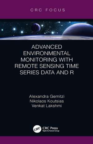
Advanced Environmental Monitoring with Remote Sensing Time Series Data and R
Autor Alexandra Gemitzi, Nikolaos Koutsias, Venkat Lakshmien Limba Engleză Hardback – 27 noi 2019
Features
- Includes real-world applications of environmental remotely sensed data
- Analyzes the advantages and restrictions of each data source
- Focuses on a wide spectrum of applications, such as hydrology, vegetation changes, land surface temperature, fire detection, and impacts
- Includes R computer codes with explanatory comments and all applications use only freely available remotely sensed data
- Presents a step-by-step processing through open source GIS and statistical analysis software
| Toate formatele și edițiile | Preț | Express |
|---|---|---|
| Paperback (1) | 126.43 lei 6-8 săpt. | |
| CRC Press – 21 ian 2023 | 126.43 lei 6-8 săpt. | |
| Hardback (1) | 326.19 lei 6-8 săpt. | |
| CRC Press – 27 noi 2019 | 326.19 lei 6-8 săpt. |
Preț: 326.19 lei
Preț vechi: 422.35 lei
-23% Nou
Puncte Express: 489
Preț estimativ în valută:
62.42€ • 65.30$ • 51.85£
62.42€ • 65.30$ • 51.85£
Carte tipărită la comandă
Livrare economică 02-16 aprilie
Preluare comenzi: 021 569.72.76
Specificații
ISBN-13: 9780367205270
ISBN-10: 0367205270
Pagini: 114
Ilustrații: 11
Dimensiuni: 138 x 216 x 14 mm
Greutate: 0.2 kg
Ediția:1
Editura: CRC Press
Colecția CRC Press
ISBN-10: 0367205270
Pagini: 114
Ilustrații: 11
Dimensiuni: 138 x 216 x 14 mm
Greutate: 0.2 kg
Ediția:1
Editura: CRC Press
Colecția CRC Press
Cuprins
Introduction 1. Environmental Applications of Medium to High Resolution Remotely Sensed Data 2. Environmental Applications of Medium Resolution Remote Sensing Imaging 3. Environmental Applications of Low Resolution Remotely Sensed Data 4. Processing Remotely Sensed Data Conclusions
Notă biografică
Alexandra Gemitzi graduated from Aristotle University of Thessaloniki (Greece) in 1993 with a Bachelor degree in Geology and a Master of Science in Groundwater Engineering from University of Newcastle upon Tyne (UK) in 1995. She obtained a Doctorate from the Department of Civil Engineering of Aristotle University of Thessaloniki, sponsored by the National Scholarship Foundation. She is an Associate Professor at the Department of Environmental Engineering of Democritus University of Thrace (Greece). Before starting her academic career, she has worked as geologist for almost ten years in the private and public sector. Her main teaching and research interests are related to environmental modelling using Geographic Information Systems, coupling remote sensing and ground-based observations. Her research focuses on the simulation and assessment of environmental systems, climate and land use change effects and the prediction and risk assessment of extreme natural phenomena or natural disasters. Her published work features over 30 publications in peer reviewed journals and 50 conference presentations.
Venkat Lakshmi graduated from University of Roorkee in 1987 with a Bachelor degree in Civil Engineering and a Doctorate in Civil and Environmental Engineering in 1996 from Princeton. He worked at NASA Goddard Space Flight Center 1996-1999 as a research scientist. His areas of interest are catchment hydrology, satellite data validation and assimilation, field experiments, land-atmosphere interactions, satellite data downscaling, vadose zone and water resources. He is the Carolina Trustee Professor and former Chair of the Department of Earth and Ocean Sciences at the University of South Carolina and has over 80 peer-reviewed articles and 300 presentations and thesis supervisor for 20 graduate students. He is currently is serving as Associate Editor of Journal of Hydrology and editor for Vadose Zone Journal and former chairman of the Chapman Conference committee for AGU and the founding editor of Remote Sensing in Earth System Science. He has served as Cox Visiting Professor at Stanford University 2006-2007 and 2015-2016.
Nikos Koutsias is an Associate Professor at the Department of Environmental and Natural Resources Management of University of Patras, where he gives courses in remote sensing, GIS and spatial analysis. He obtained his diploma degree in Environmental Studies from the University of Aegean, his M.Sc. degree in Environmental and Renewable Resources from the Mediterranean Agronomic Institute of Chania
(MAICh), and his Ph.D. from the Department of Forestry and Natural Environment, Aristotle University of Thessaloniki. He had a post doctorate position at Geographic Information Systems division (GIS) in the Department of Geography of the University of Zurich. He has been working in the field of remote sensing and GIS with special emphasis on wildland fires, forestry and ecology for the last 25 years. He has participated in national and European projects and has several publications in journals, books, and international conferences. He is the recent recipient of a Marie Curie Individual Scholarship.
Descriere
Provides a step-by-step guide on how to use various publicly-available, remotely-sensed time series data sources for environmental monitoring and assessment. Readers will learn how extract valuable information on global changes from a 20-year collection of ready-to-use remotely-sensed data through the free, open GIS and statistical software R.
