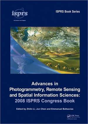
Advances in Photogrammetry, Remote Sensing and Spatial Information Sciences: 2008 ISPRS Congress Book: ISPRS Book Series
Editat de Zhilin Li, Jun Chen, Emmanuel Baltsaviasen Limba Engleză Hardback – iul 2008
- Introduction
- Sensors, Platforms and Data Acquisition Systems
- Data Processing and Analysis
- Data Modelling, Management and Visualisation
- Applications
- Education and Cooperation.
Advances in Photogrammetry, Remote Sensing and Spatial Information Sciences: 2008 ISPRS Congress Book provides a comprehensive overview of the progress made in these areas since the XXth ISPRS Congress, which was held in 2004 in Istanbul, Turkey. The volume will be invaluable not only to scientists and researchers, but also to university students and practitioners.
Preț: 1194.63 lei
Preț vechi: 1675.58 lei
-29% Nou
Puncte Express: 1792
Preț estimativ în valută:
228.62€ • 248.25$ • 192.04£
228.62€ • 248.25$ • 192.04£
Carte tipărită la comandă
Livrare economică 23 aprilie-07 mai
Preluare comenzi: 021 569.72.76
Specificații
ISBN-13: 9780415478052
ISBN-10: 0415478057
Pagini: 546
Dimensiuni: 174 x 246 x 37 mm
Greutate: 1.17 kg
Ediția:1
Editura: CRC Press
Colecția CRC Press
Seria ISPRS Book Series
Locul publicării:Boca Raton, United States
ISBN-10: 0415478057
Pagini: 546
Dimensiuni: 174 x 246 x 37 mm
Greutate: 1.17 kg
Ediția:1
Editura: CRC Press
Colecția CRC Press
Seria ISPRS Book Series
Locul publicării:Boca Raton, United States
Cuprins
List of contributors Foreword Preface Part I Introduction Chapter 1 Historical development of ISPRS, John Trinder & Lawrence Fritz Chapter 2 Scientific-Technological developments of photogrammetry and remote sensing between 2004 and 2008, Armin Gruen Part II Sensors, platforms and data acquisition systems Chapter 3 Spaceborne digital imaging sensors and systems, Gordon Petrie Chapter 4 Airborne digital imaging sensors and systems, Gordon Petrie & Kenneth Smillie Chapter 5 Close-range photogrammetry sensors, Hans-Gerd Maas Chapter 6 LIDAR: Airborne and terrestrial sensors, Aloysius Wehr Chapter 7 Land mobile mapping systems, Naser El-Sheimy Chapter 8 Small satellite missions, Rainer Sandau Chapter 9 Unmanned aerial vehicles for photogrammetry and remote sensing, Jurgen Everaerts Part III Data processing and analysis Chapter 10 Remote sensing signatures: Measurements, modelling and applications, Shunlin Liang, Michael Schaepman & Mathias Kneubühler Chapter 11 Geometric modelling of linear CCDs and panoramic imagers, Karsten Jacobsen Chapter 12 DSM generation and deformation measurement from SAR data, Michele Crosetto & Paolo Pasquali Chapter 13 Early stages of LIDAR data processing, Norbert Pfeifer & Jan Böhm Chapter 14 Pan-Sharpening for improved information extraction, Yun Zhang Chapter 15 Object extraction and attribution from hyperspectral images, Freek van der Meer, Harald van der Werff, Mark van der Meijde, Frank van Ruitenbeek, Chris Hecker & Steven de Jong Chapter 16 Automated extraction of roads, buildings, and vegetation from multi-source data, Helmut Mayer, Stefan Hinz & Uwe Stilla Chapter 17 Processing of multitemporal data and change detection, Haigang Sui, Qiming Zhou, Jianya Gong & Guorui Ma Part IV Data modelling, management and visualization Chapter 18 Spatio-Temporal modelling, Wolfgang Kainz & Xinming Tang Chapter 19 Multi-scale modelling and representation of geospatial data, Zhilin Li Chapter 20 Multiple representation databases, Monika Sester Chapter 21 Dynamic GIS, Christopher M. Gold, Darka Mioc & François Anton Chapter 22 Semantic integration of heterogeneous geospatial information, Marinos Kavouras & Margarita Kokla Chapter 23 3D Data modelling and visualization, Sabry El-Hakim Part V Applications Chapter 24 Spatial data infrastructures and clearinghouses, Costas Armenakis Chapter 25 Web mapping/GIS services and applications, Songnian Li Chapter 26 Updating geospatial databases from images, Christian Heipke, Peter A. Woodsford & Markus Gerke Chapter 27 Applications in cultural heritage documentation, Petros Patias, Pierre Grussenmeyer & Klaus Hanke Chapter 28 Natural disaster management: Activities in support of the UN system, Piero Boccardo & Fabio Giulio Tonolo Chapter 29 Environmental sensing and human health, Stanley A. Morain & Amelia M. Budge Chapter 30 Industrial applications of photogrammetry, Thomas Luhmann & Stuart Robson Chapter 31 Medical applications, Nicola D’apuzzo & Harvey Mitchell Chapter 32 Forestry applications, Barbara Koch & Matthias Dees Part VI Education and cooperation Chapter 33 Educational developments and outreach, Kohei Cho, Gerhard König & Joac
Notă biografică
Zhilin Li, Jun Chen, Emmanuel Baltsavias
Descriere
A compilation of 34 contributions from 62 researchers, this volume covers the state-of-the-art in photogrammetry, remote sensing, and spatial information sciences. It covers sensors, platforms and data acquisition systems, data processing and analysis, data modelling, management and visualization, applications, and education and cooperation. It provides a comprehensive overview of the progress made in these areas since the twentieth ISPRS Congress, which was held in 2004 in Istanbul, Turkey. This volume is invaluable not only to scientists and researchers, but also to university students and practitioners.
