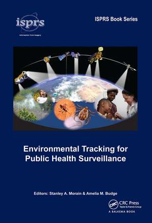
Environmental Tracking for Public Health Surveillance: ISPRS Book Series
Editat de Stanley A. Morain, Amelia Budgeen Limba Engleză Paperback – 14 oct 2024
Environmental Tracking for Public Health Surveillance focuses on the expanding use of satellite sensor imagery and long-term spectral measurements for assessing and modelling Earth’s environments in context of public health surveillance. It addresses vector-borne, air-borne, water-borne, and zoonotic diseases, and explores analytical methods for forecasting environmental conditions and their potential for consequent disease outbreaks. Infectious and contagious diseases are of particular interest in this volume because once parasite-vector-human host pathways are triggered by favourable biological circumstances, pandemic diseases can spread to global scale in a matter of hours. The chapters advance readers through three sets of material. Part I reviews the 1970-2012 history of satellite Earth-science surveillance technology that led to linking natural environments to human diseases, and more generally to public health applications. Part II describes specific infectious and contagious diseases and the threat of emerging and re-emerging diseases. Part III explores the kinds of satellite data, modelling, and electronic information systems being developed to expedite health intercessions and responses at local to regional and global scales of reference. Equally important are the extensive reference sections for chapters in Parts II and III. For readers interested in tracking the development of Earth-science technology, these constitute a thorough entrée to both the health and environmental literature.
The chapters are written jointly by experts in both the health and Earth-science technologies. Each chapter is accompanied by an extensive list of citations to provide background and validation of the current state-of-the-art for a variety of high-interest human diseases and associated health and well-being issues. The importance of day-to-day weather patterns, the impacts of severe weather events and longer-term climate cycles form the basis for developing information systems that meet goals and expectations of national and international health monitoring bodies.
Environmental Tracking for Public Health Surveillance provides a state-of-the-art overview on how environmental tracking data from satellite, airborne, and ground-based sensors are being integrated into appropriate geophysical and spatial information system models to enhance public health surveillance and decision-making from local to global levels, and is intended primarily for a cross-disciplinary professional audience consisting of public health decision-makers, spatial data analysts, modelers, Earth observation specialists, and medical researchers.
| Toate formatele și edițiile | Preț | Express |
|---|---|---|
| Paperback (1) | 321.56 lei 6-8 săpt. | |
| CRC Press – 14 oct 2024 | 321.56 lei 6-8 săpt. | |
| Hardback (1) | 999.55 lei 6-8 săpt. | |
| CRC Press – 25 sep 2012 | 999.55 lei 6-8 săpt. |
Preț: 321.56 lei
Preț vechi: 353.72 lei
-9% Nou
Puncte Express: 482
Preț estimativ în valută:
61.54€ • 66.82$ • 51.69£
61.54€ • 66.82$ • 51.69£
Carte tipărită la comandă
Livrare economică 23 aprilie-07 mai
Preluare comenzi: 021 569.72.76
Specificații
ISBN-13: 9781032919409
ISBN-10: 103291940X
Pagini: 480
Dimensiuni: 174 x 246 mm
Greutate: 0.89 kg
Ediția:1
Editura: CRC Press
Colecția CRC Press
Seria ISPRS Book Series
Locul publicării:Boca Raton, United States
ISBN-10: 103291940X
Pagini: 480
Dimensiuni: 174 x 246 mm
Greutate: 0.89 kg
Ediția:1
Editura: CRC Press
Colecția CRC Press
Seria ISPRS Book Series
Locul publicării:Boca Raton, United States
Public țintă
AcademicNotă biografică
The editors have spent almost 85 years developing satellite-based environmental applications, the most recent 20-years of which have focused on developing respiratory heath applications funded by the Applied Sciences Division of the National Aeronautics and Space Administration. They have been active professionally in the American Society for Photogrammetry and Remote Sensing (ASPRS) and the International Society for Photogrammetry and Remote Sensing (ISPRS). For most of their funded R&D efforts they have served as principal investigators and co-PIs on multidisciplinary teams. In addition to peer-reviewed technical publications, they have served as author-editors for several books and sponsored research reports. Stanley Morain is currently Professor Emeritus of Geography and retired director of the Earth Data Analysis Center, University of New Mexico. Amelia Budge continues to be a co-PI on a NASA-sponsored multi-year project to develop a Pollen Regional Atmospheric Model (PREAM) for respiratory health. She recently completed her duties as Chairperson of the 2008-2012 ISPRS working group for Commission VIII (Remote Sensing Applications and Policy), Working Group 2 (Health).
Cuprins
Preface, Foreword, List of contributors, Acronyms, Part I: Introduction, Part II: Infectious and contagious diseases in the environment, Part III: Data, modelling, and information systems, ISPRS Book Series Colour plates
Recenzii
"Environmental Tracking for Public Health Surveillance not only bridges the gap between the fields of satellite Earth observations and environmental and public health sciences, but also presents innovative applications of satellite-based Earth observation data in monitoring and forecasting of diverse vector-borne diseases while also highlighting efforts for better management of factors that comprise public health."
"The justification of this edition goes well beyond the need to bridge the gap betwee the fields of satellite remote sensing, environmental and public health sciences, and provide yet another book of compiled works of quality applied research. The book is well-organized and information is presented in a format to be quite ueseful as a valuable reference for anyone who is interested in the applications of satellite remote sensing in public health science research."
Mahtab A. Lodhi, University of New Orleans, in Photogrammetric Engineering and Remote Sensing journal, October 2013.
Descriere
Satellite imagery and data are widely used in public health surveillance to provide early warning of disease outbreaks and for averting pandemics. Convergence of these technologies began in the 1970s and has gained wide acceptance in the 21st Century. This book is written jointly by experts in both the health and Earth-science technologies. Each
