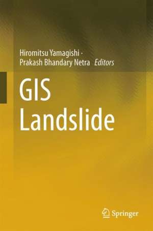
GIS Landslide
Editat de Hiromitsu Yamagishi, Netra Prakash Bhandaryen Limba Engleză Hardback – 23 mai 2017
Included among the chapters of this book are GIS using susceptibility mapping, analyses of deep-seated and shallow landslides, measuring and visualization of landslide distribution in relation to topography, geological facies and structures, rivers, land use, and infrastructures such as roads and streets. Filled with photographs, figures, and tables, this book is of great value to researchers in the fields of geography, geology, seismology, environment, remote sensing, and atmospheric research, as well as to students in these fields.
| Toate formatele și edițiile | Preț | Express |
|---|---|---|
| Paperback (1) | 941.82 lei 6-8 săpt. | |
| Springer – 29 iul 2018 | 941.82 lei 6-8 săpt. | |
| Hardback (1) | 947.85 lei 6-8 săpt. | |
| Springer – 23 mai 2017 | 947.85 lei 6-8 săpt. |
Preț: 947.85 lei
Preț vechi: 1155.91 lei
-18% Nou
Puncte Express: 1422
Preț estimativ în valută:
181.38€ • 190.24$ • 150.99£
181.38€ • 190.24$ • 150.99£
Carte tipărită la comandă
Livrare economică 01-15 aprilie
Preluare comenzi: 021 569.72.76
Specificații
ISBN-13: 9784431543909
ISBN-10: 4431543902
Pagini: 300
Ilustrații: VIII, 230 p. 107 illus., 85 illus. in color.
Dimensiuni: 155 x 235 mm
Greutate: 0.51 kg
Ediția:1st ed. 2017
Editura: Springer
Colecția Springer
Locul publicării:Tokyo, Japan
ISBN-10: 4431543902
Pagini: 300
Ilustrații: VIII, 230 p. 107 illus., 85 illus. in color.
Dimensiuni: 155 x 235 mm
Greutate: 0.51 kg
Ediția:1st ed. 2017
Editura: Springer
Colecția Springer
Locul publicării:Tokyo, Japan
Public țintă
ResearchCuprins
Scope and review [established research].- Introduction to GIS.- Introduction to remote sensing.- Measuring and visulalization of deep-seated landslide using GIS.- Relation to topography.- Relation to geology and geologic structures.- Analyses of deep-seated landslides and hazard mapping using GIS.- Measuring and visualization of shallow landslide induced by heavy rainfalls using GIS.- Measuring and visualization of precipitation using GIS.- Measuring and visualization of shallow landslide induced by earthquakes using GIS.- Measuring and GIS analyses of drainage system and flood.- Measuring and visualization of glaciers using GIS.- Photographs and remote sensing analyses.- Related extensional analyses.- Scientific problems.- Technical problems.- Programming.- For the future.
Textul de pe ultima copertă
This book presents landslide studies using the geographic information system (GIS), which includes not only the science of GIS and remote sensing, but also technical innovations, such as detailed light detection and ranging profiles, among others. To date most of the research on landslides has been found in journals on topography, geology, geo-technology, landslides, and GIS, and is limited to specific scientific aspects. Although journal articles on GIS using landslide studies are abundant, there are very few books on this topic. This book is designed to fill that gap and show how the latest GIS technology can contribute in terms of landslide studies. In a related development, the GIS Landslide Workshop was established in Japan 7 years ago in order to communicate and solve the scientific as well as technical problems of GIS analyses, such as how to use GIS software and its functions. The workshop has significantly contributed to progress in the field.
Included among the chapters of this book are GIS using susceptibility mapping, analyses of deep-seated and shallow landslides, measuring and visualization of landslide distribution in relation to topography, geological facies and structures, rivers, land use, and infrastructures such as roads and streets. Filled with photographs, figures, and tables, this book is of great value to researchers in the fields of geography, geology, seismology, environment, remote sensing, and atmospheric research, as well as to students in these fields.
Included among the chapters of this book are GIS using susceptibility mapping, analyses of deep-seated and shallow landslides, measuring and visualization of landslide distribution in relation to topography, geological facies and structures, rivers, land use, and infrastructures such as roads and streets. Filled with photographs, figures, and tables, this book is of great value to researchers in the fields of geography, geology, seismology, environment, remote sensing, and atmospheric research, as well as to students in these fields.
Caracteristici
Provides a unique compilation of research data on landslides Presents the latest measuring and visualization methods for landslides using GIS Explains how to deal with landslides using GIS extensional analyses (programming) Includes supplementary material: sn.pub/extras
