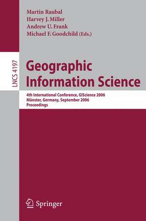
Geographic Information Science: 4th International Conference, GIScience 2006, Münster, Germany, September 20-23, 2006, Proceedings: Lecture Notes in Computer Science, cartea 4197
Editat de Martin Raubal, Harvey J. Miller, Andrew U. Frank, Michael F. Goochilden Limba Engleză Paperback – 19 sep 2006
Din seria Lecture Notes in Computer Science
- 20%
 Preț: 1061.55 lei
 - 20%
 Preț: 307.71 lei
 - 20%
 Preț: 438.69 lei
 - 20%
 Preț: 645.28 lei
 -
 Preț: 410.88 lei
 - 15%
 Preț: 580.46 lei
 - 17%
 Preț: 427.22 lei
 - 20%
 Preț: 596.46 lei
 -
 Preț: 449.57 lei
 - 20%
 Preț: 353.50 lei
 - 20%
 Preț: 1414.79 lei
 - 20%
 Preț: 309.90 lei
 - 20%
 Preț: 583.40 lei
 - 20%
 Preț: 1075.26 lei
 - 20%
 Preț: 310.26 lei
 - 20%
 Preț: 655.02 lei
 - 20%
 Preț: 580.93 lei
 - 20%
 Preț: 340.32 lei
 - 18%
 Preț: 938.83 lei
 - 20%
 Preț: 591.51 lei
 - 15%
 Preț: 438.59 lei
 - 20%
 Preț: 337.00 lei
 -
 Preț: 389.48 lei
 - 20%
 Preț: 607.39 lei
 - 20%
 Preț: 1024.44 lei
 - 20%
 Preț: 579.30 lei
 - 20%
 Preț: 763.23 lei
 - 20%
 Preț: 453.32 lei
 - 20%
 Preț: 575.48 lei
 - 20%
 Preț: 585.88 lei
 - 20%
 Preț: 825.93 lei
 - 20%
 Preț: 763.23 lei
 - 17%
 Preț: 360.19 lei
 - 20%
 Preț: 1183.14 lei
 - 20%
 Preț: 340.32 lei
 - 20%
 Preț: 504.57 lei
 - 20%
 Preț: 369.12 lei
 - 20%
 Preț: 583.40 lei
 - 20%
 Preț: 343.62 lei
 - 20%
 Preț: 350.21 lei
 - 20%
 Preț: 764.89 lei
 - 20%
 Preț: 583.40 lei
 - 20%
 Preț: 649.49 lei
 - 20%
 Preț: 341.95 lei
 - 20%
 Preț: 238.01 lei
 - 20%
 Preț: 538.29 lei
Preț: 340.32 lei
Preț vechi: 425.40 lei
-20% Nou
Puncte Express: 510
Preț estimativ în valută:
65.12€ • 67.99$ • 53.90£
65.12€ • 67.99$ • 53.90£
Carte tipărită la comandă
Livrare economică 05-19 aprilie
Preluare comenzi: 021 569.72.76
Specificații
ISBN-13: 9783540445265
ISBN-10: 3540445269
Pagini: 440
Ilustrații: XIV, 422 p.
Dimensiuni: 155 x 235 x 23 mm
Greutate: 0.64 kg
Ediția:2006
Editura: Springer Berlin, Heidelberg
Colecția Springer
Seriile Lecture Notes in Computer Science, Information Systems and Applications, incl. Internet/Web, and HCI
Locul publicării:Berlin, Heidelberg, Germany
Public țintă
ResearchCuprins
A Social and Spatial Network Approach to the Investigation of Research Communities over the World Wide Web.- Projective Relations in a 3D Environment.- A Multi-resolution Representation for Terrain Morphology.- A Spatiotemporal Model of Strategies and Counter Strategies for Location Privacy Protection.- Incorporating Landmarks with Quality Measures in Routing Procedures.- What Is the Region Occupied by a Set of Points?.- Voronoi Hierarchies.- Characterising Meanders Qualitatively.- Landmarks in OpenLS — A Data Structure for Cognitive Ergonomic Route Directions.- Status Functions, Collective Intentionality: Matters of Trust for Geospatial Information Sharing.- Pattern Recognition in Road Networks on the Example of Circular Road Detection.- Implementing Anchoring.- Generating Raster DEM from Mass Points Via TIN Streaming.- Towards a Similarity-Based Identity Assumption Service for Historical Places.- Coupling Bayesian Networks with GIS-Based Cellular Automata for Modeling Land Use Change.- Orientation Calculi and Route Graphs: Towards Semantic Representations for Route Descriptions.- Incremental Rank Updates for Moving Query Points.- The Head-Body-Tail Intersection for Spatial Relations Between Directed Line Segments.- A GIS-Based Approach for Urban Multi-criteria Quasi Optimized Route Guidance by Considering Unspecified Site Satisfaction.- Ontological Analysis of Observations and Measurements.- Splitting the Linear Least Squares Problem for Precise Localization in Geosensor Networks.- The Spatial Dimensions of Multi-Criteria Evaluation – Case Study of a Home Buyer’s Spatial Decision Support System.- Graph-Based Navigation Strategies for Heterogeneous Spatial Data Sets.- Correlation Analysis of Discrete Motions.- Representing Topological Relationships for MovingObjects.- UMN-MapServer: A High-Performance, Interoperable, and Open Source Web Mapping and Geo-spatial Analysis System.
