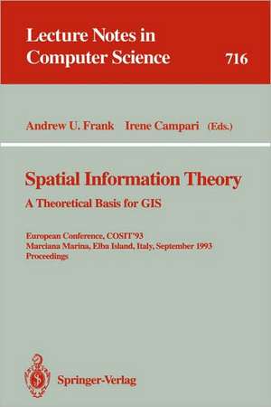
Spatial Information Theory: A Theoretical Basis for GIS: A Theoretical Basis for GIS. European Conference, COSIT'93, Marciana Marina, Elba Island, Italy, September 19-22, 1993. Proceedings: Lecture Notes in Computer Science, cartea 716
Editat de Andrew U. Frank, Irene Camparien Limba Engleză Paperback – 2 sep 1993
Din seria Lecture Notes in Computer Science
- 20%
 Preț: 1061.55 lei
 - 20%
 Preț: 307.71 lei
 - 20%
 Preț: 438.69 lei
 - 20%
 Preț: 645.28 lei
 -
 Preț: 410.88 lei
 - 15%
 Preț: 580.46 lei
 - 17%
 Preț: 427.22 lei
 - 20%
 Preț: 596.46 lei
 -
 Preț: 381.21 lei
 - 20%
 Preț: 353.50 lei
 - 20%
 Preț: 1414.79 lei
 - 20%
 Preț: 309.90 lei
 - 20%
 Preț: 583.40 lei
 - 20%
 Preț: 1075.26 lei
 - 20%
 Preț: 310.26 lei
 - 20%
 Preț: 655.02 lei
 - 20%
 Preț: 580.93 lei
 - 20%
 Preț: 340.32 lei
 - 15%
 Preț: 438.59 lei
 - 20%
 Preț: 591.51 lei
 - 20%
 Preț: 649.49 lei
 - 20%
 Preț: 337.00 lei
 -
 Preț: 449.57 lei
 - 20%
 Preț: 607.39 lei
 - 20%
 Preț: 1024.44 lei
 - 20%
 Preț: 579.30 lei
 - 20%
 Preț: 763.23 lei
 - 20%
 Preț: 453.32 lei
 - 20%
 Preț: 575.48 lei
 - 20%
 Preț: 585.88 lei
 - 20%
 Preț: 825.93 lei
 - 20%
 Preț: 763.23 lei
 - 17%
 Preț: 360.19 lei
 - 20%
 Preț: 1183.14 lei
 - 20%
 Preț: 340.32 lei
 - 20%
 Preț: 504.57 lei
 - 20%
 Preț: 369.12 lei
 - 20%
 Preț: 583.40 lei
 - 20%
 Preț: 343.62 lei
 - 20%
 Preț: 350.21 lei
 - 20%
 Preț: 764.89 lei
 - 20%
 Preț: 583.40 lei
 -
 Preț: 389.48 lei
 - 20%
 Preț: 341.95 lei
 - 20%
 Preț: 238.01 lei
 - 20%
 Preț: 538.29 lei
Preț: 342.65 lei
Preț vechi: 428.31 lei
-20% Nou
Puncte Express: 514
Preț estimativ în valută:
65.57€ • 68.63$ • 54.57£
65.57€ • 68.63$ • 54.57£
Carte tipărită la comandă
Livrare economică 31 martie-14 aprilie
Preluare comenzi: 021 569.72.76
Specificații
ISBN-13: 9783540572077
ISBN-10: 3540572074
Pagini: 500
Ilustrații: XII, 488 p.
Dimensiuni: 155 x 233 x 26 mm
Greutate: 0.7 kg
Ediția:1993
Editura: Springer Berlin, Heidelberg
Colecția Springer
Seria Lecture Notes in Computer Science
Locul publicării:Berlin, Heidelberg, Germany
ISBN-10: 3540572074
Pagini: 500
Ilustrații: XII, 488 p.
Dimensiuni: 155 x 233 x 26 mm
Greutate: 0.7 kg
Ediția:1993
Editura: Springer Berlin, Heidelberg
Colecția Springer
Seria Lecture Notes in Computer Science
Locul publicării:Berlin, Heidelberg, Germany
Public țintă
ResearchCuprins
A cognitive model for the process of multimodal, incremental route descriptions.- Cognitive maps, cognitive collages, and spatial mental models.- A logical framework for reasoning about space.- Maintaining qualitative spatial knowledge.- Qualitative triangulation for spatial reasoning.- Enhancing qualitative spatial reasoning — Combining orientation and distance.- Map semantics.- Development of a cartographic language.- Spatial queries and data models.- Topological querying of multiple map layers.- Towards a conceptual data model for the analysis of spatio-temporal processes: the example of the search for optimal grazing strategies.- The cognitive structure of space: An analysis of temporal sequences.- Hierarchies of space and time.- The voronoi model and cultural space: applications to the social sciences and humanities.- Interaction with GIS attribute data based on categorical coverages.- The semantics of relations in 2D space using representative points: Spatial indexes.- Computing visibility maps on a digital terrain model.- Toward a theoretical framework for geographic entity types.- Land, space and spatial planning in three time regions.- Geographic and manipulable space in two Tamil linguistic systems.- Scale and multiple psychologies of space.- GIS and modeling prerequisites.- A map editing kernel implementation: application to multiple scale display.- Metaphors create theories for users.- Using a landscape metaphor to represent a corpus of documents.- From interface to interplace: the spatial environment as a medium for interaction.- A keystroke level analysis of manual map digitizing.- Critical issues in the evaluation of spatial autocorrelation.- A directional path distance model for raster distance mapping.- Symbolic spatial reasoning on object shapes forqualitative matching.- Reasoning about spatial structure in landscapes with Geographic Information Systems.
