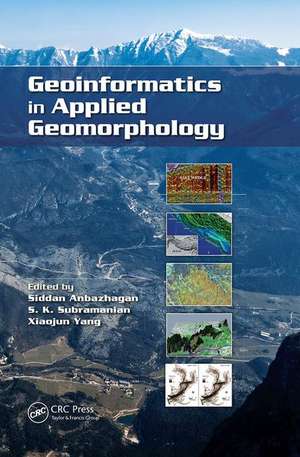
Geoinformatics in Applied Geomorphology
Editat de Siddan Anbazhagan, S. K. Subramanian, XIAOJUN YANGen Limba Engleză Paperback – 31 mar 2017
Using case studies to illustrate concepts and methods, this book covers:
- Arid environments, such as the Thar desert, West Texas, the Qatar Peninsula, and the Dead Sea areas
- Coastal shoreline changes in Kuwait
- Coastal zone management in India
- Estuarine bathymetric study of Tampa Bay, Florida
- Fluvial landforms of the Elbe river basin, Germany
- Subsurface coastal geomorphology and coastal morphological changes due to tsunamis in the East coast of India
- The Himalayas, Jammu & Kashmir, Western Ghats, and Precambrian terrain of South India
| Toate formatele și edițiile | Preț | Express |
|---|---|---|
| Paperback (1) | 585.27 lei 6-8 săpt. | |
| CRC Press – 31 mar 2017 | 585.27 lei 6-8 săpt. | |
| Hardback (1) | 1389.36 lei 6-8 săpt. | |
| CRC Press – 6 iun 2011 | 1389.36 lei 6-8 săpt. |
Preț: 585.27 lei
Preț vechi: 688.56 lei
-15% Nou
Puncte Express: 878
Preț estimativ în valută:
111.99€ • 117.24$ • 92.67£
111.99€ • 117.24$ • 92.67£
Carte tipărită la comandă
Livrare economică 05-19 aprilie
Preluare comenzi: 021 569.72.76
Specificații
ISBN-13: 9781138074453
ISBN-10: 1138074454
Pagini: 398
Ilustrații: 36 Tables, black and white; 162 Illustrations, black and white
Dimensiuni: 152 x 229 mm
Greutate: 0.45 kg
Ediția:1
Editura: CRC Press
Colecția CRC Press
ISBN-10: 1138074454
Pagini: 398
Ilustrații: 36 Tables, black and white; 162 Illustrations, black and white
Dimensiuni: 152 x 229 mm
Greutate: 0.45 kg
Ediția:1
Editura: CRC Press
Colecția CRC Press
Cuprins
Geoinformatics: An Overview and Recent Trends. Airborne Laser Scanning and High-Resolution Satellite Data for Geomorphological Mapping in Parts of Elbe River Valley, Germany. Geoinformatics in Spatial and Temporal Analyses of Wind Erosion in Thar Desert. Remote Sensing and GIS for Coastal Zone Management: Indian Experience. Kuwait Coastline Evolution during 1989–2007. Detecting Estuarine Bathymetric Changes with Historical Nautical Data and GIS. High-Resolution Mapping, Modeling, and Evolution of Subsurface Geomorphology Using Ground-Penetrating Radar Techniques. Remote Sensing in Tectonic Geomorphic Studies: Selected Illustrations from the Northwestern Frontal Himalaya, India. Strain Accumulation Studies between Antarctica and India by Geodetically Tying the Two Continents with GPS Measurements. Indian Ocean Basin Deformation Studies by Episodic GPS Campaigns in the Islands Surrounding India. Remote Sensing and GIS in Groundwater Evaluation in Hilly Terrain of Jammu and Kashmir. Remote Sensing in Delineating Deep Fractured Aquifer Zones. Remote Sensing and GIS for Locating Artificial Recharge Structures for Groundwater Sustainability. A Fuzzy Arithmetic Approach to Characterize Aquifer Vulnerability Considering Geologic Variability and Decision-Makers’ Imprecision. Remote Sensing and GIS in Petroleum Exploration. Geoinformatics in Terrain Analysis and Landslide Susceptibility Mapping in Part of Western Ghats, India. Impact of Tsunami on Coastal Morphological Changes in Nagapattinam Coast, India. Remote Sensing for Glacier Morphological and Mass Balance Studies. Geomorphology and Development Mechanism of Sinkholes in Arid Regions with Emphasis on West Texas, Qatar Peninsula, and Dead Sea Area. Index.
Notă biografică
Prof. Siddan Anbazhagan is Director, Centre for Geoinformatics and Planetary studies, and Head, Department of Geology at Periyar University, India. He obtained PhD from Bharathidasan University (1995) and was awarded an Alexander von Humboldt Fellowship for his post-doctoral research in Germany. Dr. Anbazhagan’s research interests include remote sensing and GIS for applied geomorphology, hydrogeology and disaster mitigation. His current area of interest is planetary remote sensing. His research has been funded by ISRO, DST, MHRD and UGC. Anbazhagan has authored or co-authored more than 60 publications including an edited book on Exploration Geology and Geoinformatics. He serves as a reviewer for several remote sensing, environmental and water resources journals. He currently serves as Syndicate member and Coordinator for Research & Development in the Periyar University.
Dr. S.K.Subramanian is a Senior Scientist, heading Hydrogeology Division at National Remote Sensing Centre (NRSC), Hyderabad, India, Indian Space Research Organization (ISRO). He completed his higher education from IIT Bombay and Indian School of Mines. Dr. Subramanian has more than 30 years of professional experience in Remote Sensing and Geomorphology. He has coordinated number of National mission projects including Integrated Mission for Sustainable Development (IMSD), National (Natural) Resources Information System (NRIS), Rajiv Gandhi National Drinking Water Mission (RGNDWM) and National Agricultural Technology Project (NATP) especially in Geomorphology and Groundwater. In addition, he has been involved in several research projects including geomorphologic evolution of West Coast, mass movement in the Kosi catchment, geomorphology of Nepal, Chambal Ayacut of Rajasthan state and integrated studies and mapping of Dubai, UAE. He has authored or co-authored nearly 50 publications.
Xiaojun Yang is within the Geography Department of Florida State University, USA. He obtained BS in Geology from the Chinese University of Geosciences (CUG) (1986), MS in Paleontology from CUG's Beijing Graduate School (1989), MS in Applied Geomorphology from ITC (1995), and PhD in Geography from the University of Georgia (2000). His research interest includes the development of geospatial information science and technologies with applications in environmental and urban domains. His research has been funded by EPA, NSF, and NASA. He has authored or co-authored more than 80 publications including three books and six journal theme/special issues. He was Guest Editor for Environmental Management, ISPRS Journal of Photogrammetry and Remote Sensing, Photogrametrical Engineering and Remote Sensing, International Journal of Remote Sensing, and Computer, Environment and Urban Systems. He currently serves as Chair, Commission on Mapping from Satellite Imagery, International Cartographic Association.
Descriere
This book provides an overview of geoinformatics and current trends in applied geomorphology. It discusses airborne laser scanning in geomorphic mapping, case studies of coastal zone management and mapping, tsunami inundation mapping, desert environmental mapping, tectonic geomorphology, groundwater exploration and management, petroleum exploration, disaster management and glacier mass balance studies. The self-contained chapters begin with basic aspects, follow with geoinformatics application, and finish with relevant case studies. Figures, photographs, tables, and equations are included.
